TopoQuest Logo
Do you find TopoQuest useful?
Help keep TopoQuest running and adding new maps/features by donating!
Bitcoin:  19c7KJd3qBynnjoSw5npx9KScwjBe4ifkT
Litecoin:  LXs6TkuXGGXo1vDsWCkWVdjQX94eUKd6ui
Home View Maps Find Maps Find Places Resources & Links


Dun Glen, Nevada Topographic Map

USGS Map Title: Dun Glen, NV
USGS Map MRC: 40117F8
DRG (GeoTIFF) Download: o40117f8.tif


Neighboring USGS Topographic Map Quads:


  Cosgrave, NV  
40118G1
 

  Dun Glen Peak, NV  
40117G8
 

  Rose Creek Mountain, NV  
40117G7
 

  Mill City, NV  
40118F1
 

  Dun Glen, NV  
40117F8
 

  Natchez Pass, NV  
40117F7
 

  Star Creek Ranch, NV  
40118E1
 

  Inskip Canyon, NV  
40117E8
 

  Lee Peak, NV  
40117E7


Map MRC Location:

N41°
W118°
N41°
W117°
H8 H7 H6 H5 H4 H3 H2 H1
G8 G7 G6 G5 G4 G3 G2 G1
F8 F7 F6 F5 F4 F3 F2 F1
E8 E7 E6 E5 E4 E3 E2 E1
D8 D7 D6 D5 D4 D3 D2 D1
C8 C7 C6 C5 C4 C3 C2 C1
B8 B7 B6 B5 B4 B3 B2 B1
A8 A7 A6 A5 A4 A3 A2 A1
N40°
W118°
N40°
W117°

Dun Glen, NV USGS 1:24K Topographic Map Preview:
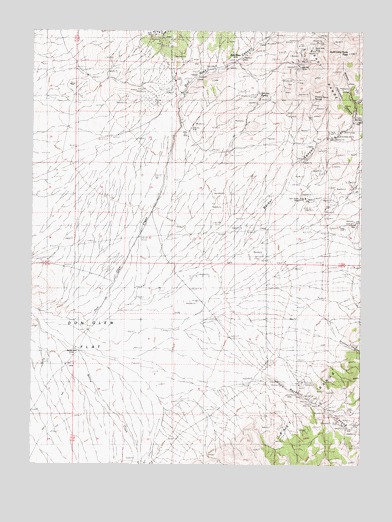
Dun Glen, NV USGS Topographic Map
Click on map above to begin viewing in our Map Viewer.

This topographic map contains these locations and features:
Feature Name Type Latitude Longitude GNIS ID View Map
Auld Lang Syne PeakSummitN40.7435°W117.8812°838533View Map
Barber CanyonValleyN40.6816°W117.9312°845350View Map
Barber Canyon MineMineN40.7196°W117.8865°853983View Map
Barbers CreekStreamN40.6649°W117.9787°852125View Map
Black Hole MineMineN40.7457°W117.8932°838836View Map
Butcher SpringSpringN40.7321°W117.9150°839227View Map
Dun Glen (historical)Populated PlaceN40.7418°W117.9221°856017View Map
Dun Glen CanyonValleyN40.7157°W117.9485°854431View Map
Dun Glen MineMineN40.7427°W117.9199°853981View Map
Dun Glen Post Office (historical)Post OfficeN40.7418°W117.9221°864606View Map
Emigrant CanyonValleyN40.7230°W117.8790°840347View Map
Essex Quartz MillLocaleN40.7310°W117.9454°854809View Map
Hidden CanyonValleyN40.7296°W117.8787°840967View Map
Jackrabbit CanyonValleyN40.7260°W117.8793°841339View Map
Jacobs WellLocaleN40.6577°W117.9824°852227View Map
McCann CanyonValleyN40.7232°W117.8801°845901View Map
Monroe MineMineN40.7385°W117.9001°842197View Map
Orofino CanyonValleyN40.6630°W117.9046°854559View Map
Potato Patch SpringSpringN40.7305°W117.8945°852233View Map
Rock Hill CreekStreamN40.6494°W117.9165°852182View Map
RockhillLocaleN40.6399°W117.8843°856500View Map
Rockhill CanyonValleyN40.6496°W117.9118°856357View Map
Rockhill Canyon MinesMineN40.6444°W117.8982°854028View Map
South Fork Emigrant CanyonValleyN40.7316°W117.8757°845671View Map
Tallulah MineMineN40.7418°W117.9221°853979View Map
Tiptop Post Office (historical)Post OfficeN40.7410°W117.9010°864605View Map
Twin Dome MineMineN40.7013°W117.8965°844478View Map
White Bear MineMineN40.7427°W117.8976°853982View Map
Willow CreekStreamN40.6677°W117.9987°845746View Map
Yosemite MineMineN40.7418°W117.9221°853980View Map

Note: Coordinates in the location and feature list above are referenced to NAD83 datum.


Copyright (C) 2008-2024 Ryan Niemi / Sunset Dynamics ... All Rights Reserved