TopoQuest Logo
Do you find TopoQuest useful?
Help keep TopoQuest running and adding new maps/features by donating!
Bitcoin:  19c7KJd3qBynnjoSw5npx9KScwjBe4ifkT
Litecoin:  LXs6TkuXGGXo1vDsWCkWVdjQX94eUKd6ui
Home View Maps Find Maps Find Places Resources & Links


Arapahoe, Nebraska Topographic Map

USGS Map Title: Arapahoe, NE
USGS Map MRC: 40099C8
DRG (GeoTIFF) Download: o40099c8.tif


Neighboring USGS Topographic Map Quads:


  Cambridge NE, NE  
40100D1
 

  Arapahoe NW, NE  
40099D8
 

  Arapahoe NE, NE  
40099D7
 

  Holbrook, NE  
40100C1
 

  Arapahoe, NE  
40099C8
 

  Edison, NE  
40099C7
 

  Wilsonville NE, NE  
40100B1
 

  Hendley, NE  
40099B8
 

  Beaver City, NE  
40099B7


Map MRC Location:

N41°
W100°
N41°
W99°
H8 H7 H6 H5 H4 H3 H2 H1
G8 G7 G6 G5 G4 G3 G2 G1
F8 F7 F6 F5 F4 F3 F2 F1
E8 E7 E6 E5 E4 E3 E2 E1
D8 D7 D6 D5 D4 D3 D2 D1
C8 C7 C6 C5 C4 C3 C2 C1
B8 B7 B6 B5 B4 B3 B2 B1
A8 A7 A6 A5 A4 A3 A2 A1
N40°
W100°
N40°
W99°

Arapahoe, NE USGS 1:24K Topographic Map Preview:
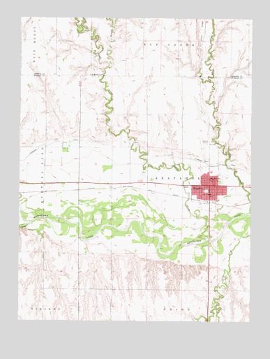
Arapahoe, NE USGS Topographic Map
Click on map above to begin viewing in our Map Viewer.

This topographic map contains these locations and features:
Feature Name Type Latitude Longitude GNIS ID View Map
ArapahoeLocaleN40.2997°W99.9018°1875716View Map
ArapahoePopulated PlaceN40.3042°W99.9004°827034View Map
Arapahoe CemeteryCemeteryN40.3242°W99.9001°1875737View Map
Arapahoe Election PrecinctCivilN40.2635°W99.9115°1928697View Map
Arapahoe Golf CourseLocaleN40.2778°W99.8921°1875729View Map
Arapahoe Good Samaritan CenterHospitalN40.3022°W99.8965°1875728View Map
Arapahoe Medical ClinicHospitalN40.3014°W99.8973°1875727View Map
Arapahoe Municipal AirportAirportN40.3394°W99.9065°837470View Map
Arapahoe Post OfficePost OfficeN40.3029°W99.8974°1875717View Map
Arapahoe Public LibraryBuildingN40.3020°W99.8979°1875725View Map
Arapahoe Public SchoolsSchoolN40.3092°W99.8962°1875726View Map
Arapahoe Volunteer AmbulanceBuildingN40.3036°W99.8966°2553788View Map
Arapahoe Volunteer Fire DepartmentBuildingN40.3037°W99.8966°1875730View Map
Christian Church of ChristChurchN40.3036°W99.9023°1875720View Map
City of ArapahoeCivilN40.3048°W99.8980°2393970View Map
Crum CreekStreamN40.2931°W99.8804°828496View Map
Dickmeyer DamDamN40.3600°W99.9037°1768171View Map
Dickmeyer ReservoirReservoirN40.3598°W99.9041°1768172View Map
East Branch Muddy CreekStreamN40.3547°W99.9529°828941View Map
Elder CreekStreamN40.3697°W99.9637°829039View Map
Elk CreekStreamN40.2950°W99.8754°829055View Map
First United Methodist ChurchChurchN40.3050°W99.8965°1875721View Map
Golter Overflow DamDamN40.3483°W99.8954°1767683View Map
Golter ReservoirReservoirN40.3483°W99.8954°1767684View Map
Krumme DamDamN40.3289°W99.9201°1769050View Map
Krumme ReservoirReservoirN40.3291°W99.9203°1769051View Map
Leissing DamDamN40.3700°W99.9054°1769316View Map
Leissing ReservoirReservoirN40.3706°W99.9048°1769317View Map
Muddy CreekStreamN40.2911°W99.8873°831519View Map
Prairie Pines Retirement CommunityBuildingN40.3092°W99.8907°1875718View Map
Saint Germanus Catholic ChurchChurchN40.3064°W99.9032°1875722View Map
Saint Matthews ChurchChurchN40.3517°W99.9626°833018View Map
Saint Pauls Episcopal ChurchChurchN40.3081°W99.8935°1875723View Map
Shady Rest Camp Motel CampgroundLocaleN40.3061°W99.8921°1875719View Map
Timmons CreekStreamN40.2903°W99.9943°834115View Map
Township of ArapahoeCivilN40.3056°W99.9087°1875602View Map
Trinity Lutheran ChurchChurchN40.3092°W99.9023°1875724View Map

Note: Coordinates in the location and feature list above are referenced to NAD83 datum.


Copyright (C) 2008-2025 Ryan Niemi / Sunset Dynamics ... All Rights Reserved