TopoQuest Logo
Do you find TopoQuest useful?
Help keep TopoQuest running and adding new maps/features by donating!
Bitcoin:  19c7KJd3qBynnjoSw5npx9KScwjBe4ifkT
Litecoin:  LXs6TkuXGGXo1vDsWCkWVdjQX94eUKd6ui
Home View Maps Find Maps Find Places Resources & Links


Dunmor, Kentucky Topographic Map

USGS Map Title: Dunmor, KY
USGS Map MRC: 37086A8
DRG (GeoTIFF) Download: o37086a8.tif


Neighboring USGS Topographic Map Quads:


  Drakesboro, KY  
37087B1
 

  Rochester, KY  
37086B8
 

  South Hill, KY  
37086B7
 

  Rosewood, KY  
37087A1
 

  Dunmor, KY  
37086A8
 

  Quality, KY  
37086A7
 

  Sharon Grove, KY  
36087H1
 

  Lewisburg, KY  
36086H8
 

  Homer, KY  
36086H7


Map MRC Location:

N38°
W87°
N38°
W86°
H8 H7 H6 H5 H4 H3 H2 H1
G8 G7 G6 G5 G4 G3 G2 G1
F8 F7 F6 F5 F4 F3 F2 F1
E8 E7 E6 E5 E4 E3 E2 E1
D8 D7 D6 D5 D4 D3 D2 D1
C8 C7 C6 C5 C4 C3 C2 C1
B8 B7 B6 B5 B4 B3 B2 B1
A8 A7 A6 A5 A4 A3 A2 A1
N37°
W87°
N37°
W86°

Dunmor, KY USGS 1:24K Topographic Map Preview:
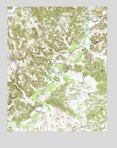
Dunmor, KY USGS Topographic Map
Click on map above to begin viewing in our Map Viewer.

This topographic map contains these locations and features:
Feature Name Type Latitude Longitude GNIS ID View Map
Alum Lick CreekStreamN37.0253°W86.9517°485910View Map
BeechlandPopulated PlaceN37.0417°W86.9125°507478View Map
Biggerstaff CreekStreamN37.0873°W86.8975°487294View Map
Blue CutGapN37.0234°W86.9675°487510View Map
Chestnut Oak RidgeRidgeN37.1153°W86.9586°489460View Map
Coon Range LakeReservoirN37.0349°W86.9435°490045View Map
Dead CreekStreamN37.0353°W86.9008°490716View Map
Dearmond CemeteryCemeteryN37.0753°W86.9703°490742View Map
Diamond SpringsPopulated PlaceN37.0356°W86.9758°507853View Map
DunmorPopulated PlaceN37.0737°W86.9961°491320View Map
Dunmor Census Designated PlaceCensusN37.0753°W86.9951°2629605View Map
Dunmor Volunteer Fire DepartmentBuildingN37.0734°W86.9955°2636952View Map
Fitzhugh CemeteryCemeteryN37.0384°W86.9847°492150View Map
Forgys BranchStreamN37.0995°W86.8961°492335View Map
Forgys MillLocaleN37.0881°W86.8919°492336View Map
Forgytown (historical)Populated PlaceN37.0884°W86.8927°2742331View Map
GusPopulated PlaceN37.1175°W86.9089°508150View Map
Harper CrossroadsPopulated PlaceN37.0903°W86.8853°508193View Map
HarreldsvillePopulated PlaceN37.0648°W86.8939°508195View Map
Hollow BillPopulated PlaceN37.0562°W86.9883°508266View Map
Huckleberry KnobSummitN37.1028°W86.9678°494715View Map
Iron MountainSummitN37.0284°W86.9367°495007View Map
Jockys BranchStreamN37.0737°W86.9456°495289View Map
Lewisburg DivisionCivilN37.0033°W86.9322°1937102View Map
Lyons BranchStreamN37.1125°W86.9028°497392View Map
Mount Moriah ChurchChurchN37.1059°W86.9403°498777View Map
New Hebron ChurchChurchN37.1031°W86.9228°499332View Map
North Logan SchoolSchoolN37.0639°W86.9236°499577View Map
Old Hebron ChurchChurchN37.1103°W86.9114°499831View Map
PenrodPopulated PlaceN37.1142°W86.9992°500395View Map
Pogue (historical)Populated PlaceN37.0569°W86.9698°2743093View Map
Pogue SchoolSchoolN37.0578°W86.9697°500990View Map
Rawhide CreekStreamN37.0334°W86.9633°501608View Map
Red HillSummitN37.0159°W86.9803°501650View Map
Rock Springs (historical)Populated PlaceN37.0720°W86.8969°2742349View Map
Rock Springs SchoolSchoolN37.0717°W86.8964°502152View Map
Roundabout SwampSwampN37.0731°W86.9100°502416View Map
Sand SpringPopulated PlaceN37.0285°W86.8850°2743097View Map
Simmons CreekStreamN37.0195°W86.9050°503523View Map
Simmons KnobSummitN37.0156°W86.8936°503525View Map
Tan KnobSummitN37.0220°W86.8822°504933View Map
Ware RidgeRidgeN37.0959°W86.9653°506224View Map
Welburn RidgeRidgeN37.0948°W86.9864°506360View Map
Wolf LickPopulated PlaceN37.0189°W86.9561°509397View Map
Wolf Lick CreekStreamN37.0628°W86.9436°507017View Map

Note: Coordinates in the location and feature list above are referenced to NAD83 datum.


Copyright (C) 2008-2024 Ryan Niemi / Sunset Dynamics ... All Rights Reserved