TopoQuest Logo
Do you find TopoQuest useful?
Help keep TopoQuest running and adding new maps/features by donating!
Bitcoin:  19c7KJd3qBynnjoSw5npx9KScwjBe4ifkT
Litecoin:  LXs6TkuXGGXo1vDsWCkWVdjQX94eUKd6ui
Home View Maps Find Maps Find Places Resources & Links


Dusty, New Mexico Topographic Map

USGS Map Title: Dusty, NM
USGS Map MRC: 33107F6
DRG (GeoTIFF) Download: o33107f6.tif


Neighboring USGS Topographic Map Quads:


  Luera Mountains East, NM  
33107G7
 

  Oak Peak, NM  
33107G6
 

  Bay Buck Peaks, NM  
33107G5
 

  Paddys Hole, NM  
33107F7
 

  Dusty, NM  
33107F6
 

  Welty Hill, NM  
33107F5
 

  Wahoo Peak, NM  
33107E7
 

  Wahoo Ranch, NM  
33107E6
 

  Montoya Butte, NM  
33107E5


Map MRC Location:

N34°
W108°
N34°
W107°
H8 H7 H6 H5 H4 H3 H2 H1
G8 G7 G6 G5 G4 G3 G2 G1
F8 F7 F6 F5 F4 F3 F2 F1
E8 E7 E6 E5 E4 E3 E2 E1
D8 D7 D6 D5 D4 D3 D2 D1
C8 C7 C6 C5 C4 C3 C2 C1
B8 B7 B6 B5 B4 B3 B2 B1
A8 A7 A6 A5 A4 A3 A2 A1
N33°
W108°
N33°
W107°

Dusty, NM USGS 1:24K Topographic Map Preview:
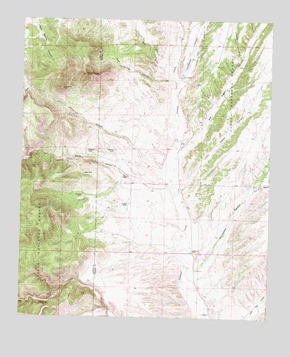
Dusty, NM USGS Topographic Map
Click on map above to begin viewing in our Map Viewer.

This topographic map contains these locations and features:
Feature Name Type Latitude Longitude GNIS ID View Map
10016 Water WellWellN33.7265°W107.6700°922029View Map
10017 Water WellWellN33.7265°W107.6700°922030View Map
10018 Water WellWellN33.6278°W107.6570°922020View Map
Ben DrawValleyN33.7256°W107.6737°903737View Map
Big Pigeon CanyonValleyN33.6906°W107.6717°903803View Map
Drill Draw CanyonValleyN33.6792°W107.6339°905857View Map
DustyPopulated PlaceN33.6270°W107.6559°2038780View Map
DustyPopulated PlaceN33.6267°W107.6550°1984620View Map
Hells TankReservoirN33.6472°W107.7417°936637View Map
Henderson RanchLocaleN33.6526°W107.6637°906926View Map
Home TankReservoirN33.6782°W107.7343°936635View Map
Horse DrawValleyN33.7342°W107.6389°907094View Map
Johnson TankReservoirN33.6952°W107.7177°907416View Map
Jones CanyonValleyN33.7209°W107.7475°907428View Map
Limestone CanyonValleyN33.7240°W107.6728°907966View Map
Little Pigeon CanyonValleyN33.6778°W107.6700°908040View Map
Lower Pigeon TankReservoirN33.6890°W107.6262°914146View Map
Lower Pigeon TankReservoirN33.7259°W107.6267°936634View Map
Lower TankReservoirN33.6726°W107.6965°908291View Map
McCracken RanchLocaleN33.6753°W107.7195°908502View Map
New TankReservoirN33.6851°W107.7189°909068View Map
Outlaw TankReservoirN33.6283°W107.7364°1984619View Map
Patterson CanyonValleyN33.6856°W107.6778°909508View Map
Patterson PeakSummitN33.7212°W107.7306°909509View Map
Pigeon CabinLocaleN33.7309°W107.6534°909639View Map
Pigeon WindmillLocaleN33.7306°W107.6425°936633View Map
Rock Springs CanyonValleyN33.7226°W107.6734°910384View Map
Rock Springs PeakSummitN33.7270°W107.7184°910386View Map
Shreves TankReservoirN33.6841°W107.6998°911026View Map
Snow TankReservoirN33.6694°W107.7497°936636View Map
Spring TankReservoirN33.6548°W107.7339°1984618View Map
Stalling TankReservoirN33.6953°W107.7039°911383View Map
Stock TankReservoirN33.7426°W107.7412°2038701View Map
Stone CanyonValleyN33.6826°W107.6745°911432View Map
Sullivans Hole CanyonValleyN33.7237°W107.6734°911476View Map
Tucker RanchLocaleN33.7267°W107.6698°911845View Map
Whitewater CanyonValleyN33.6462°W107.6664°912351View Map

Note: Coordinates in the location and feature list above are referenced to NAD83 datum.


Copyright (C) 2008-2024 Ryan Niemi / Sunset Dynamics ... All Rights Reserved