TopoQuest Logo
Do you find TopoQuest useful?
Help keep TopoQuest running and adding new maps/features by donating!
Bitcoin:  19c7KJd3qBynnjoSw5npx9KScwjBe4ifkT
Litecoin:  LXs6TkuXGGXo1vDsWCkWVdjQX94eUKd6ui
Home View Maps Find Maps Find Places Resources & Links


Dutton, Montana Topographic Map

USGS Map Title: Dutton, MT
USGS Map MRC: 47111G6
DRG (GeoTIFF) Download: o47111g6.tif


Neighboring USGS Topographic Map Quads:


  Collins, MT  
47111H7
 

  Dutton NW, MT  
47111H6
 

  Dutton NE, MT  
47111H5
 

  Collins SE, MT  
47111G7
 

  Dutton, MT  
47111G6
 

  Dutton SE, MT  
47111G5
 

  Greenfield, MT  
47111F7
 

  Power, MT  
47111F6
 

  Vaughn NE, MT  
47111F5


Map MRC Location:

N48°
W112°
N48°
W111°
H8 H7 H6 H5 H4 H3 H2 H1
G8 G7 G6 G5 G4 G3 G2 G1
F8 F7 F6 F5 F4 F3 F2 F1
E8 E7 E6 E5 E4 E3 E2 E1
D8 D7 D6 D5 D4 D3 D2 D1
C8 C7 C6 C5 C4 C3 C2 C1
B8 B7 B6 B5 B4 B3 B2 B1
A8 A7 A6 A5 A4 A3 A2 A1
N47°
W112°
N47°
W111°

Dutton, MT USGS 1:24K Topographic Map Preview:
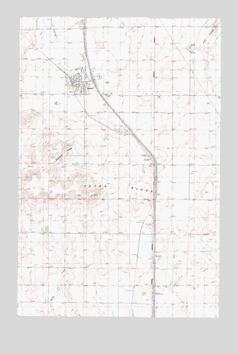
Dutton, MT USGS Topographic Map
Click on map above to begin viewing in our Map Viewer.

This topographic map contains these locations and features:
Feature Name Type Latitude Longitude GNIS ID View Map
23N01W03AAC_01 WellWellN47.7822°W111.7114°824948View Map
Bethany Lutheran ChurchChurchN47.8508°W111.7158°1761987View Map
Bosseler RidgeSummitN47.8172°W111.7217°769116View Map
Cargill (historical)LocaleN47.7888°W111.6730°1762131View Map
DuttonLocaleN47.8477°W111.7153°1762110View Map
DuttonPopulated PlaceN47.8427°W111.7117°770938View Map
Dutton AirportAirportN47.8452°W111.6983°806403View Map
Dutton CemeteryCemeteryN47.8504°W111.7095°1761990View Map
Dutton Co-operative Elevator (historical)LocaleN47.8427°W111.7117°1761997View Map
Dutton Farmers ElevatorLocaleN47.8427°W111.7117°1761998View Map
Dutton Post OfficePost OfficeN47.8473°W111.7164°1762072View Map
Dutton Public LibraryBuildingN47.8480°W111.7155°1761992View Map
Dutton Public SchoolsSchoolN47.8513°W111.7147°1761965View Map
Dutton United Methodist ChurchChurchN47.8472°W111.7142°1761989View Map
Dutton Volunteer Fire DepartmentBuildingN47.8484°W111.7158°2546597View Map
Dutton-Power DivisionCivilN47.8180°W111.6384°1940603View Map
Interchange 313CrossingN47.8486°W111.7050°1762023View Map
Peavey Elevator (historical)LocaleN47.8427°W111.7117°1762000View Map
Robbie DamDamN47.7550°W111.6725°798450View Map
Saint Williams Catholic ChurchChurchN47.8488°W111.7142°1761988View Map
Snider School (historical)SchoolN47.7994°W111.6253°776702View Map
Teton RidgeRidgeN47.8030°W111.7139°777481View Map
Thav DamDamN47.7750°W111.7408°798454View Map
Town of DuttonCivilN47.8475°W111.7143°2412453View Map
Triangle Terminal Co-operative ElevatorLocaleN47.8427°W111.7117°1761999View Map

Note: Coordinates in the location and feature list above are referenced to NAD83 datum.


Copyright (C) 2008-2025 Ryan Niemi / Sunset Dynamics ... All Rights Reserved