TopoQuest Logo
Do you find TopoQuest useful?
Help keep TopoQuest running and adding new maps/features by donating!
Bitcoin:  19c7KJd3qBynnjoSw5npx9KScwjBe4ifkT
Litecoin:  LXs6TkuXGGXo1vDsWCkWVdjQX94eUKd6ui
Home View Maps Find Maps Find Places Resources & Links


Duzel Rock, California Topographic Map

USGS Map Title: Duzel Rock, CA
USGS Map MRC: 41122E6
DRG (GeoTIFF) Download: o41122e6.tif


Neighboring USGS Topographic Map Quads:


  Indian Creek Baldy, CA  
41122F7
 

  Yreka, CA  
41122F6
 

  Montague, CA  
41122F5
 

  Fort Jones, CA  
41122E7
 

  Duzel Rock, CA  
41122E6
 

  Gazelle, CA  
41122E5
 

  McConaughy Gulch, CA  
41122D7
 

  Gazelle Mountain, CA  
41122D6
 

  China Mountain, CA  
41122D5


Map MRC Location:

N42°
W123°
N42°
W122°
H8 H7 H6 H5 H4 H3 H2 H1
G8 G7 G6 G5 G4 G3 G2 G1
F8 F7 F6 F5 F4 F3 F2 F1
E8 E7 E6 E5 E4 E3 E2 E1
D8 D7 D6 D5 D4 D3 D2 D1
C8 C7 C6 C5 C4 C3 C2 C1
B8 B7 B6 B5 B4 B3 B2 B1
A8 A7 A6 A5 A4 A3 A2 A1
N41°
W123°
N41°
W122°

Duzel Rock, CA USGS 1:24K Topographic Map Preview:
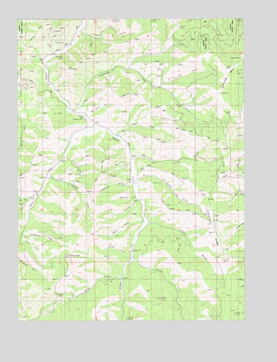
Duzel Rock, CA USGS Topographic Map
Click on map above to begin viewing in our Map Viewer.

This topographic map contains these locations and features:
Feature Name Type Latitude Longitude GNIS ID View Map
Antelope MountainSummitN41.5929°W122.6392°266383View Map
Bald HillSummitN41.6040°W122.7209°1657740View Map
Barn GulchValleyN41.5635°W122.6889°256533View Map
Beef Corral GulchValleyN41.5851°W122.7103°256789View Map
Cedar GulchValleyN41.5768°W122.6956°258136View Map
Clapboard GulchValleyN41.5585°W122.7309°258392View Map
Cottonwood CreekStreamN41.5857°W122.7195°258759View Map
Crooked GulchValleyN41.6190°W122.7150°258932View Map
Duzel CreekStreamN41.5813°W122.7106°266667View Map
Duzel RockPillarN41.5268°W122.7228°259643View Map
East GulchValleyN41.5404°W122.6786°259760View Map
Farley GulchValleyN41.5254°W122.6906°260052View Map
Glendenning GulchValleyN41.5563°W122.6886°260607View Map
Highland SchoolSchoolN41.5810°W122.7042°261344View Map
KYRE-FM (Yreka)TowerN41.6093°W122.6259°1663146View Map
Long GulchValleyN41.5518°W122.7414°262843View Map
Mill GulchValleyN41.5674°W122.6859°263623View Map
Moonshine GulchValleyN41.5507°W122.6867°1657811View Map
Piney MountainSummitN41.6226°W122.7350°1657818View Map
Portugese GulchValleyN41.5582°W122.6831°264969View Map
Salt Log GulchValleyN41.5976°W122.6706°265785View Map
Scarface RidgeRidgeN41.5329°W122.6397°265899View Map
Sissel GulchValleyN41.5243°W122.6861°266215View Map
Spring BranchStreamN41.5174°W122.6931°267586View Map
Stack GulchValleyN41.5674°W122.7239°267653View Map
Tapplin GulchValleyN41.5404°W122.6834°268090View Map
Telephone GulchValleyN41.5351°W122.7464°268128View Map
Whiskey GulchValleyN41.5488°W122.6850°1657841View Map
Wood GulchValleyN41.5332°W122.7492°1657843View Map

Note: Coordinates in the location and feature list above are referenced to NAD83 datum.


Copyright (C) 2008-2025 Ryan Niemi / Sunset Dynamics ... All Rights Reserved