TopoQuest Logo
Do you find TopoQuest useful?
Help keep TopoQuest running and adding new maps/features by donating!
Bitcoin:  19c7KJd3qBynnjoSw5npx9KScwjBe4ifkT
Litecoin:  LXs6TkuXGGXo1vDsWCkWVdjQX94eUKd6ui
Home View Maps Find Maps Find Places Resources & Links


Arbuckle Mountain, Oregon Topographic Map

USGS Map Title: Arbuckle Mountain, OR
USGS Map MRC: 45119B3
DRG (GeoTIFF) Download: o45119b3.tif


Neighboring USGS Topographic Map Quads:


  Skinners Fork, OR  
45119C4
 

  Freezeout Ridge, OR  
45119C3
 

  Hoodlum Canyon, OR  
45119C2
 

  Summerfield Ridge, OR  
45119B4
 

  Arbuckle Mountain, OR  
45119B3
 

  Matlock Prairie, OR  
45119B2
 

  Madison Butte, OR  
45119A4
 

  Lake Penland, OR  
45119A3
 

  Thompson Flat, OR  
45119A2


Map MRC Location:

N46°
W120°
N46°
W119°
H8 H7 H6 H5 H4 H3 H2 H1
G8 G7 G6 G5 G4 G3 G2 G1
F8 F7 F6 F5 F4 F3 F2 F1
E8 E7 E6 E5 E4 E3 E2 E1
D8 D7 D6 D5 D4 D3 D2 D1
C8 C7 C6 C5 C4 C3 C2 C1
B8 B7 B6 B5 B4 B3 B2 B1
A8 A7 A6 A5 A4 A3 A2 A1
N45°
W120°
N45°
W119°

Arbuckle Mountain, OR USGS 1:24K Topographic Map Preview:
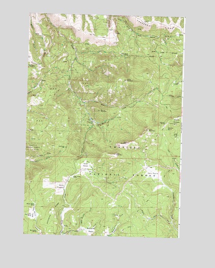
Arbuckle Mountain, OR USGS Topographic Map
Click on map above to begin viewing in our Map Viewer.

This topographic map contains these locations and features:
Feature Name Type Latitude Longitude GNIS ID View Map
Arbuckle CorralLocaleN45.2223°W119.2628°1137283View Map
Arbuckle MountainSummitN45.1935°W119.2522°1137284View Map
Arbuckle SpringSpringN45.1898°W119.2638°1137286View Map
Bald MountainSummitN45.1779°W119.2936°1137453View Map
Black MountainSummitN45.2132°W119.2950°1138205View Map
Blake Ranch SpringSpringN45.2271°W119.2953°1138245View Map
Blakes PondLakeN45.2408°W119.2909°1153281View Map
Butcher Bill MeadowFlatN45.1279°W119.3206°1139033View Map
Coalmine HillSummitN45.1746°W119.3433°1139873View Map
Coalmine Hill Recreation SiteLocaleN45.1662°W119.3339°1952963View Map
Cutsforth County ParkParkN45.1890°W119.3225°1140576View Map
Cutsforth PondLakeN45.1907°W119.3239°1153282View Map
Driveway SpringSpringN45.1860°W119.2622°1141255View Map
Freezeout RidgeRidgeN45.2440°W119.2600°1142447View Map
Herren CreekStreamN45.1910°W119.3231°1143515View Map
Herren MeadowFlatN45.1648°W119.3264°1143516View Map
Horse Heaven CreekStreamN45.1279°W119.3283°1143765View Map
Kelly MountainSummitN45.1854°W119.2767°1144529View Map
Kelly PrairieFlatN45.1618°W119.2720°1144530View Map
Linger Longer PrairieFlatN45.1579°W119.3367°1145047View Map
Little Bald MountainSummitN45.1712°W119.3020°1145075View Map
Louse SpringSpringN45.1831°W119.2532°1145579View Map
Martin PrairieFlatN45.1374°W119.3678°1145850View Map
Martin Prairie SpringSpringN45.1417°W119.3662°1145851View Map
Penland PrairieFlatN45.1265°W119.3031°1147580View Map
Porcupine RidgeRidgeN45.1390°W119.3522°1147897View Map
Rasmuss MeadowFlatN45.1524°W119.3425°1148223View Map
Round MountainSummitN45.1957°W119.3156°1148788View Map
Shaw CreekStreamN45.2004°W119.3317°1149296View Map
Smith DitchCanalN45.1654°W119.3228°1149752View Map
Sweet Grass SpringSpringN45.1360°W119.3686°1150780View Map
Wee Lambie SpringSpringN45.1265°W119.3642°1151993View Map
Wilson CreekStreamN45.1332°W119.2561°1152452View Map
Yokum CabinLocaleN45.2104°W119.3420°1156108View Map

Note: Coordinates in the location and feature list above are referenced to NAD83 datum.


Copyright (C) 2008-2025 Ryan Niemi / Sunset Dynamics ... All Rights Reserved