TopoQuest Logo
Do you find TopoQuest useful?
Help keep TopoQuest running and adding new maps/features by donating!
Bitcoin:  19c7KJd3qBynnjoSw5npx9KScwjBe4ifkT
Litecoin:  LXs6TkuXGGXo1vDsWCkWVdjQX94eUKd6ui
Home View Maps Find Maps Find Places Resources & Links


Eagle, Colorado Topographic Map

USGS Map Title: Eagle, CO
USGS Map MRC: 39106F7
DRG (GeoTIFF) Download: o39106f7.tif


Neighboring USGS Topographic Map Quads:


  Burns South, CO  
39106G8
 

  Castle Peak, CO  
39106G7
 

  State Bridge, CO  
39106G6
 

  Gypsum, CO  
39106F8
 

  Eagle, CO  
39106F7
 

  Wolcott, CO  
39106F6
 

  Suicide Mountain, CO  
39106E8
 

  The Seven Hermits, CO  
39106E7
 

  Fulford, CO  
39106E6


Map MRC Location:

N40°
W107°
N40°
W106°
H8 H7 H6 H5 H4 H3 H2 H1
G8 G7 G6 G5 G4 G3 G2 G1
F8 F7 F6 F5 F4 F3 F2 F1
E8 E7 E6 E5 E4 E3 E2 E1
D8 D7 D6 D5 D4 D3 D2 D1
C8 C7 C6 C5 C4 C3 C2 C1
B8 B7 B6 B5 B4 B3 B2 B1
A8 A7 A6 A5 A4 A3 A2 A1
N39°
W107°
N39°
W106°

Eagle, CO USGS 1:24K Topographic Map Preview:
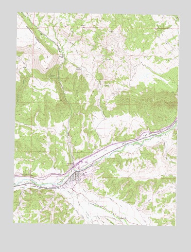
Eagle, CO USGS Topographic Map
Click on map above to begin viewing in our Map Viewer.

This topographic map contains these locations and features:
Feature Name Type Latitude Longitude GNIS ID View Map
Abrams CreekStreamN39.6411°W106.8267°175865View Map
Castle CreekStreamN39.6683°W106.7989°176256View Map
Castle Peak HeliportAirportN39.6997°W106.7678°204630View Map
Colorado State Patrol Eagle PostBuildingN39.6495°W106.8347°2735576View Map
EaglePopulated PlaceN39.6553°W106.8287°204664View Map
Eagle County Detention CenterBuildingN39.6639°W106.8180°2757311View Map
Eagle County Historical MuseumBuildingN39.6578°W106.8287°2041844View Map
Eagle County Sheriff's OfficeBuildingN39.6638°W106.8183°2735559View Map
Eagle MineMineN39.6380°W106.8417°1684176View Map
Eagle Police DepartmentBuildingN39.6551°W106.8276°2757291View Map
Eagle Post OfficePost OfficeN39.6596°W106.8239°2734623View Map
Eagle-Gypsum DivisionCivilN39.7100°W106.8058°1935451View Map
Eby CreekStreamN39.6592°W106.8306°175771View Map
Fivemile RockPillarN39.7242°W106.8392°176255View Map
Fourmile SpringSpringN39.7122°W106.8489°176254View Map
Greater Eagle Fire Protection DistrictBuildingN39.6547°W106.8233°2666950View Map
Hernage CreekStreamN39.6339°W106.8214°175864View Map
Hockett DitchCanalN39.6464°W106.8670°202326View Map
Hockett GulchValleyN39.6449°W106.8425°175866View Map
Hollingsworth DitchCanalN39.6733°W106.7692°202329View Map
KWLI-FM (Eagle)TowerN39.7383°W106.8000°204127View Map
Love and White DitchCanalN39.6325°W106.7770°202331View Map
Mathews DitchCanalN39.6392°W106.7964°176249View Map
Mayer GulchValleyN39.6302°W106.8067°175862View Map
Neilson GucchValleyN39.6536°W106.8413°176252View Map
Noecker DamDamN39.7186°W106.8259°199778View Map
Noecker ReservoirReservoirN39.7173°W106.8241°176258View Map
Oelsen DitchCanalN39.7303°W106.8314°176257View Map
Oleson DitchCanalN39.6275°W106.7936°202332View Map
Red CanyonValleyN39.6503°W106.8323°175858View Map
Road GulchValleyN39.6331°W106.7780°175860View Map
Schumm Ditch Number 1CanalN39.6511°W106.8570°175868View Map
Skillman GulchValleyN39.6461°W106.8669°175867View Map
Sunset View CemeteryCemeteryN39.6507°W106.8251°2734653View Map
Third GulchValleyN39.6297°W106.8104°175863View Map
Town of EagleCivilN39.6366°W106.8157°2412456View Map
Warren DitchCanalN39.6758°W106.7759°202330View Map
Warren GulchValleyN39.6760°W106.7604°175859View Map
Western Eagle County Ambulance District Eagle StationBuildingN39.6623°W106.8295°2716996View Map
Wilkinson DitchCanalN39.6694°W106.8025°176253View Map

Note: Coordinates in the location and feature list above are referenced to NAD83 datum.


Copyright (C) 2008-2024 Ryan Niemi / Sunset Dynamics ... All Rights Reserved