TopoQuest Logo
Do you find TopoQuest useful?
Help keep TopoQuest running and adding new maps/features by donating!
Bitcoin:  19c7KJd3qBynnjoSw5npx9KScwjBe4ifkT
Litecoin:  LXs6TkuXGGXo1vDsWCkWVdjQX94eUKd6ui
Home View Maps Find Maps Find Places Resources & Links


Eagle Rock, Oregon Topographic Map

USGS Map Title: Eagle Rock, OR
USGS Map MRC: 44120B6
DRG (GeoTIFF) Download: o44120b6.tif


Neighboring USGS Topographic Map Quads:


  Prineville, OR  
44120C7
 

  Ochoco Reservoir, OR  
44120C6
 

  Cadle Butte, OR  
44120C5
 

  Stearns Butte, OR  
44120B7
 

  Eagle Rock, OR  
44120B6
 

  Pilot Butte, OR  
44120B5
 

  Bowman Dam, OR  
44120A7
 

  Alkali Flat, OR  
44120A6
 

  Conant Basin, OR  
44120A5


Map MRC Location:

N45°
W121°
N45°
W120°
H8 H7 H6 H5 H4 H3 H2 H1
G8 G7 G6 G5 G4 G3 G2 G1
F8 F7 F6 F5 F4 F3 F2 F1
E8 E7 E6 E5 E4 E3 E2 E1
D8 D7 D6 D5 D4 D3 D2 D1
C8 C7 C6 C5 C4 C3 C2 C1
B8 B7 B6 B5 B4 B3 B2 B1
A8 A7 A6 A5 A4 A3 A2 A1
N44°
W121°
N44°
W120°

Eagle Rock, OR USGS 1:24K Topographic Map Preview:
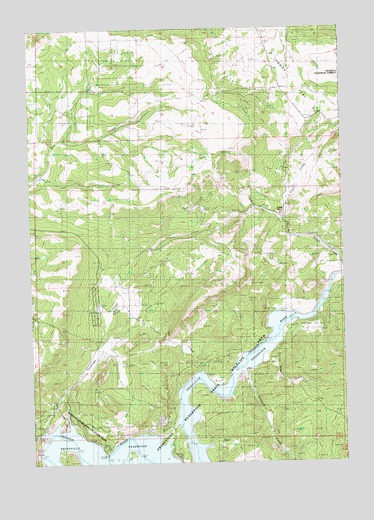
Eagle Rock, OR USGS Topographic Map
Click on map above to begin viewing in our Map Viewer.

This topographic map contains these locations and features:
Feature Name Type Latitude Longitude GNIS ID View Map
Antelope CreekStreamN44.1326°W120.7406°1116969View Map
Bailey School (historical)SchoolN44.1496°W120.6820°1117146View Map
Big Bend IslandIslandN44.1262°W120.7386°1129533View Map
Carey RanchLocaleN44.1599°W120.6958°1118604View Map
Deer CreekStreamN44.1290°W120.6867°1140841View Map
Eagle CreekStreamN44.1796°W120.6264°1141471View Map
Eagle RockPillarN44.1968°W120.6517°1120268View Map
Jasper Point Boat RampLocaleN44.1359°W120.6932°2698970View Map
Klaus RanchLocaleN44.1404°W120.6936°1122797View Map
Long HollowValleyN44.1785°W120.6258°1145409View Map
Mayfield RanchLocaleN44.1301°W120.7322°1123871View Map
O'Neil CreekStreamN44.1951°W120.6508°1124891View Map
Owl CreekStreamN44.1499°W120.6853°1125082View Map
Prineville ReservoirReservoirN44.1259°W120.7181°1125673View Map
Prineville Reservoir State Park MarinaHarborN44.1286°W120.7203°2699001View Map
Prinville Reservoir State Park Boat RampLocaleN44.1269°W120.7229°2700033View Map
Roberts Bay Boat LaunchLocaleN44.1251°W120.7163°2698971View Map
Sand CreekStreamN44.1554°W120.6581°1129534View Map
Sanford CreekStreamN44.1521°W120.6678°1149062View Map
Way RanchLocaleN44.1679°W120.6486°1128746View Map

Note: Coordinates in the location and feature list above are referenced to NAD83 datum.


Copyright (C) 2008-2025 Ryan Niemi / Sunset Dynamics ... All Rights Reserved