TopoQuest Logo
Do you find TopoQuest useful?
Help keep TopoQuest running and adding new maps/features by donating!
Bitcoin:  19c7KJd3qBynnjoSw5npx9KScwjBe4ifkT
Litecoin:  LXs6TkuXGGXo1vDsWCkWVdjQX94eUKd6ui
Home View Maps Find Maps Find Places Resources & Links


Eastonville, Colorado Topographic Map

USGS Map Title: Eastonville, CO
USGS Map MRC: 39104A5
DRG (GeoTIFF) Download: o39104a5.tif


Neighboring USGS Topographic Map Quads:


  Cherry Valley School, CO  
39104B6
 

  Elbert, CO  
39104B5
 

  Bijou Basin, CO  
39104B4
 

  Black Forest, CO  
39104A6
 

  Eastonville, CO  
39104A5
 

  Peyton, CO  
39104A4
 

  Falcon NW, CO  
38104H6
 

  Falcon, CO  
38104H5
 

  Haegler Ranch, CO  
38104H4


Map MRC Location:

N40°
W105°
N40°
W104°
H8 H7 H6 H5 H4 H3 H2 H1
G8 G7 G6 G5 G4 G3 G2 G1
F8 F7 F6 F5 F4 F3 F2 F1
E8 E7 E6 E5 E4 E3 E2 E1
D8 D7 D6 D5 D4 D3 D2 D1
C8 C7 C6 C5 C4 C3 C2 C1
B8 B7 B6 B5 B4 B3 B2 B1
A8 A7 A6 A5 A4 A3 A2 A1
N39°
W105°
N39°
W104°

Eastonville, CO USGS 1:24K Topographic Map Preview:
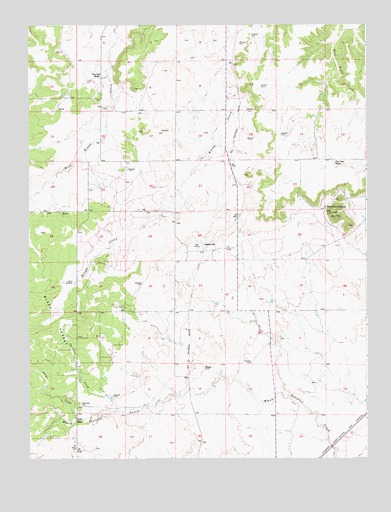
Eastonville, CO USGS Topographic Map
Click on map above to begin viewing in our Map Viewer.

This topographic map contains these locations and features:
Feature Name Type Latitude Longitude GNIS ID View Map
Ayer RanchLocaleN39.0117°W104.6075°193296View Map
Bluff CemeteryCemeteryN39.0997°W104.5849°1834802View Map
Cantrell CreekStreamN39.0142°W104.5927°193294View Map
Cherokee Trail Ranch AirportAirportN39.1070°W104.5816°2443947View Map
EastonvillePopulated PlaceN39.0611°W104.5622°193298View Map
Eastonville CemeteryCemeteryN39.0157°W104.6064°193295View Map
Falcon Fire Department Station 2BuildingN39.0437°W104.6081°2667246View Map
Fat Chance AirportAirportN39.1005°W104.5480°2443948View Map
Kiowa Creek Watershed 1-M-10 DamDamN39.0917°W104.6172°198374View Map
Kiowa Creek Watershed 1-M-10 ReservoirReservoirN39.0917°W104.6172°198375View Map
Kiowa Creek Watershed H-21 DamDamN39.1150°W104.5655°198308View Map
Kiowa Creek Watershed H-21 ReservoirReservoirN39.1155°W104.5644°198309View Map
Kiowa Creek Watershed J-33 DamDamN39.1033°W104.5639°198312View Map
Kiowa Creek Watershed J-33 ReservoirReservoirN39.1033°W104.5639°198313View Map
Kiowa Creek Watershed K-79 DamDamN39.0683°W104.5805°198220View Map
Kiowa Creek Watershed K-79 ReservoirReservoirN39.0683°W104.5805°198221View Map
Kiowa Creek Watershed K-80 DamDamN39.0750°W104.5572°198316View Map
Kiowa Creek Watershed K-80 ReservoirReservoirN39.0750°W104.5572°198317View Map
Kiowa Creek Watershed Y-77 DamDamN39.0800°W104.5522°198324View Map
Kiowa Creek Watershed Y-77 ReservoirReservoirN39.0800°W104.5522°198325View Map
Pine Park RanchLocaleN39.1097°W104.5983°193300View Map
Pine View RanchLocaleN39.0855°W104.5125°193299View Map
Rattlesnake ButteSummitN39.0708°W104.5130°193297View Map
Snipe CreekStreamN39.0119°W104.6080°193291View Map

Note: Coordinates in the location and feature list above are referenced to NAD83 datum.


Copyright (C) 2008-2024 Ryan Niemi / Sunset Dynamics ... All Rights Reserved