TopoQuest Logo
Do you find TopoQuest useful?
Help keep TopoQuest running and adding new maps/features by donating!
Bitcoin:  19c7KJd3qBynnjoSw5npx9KScwjBe4ifkT
Litecoin:  LXs6TkuXGGXo1vDsWCkWVdjQX94eUKd6ui
Home View Maps Find Maps Find Places Resources & Links


Echo, Colorado Topographic Map

USGS Map Title: Echo, CO
USGS Map MRC: 38105D5
DRG (GeoTIFF) Download: o38105d5.tif


Neighboring USGS Topographic Map Quads:


  Waugh Mountain, CO  
38105E6
 

  Hall Gulch, CO  
38105E5
 

  Gribble Mountain, CO  
38105E4
 

  Arkansas Mountain, CO  
38105D6
 

  Echo, CO  
38105D5
 

  McIntyre Hills, CO  
38105D4
 

  Cotopaxi, CO  
38105C6
 

  Hillside, CO  
38105C5
 

  Iron Mountain, CO  
38105C4


Map MRC Location:

N39°
W106°
N39°
W105°
H8 H7 H6 H5 H4 H3 H2 H1
G8 G7 G6 G5 G4 G3 G2 G1
F8 F7 F6 F5 F4 F3 F2 F1
E8 E7 E6 E5 E4 E3 E2 E1
D8 D7 D6 D5 D4 D3 D2 D1
C8 C7 C6 C5 C4 C3 C2 C1
B8 B7 B6 B5 B4 B3 B2 B1
A8 A7 A6 A5 A4 A3 A2 A1
N38°
W106°
N38°
W105°

Echo, CO USGS 1:24K Topographic Map Preview:
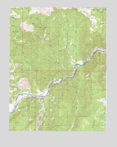
Echo, CO USGS Topographic Map
Click on map above to begin viewing in our Map Viewer.

This topographic map contains these locations and features:
Feature Name Type Latitude Longitude GNIS ID View Map
Antelope GulchValleyN38.4961°W105.6018°191526View Map
Back Door GulchValleyN38.3936°W105.5865°191779View Map
Big Emma ClaimMineN38.3853°W105.5617°1725015View Map
Bull GulchValleyN38.4660°W105.5842°191752View Map
Bull Gulch MineMineN38.4706°W105.6194°1725010View Map
Bull RidgeRidgeN38.4647°W105.6044°191753View Map
Bull Ridge MineMineN38.4706°W105.6194°1725011View Map
Cotopaxi DivisionCivilN38.4918°W105.6025°1935435View Map
Devils HoleBasinN38.4722°W105.5478°191759View Map
Dreamer MineMineN38.4725°W105.5956°1725004View Map
East GulchValleyN38.4596°W105.5528°191564View Map
EchoPopulated PlaceN38.4428°W105.5389°191760View Map
Echo CanyonValleyN38.4437°W105.5392°191758View Map
Five Point GulchValleyN38.4420°W105.5358°191789View Map
Hindman GulchValleyN38.4261°W105.5656°191757View Map
Lowe AirstripAirportN38.3982°W105.6208°2443936View Map
Misery Mine GroupMineN38.4800°W105.5417°1725007View Map
Navajo ClaimMineN38.3853°W105.5617°1725014View Map
Race Path GulchValleyN38.4064°W105.6090°191778View Map
Reese GulchValleyN38.4114°W105.6101°191756View Map
Texas CreekStreamN38.4103°W105.5833°191787View Map
Texas CreekPopulated PlaceN38.4131°W105.5806°191788View Map
Texas Creek GulchValleyN38.4114°W105.5843°191755View Map
Texas Creek MineMineN38.3897°W105.5844°1725016View Map
Tezak AirportAirportN38.4102°W105.6038°204298View Map
Thomas GulchValleyN38.3975°W105.5826°2790982View Map
Zingheim QuarryMineN38.3986°W105.5961°1725017View Map

Note: Coordinates in the location and feature list above are referenced to NAD83 datum.


Copyright (C) 2008-2024 Ryan Niemi / Sunset Dynamics ... All Rights Reserved