TopoQuest Logo
Do you find TopoQuest useful?
Help keep TopoQuest running and adding new maps/features by donating!
Bitcoin:  19c7KJd3qBynnjoSw5npx9KScwjBe4ifkT
Litecoin:  LXs6TkuXGGXo1vDsWCkWVdjQX94eUKd6ui
Home View Maps Find Maps Find Places Resources & Links


Echo, Minnesota Topographic Map

USGS Map Title: Echo, MN
USGS Map MRC: 44095E4
DRG (GeoTIFF) Download: o44095e4.tif


Neighboring USGS Topographic Map Quads:


  Wood Lake, MN  
44095F5
 

  Lone Tree Lake, MN  
44095F4
 

  Iverson Lake, MN  
44095F3
 

  School Grove Lake, MN  
44095E5
 

  Echo, MN  
44095E4
 

  Belview, MN  
44095E3
 

  Milroy, MN  
44095D5
 

  Lucan, MN  
44095D4
 

  Wabasso, MN  
44095D3


Map MRC Location:

N45°
W96°
N45°
W95°
H8 H7 H6 H5 H4 H3 H2 H1
G8 G7 G6 G5 G4 G3 G2 G1
F8 F7 F6 F5 F4 F3 F2 F1
E8 E7 E6 E5 E4 E3 E2 E1
D8 D7 D6 D5 D4 D3 D2 D1
C8 C7 C6 C5 C4 C3 C2 C1
B8 B7 B6 B5 B4 B3 B2 B1
A8 A7 A6 A5 A4 A3 A2 A1
N44°
W96°
N44°
W95°

Echo, MN USGS 1:24K Topographic Map Preview:
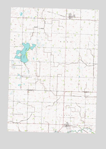
Echo, MN USGS Topographic Map
Click on map above to begin viewing in our Map Viewer.

This topographic map contains these locations and features:
Feature Name Type Latitude Longitude GNIS ID View Map
American Lutheran ChurchChurchN44.6186°W95.4142°2066265View Map
American Lutheran ChurchChurchN44.6186°W95.4142°2065628View Map
City of EchoCivilN44.6217°W95.4115°2394612View Map
City of VestaCivilN44.5066°W95.4140°2397132View Map
County Ditch Number EightyoneCanalN44.5177°W95.3972°642340View Map
County Ditch Number NinetysixCanalN44.5058°W95.4420°642384View Map
County Ditch Number NinetytwoCanalN44.5294°W95.4861°642379View Map
County Ditch Number ThirtyfiveCanalN44.5316°W95.4339°641990View Map
County Ditch Number ThirtytwoCanalN44.5100°W95.4928°641965View Map
Curtis LakeLakeN44.5794°W95.4789°642562View Map
EchoLocaleN44.6161°W95.4167°2066263View Map
EchoLocaleN44.6161°W95.4167°2065626View Map
EchoPopulated PlaceN44.6169°W95.4175°643147View Map
Echo Alliance ChurchChurchN44.6172°W95.4156°2066264View Map
Echo Alliance ChurchChurchN44.6172°W95.4156°2065627View Map
Echo Fire HallBuildingN44.6169°W95.4172°2066267View Map
Echo Police DepartmentBuildingN44.6169°W95.4172°2066266View Map
Echo Police DepartmentBuildingN44.6166°W95.4166°2065629View Map
Echo Post OfficePost OfficeN44.6169°W95.4158°2066262View Map
Echo Post OfficePost OfficeN44.6175°W95.4169°2065625View Map
Echo Volunteer Fire DepartmentBuildingN44.6171°W95.4178°2065630View Map
German CemeteryCemeteryN44.6208°W95.4208°2065678View Map
Holy Name Catholic Church CemeteryCemeteryN44.5078°W95.4222°2064552View Map
Judicial Ditch Number ThirtysevenCanalN44.5119°W95.4750°645915View Map
Peace Lutheran ChurchChurchN44.6169°W95.4172°2066268View Map
Peace Lutheran ChurchChurchN44.6169°W95.4172°2065631View Map
Posen State Wildlife Management AreaParkN44.5677°W95.4961°649686View Map
Saint John Lutheran ChurchChurchN44.5078°W95.4161°2064459View Map
Schmidt Private Airport (historical)AirportN44.5033°W95.4539°660451View Map
Township of EchoCivilN44.5843°W95.4219°664037View Map
VestaPopulated PlaceN44.5077°W95.4164°653645View Map
Vesta (historical)LocaleN44.5067°W95.4161°2064460View Map
Vesta CemeteryCemeteryN44.5158°W95.4100°2064553View Map
Vesta Fire Department and First RespondersBuildingN44.5065°W95.4186°2064457View Map
Vesta Post OfficePost OfficeN44.5078°W95.4161°2064458View Map
Vesta Town HallBuildingN44.5075°W95.4172°2064456View Map

Note: Coordinates in the location and feature list above are referenced to NAD83 datum.


Copyright (C) 2008-2024 Ryan Niemi / Sunset Dynamics ... All Rights Reserved