TopoQuest Logo
Do you find TopoQuest useful?
Help keep TopoQuest running and adding new maps/features by donating!
Bitcoin:  19c7KJd3qBynnjoSw5npx9KScwjBe4ifkT
Litecoin:  LXs6TkuXGGXo1vDsWCkWVdjQX94eUKd6ui
Home View Maps Find Maps Find Places Resources & Links


Eddiceton, Mississippi Topographic Map

USGS Map Title: Eddiceton, MS
USGS Map MRC: 31090E7
DRG (GeoTIFF) Download: o31090e7.tif


Neighboring USGS Topographic Map Quads:


  Gin Branch, MS  
31090F8
 

  Union Church, MS  
31090F7
 

  Caseyville, MS  
31090F6
 

  Kirby, MS  
31090E8
 

  Eddiceton, MS  
31090E7
 

  McCall Creek, MS  
31090E6
 

  Meadville, MS  
31090D8
 

  Bude, MS  
31090D7
 

  Little Springs, MS  
31090D6


Map MRC Location:

N32°
W91°
N32°
W90°
H8 H7 H6 H5 H4 H3 H2 H1
G8 G7 G6 G5 G4 G3 G2 G1
F8 F7 F6 F5 F4 F3 F2 F1
E8 E7 E6 E5 E4 E3 E2 E1
D8 D7 D6 D5 D4 D3 D2 D1
C8 C7 C6 C5 C4 C3 C2 C1
B8 B7 B6 B5 B4 B3 B2 B1
A8 A7 A6 A5 A4 A3 A2 A1
N31°
W91°
N31°
W90°

Eddiceton, MS USGS 1:24K Topographic Map Preview:
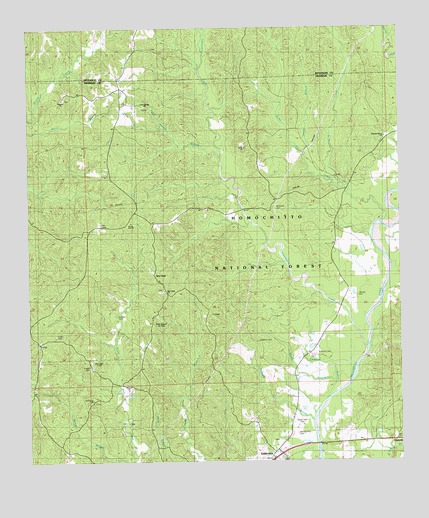
Eddiceton, MS USGS Topographic Map
Click on map above to begin viewing in our Map Viewer.

This topographic map contains these locations and features:
Feature Name Type Latitude Longitude GNIS ID View Map
Bonus Oil FieldOilfieldN31.5488°W90.8640°705535View Map
Cool Springs BranchStreamN31.5877°W90.8104°692964View Map
Cool Springs CemeteryCemeteryN31.6021°W90.8351°707566View Map
Cool Springs ChurchChurchN31.6016°W90.8354°692965View Map
Dodds BranchStreamN31.5171°W90.7757°693094View Map
EddicetonPopulated PlaceN31.5021°W90.7915°693161View Map
Eddiceton Oil FieldOilfieldN31.5335°W90.7773°705541View Map
Eddicetown Baptist ChurchChurchN31.5046°W90.7926°707568View Map
Eddicetown CemeteryCemeteryN31.5063°W90.7923°707569View Map
Fifteenmile CreekStreamN31.5327°W90.7620°693212View Map
Goldman BranchStreamN31.5229°W90.7729°693311View Map
Griffin CemeteryCemeteryN31.5360°W90.8665°693371View Map
Herring CemeteryCemeteryN31.5477°W90.7651°693453View Map
Johns CreekStreamN31.5888°W90.7823°693624View Map
Jones BranchStreamN31.5891°W90.7826°704491View Map
Lea CreekStreamN31.5788°W90.7693°693695View Map
Magee CemeteryCemeteryN31.5274°W90.8548°693867View Map
Maxwell BranchStreamN31.5116°W90.7804°693893View Map
McDanial CemeteryCemeteryN31.5735°W90.7932°693910View Map
Montgomery CemeteryCemeteryN31.5079°W90.7862°694022View Map
New HopePopulated PlaceN31.5535°W90.8329°694167View Map
New Hope Baptist ChurchChurchN31.5491°W90.8301°707591View Map
New Hope CemeteryCemeteryN31.5491°W90.8307°707592View Map
Newman CemeteryCemeteryN31.5313°W90.7793°694199View Map
Oak Grove CemeteryCemeteryN31.5174°W90.8532°707597View Map
Oak Grove ChurchChurchN31.5177°W90.8543°694229View Map
Partridge CemeteryCemeteryN31.5293°W90.8523°694321View Map
Pleasant Grove ChurchChurchN31.5932°W90.7557°694423View Map
Rocky Point CemeteryCemeteryN31.5121°W90.7851°694599View Map
Sarepta Baptist ChurchChurchN31.6041°W90.8634°694716View Map
Sarepta CemeteryCemeteryN31.6049°W90.8634°707605View Map
Steep Hill CreekStreamN31.5682°W90.7559°694887View Map
VetoPopulated PlaceN31.5779°W90.7709°705208View Map
Wheats (historical)LocaleN31.5029°W90.7773°707611View Map
Williams CemeteryCemeteryN31.5346°W90.7979°704492View Map
Williams CemeteryCemeteryN31.5349°W90.7979°705339View Map
Willis Branch Oil FieldOilfieldN31.5418°W90.8307°705340View Map
Zumbro CemeteryCemeteryN31.5416°W90.8454°695247View Map

Note: Coordinates in the location and feature list above are referenced to NAD83 datum.


Copyright (C) 2008-2025 Ryan Niemi / Sunset Dynamics ... All Rights Reserved