TopoQuest Logo
Do you find TopoQuest useful?
Help keep TopoQuest running and adding new maps/features by donating!
Bitcoin:  19c7KJd3qBynnjoSw5npx9KScwjBe4ifkT
Litecoin:  LXs6TkuXGGXo1vDsWCkWVdjQX94eUKd6ui
Home View Maps Find Maps Find Places Resources & Links


Edgerton North, Minnesota Topographic Map

USGS Map Title: Edgerton North, MN
USGS Map MRC: 43096H2
DRG (GeoTIFF) Download: o43096h2.tif


Neighboring USGS Topographic Map Quads:


  Pipestone North, MN  
44096A3
 

  Holland, MN  
44096A2
 

  Woodstock, MN  
44096A1
 

  Pipestone South, MN  
43096H3
 

  Edgerton North, MN  
43096H2
 

  Edgerton NE, MN  
43096H1
 

  Jasper SE, MN  
43096G3
 

  Edgerton South, MN  
43096G2
 

  Kenneth, MN  
43096G1


Map MRC Location:

N44°
W97°
N44°
W96°
H8 H7 H6 H5 H4 H3 H2 H1
G8 G7 G6 G5 G4 G3 G2 G1
F8 F7 F6 F5 F4 F3 F2 F1
E8 E7 E6 E5 E4 E3 E2 E1
D8 D7 D6 D5 D4 D3 D2 D1
C8 C7 C6 C5 C4 C3 C2 C1
B8 B7 B6 B5 B4 B3 B2 B1
A8 A7 A6 A5 A4 A3 A2 A1
N43°
W97°
N43°
W96°

Edgerton North, MN USGS 1:24K Topographic Map Preview:
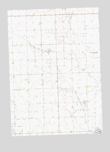
Edgerton North, MN USGS Topographic Map
Click on map above to begin viewing in our Map Viewer.

This topographic map contains these locations and features:
Feature Name Type Latitude Longitude GNIS ID View Map
Bethel Christian Reformed ChurchChurchN43.8755°W96.1281°2050142View Map
Burke State Wildlife Management AreaParkN43.9530°W96.1278°640657View Map
City of EdgertonCivilN43.8752°W96.1304°2394618View Map
City of HatfieldCivilN43.9546°W96.1905°2394322View Map
East Branch Rock RiverStreamN43.9911°W96.1667°643055View Map
Edgerton Family Medical ClinicHospitalN43.8772°W96.1364°2050147View Map
Edgerton Free Christian SchoolSchoolN43.8800°W96.1342°2050143View Map
Edgerton Public High SchoolSchoolN43.8772°W96.1303°2050144View Map
First Christian Reformed ChurchChurchN43.8755°W96.1303°2050140View Map
First Presbyterian ChurchChurchN43.8772°W96.1389°2050141View Map
HatfieldPopulated PlaceN43.9575°W96.1953°644720View Map
Hatfield (historical)LocaleN43.9575°W96.1953°2050150View Map
Hatfield Post OfficePost OfficeN43.9575°W96.1953°2050148View Map
Hillside CemeteryCemeteryN43.8764°W96.1419°645014View Map
Howard Snyder Farm Pond DamDamN43.8966°W96.1686°1777230View Map
Newalta DairyLocaleN43.9483°W96.2406°2702568View Map
R and R AcresLocaleN43.9122°W96.1672°2702532View Map
Ranger FarmsLocaleN43.8764°W96.1667°2702530View Map
Shaffer FarmsLocaleN43.9656°W96.2383°2702529View Map
Southwest Christian High SchoolSchoolN43.8764°W96.1364°2050146View Map
Township of ElmerCivilN43.8922°W96.2152°664082View Map
Township of GrayCivilN43.9804°W96.2461°664333View Map
Trosky CemeteryCemeteryN43.8917°W96.2417°653334View Map

Note: Coordinates in the location and feature list above are referenced to NAD83 datum.


Copyright (C) 2008-2025 Ryan Niemi / Sunset Dynamics ... All Rights Reserved