TopoQuest Logo
Do you find TopoQuest useful?
Help keep TopoQuest running and adding new maps/features by donating!
Bitcoin:  19c7KJd3qBynnjoSw5npx9KScwjBe4ifkT
Litecoin:  LXs6TkuXGGXo1vDsWCkWVdjQX94eUKd6ui
Home View Maps Find Maps Find Places Resources & Links


Egg Lake, California Topographic Map

USGS Map Title: Egg Lake, CA
USGS Map MRC: 41121C3
DRG (GeoTIFF) Download: o41121c3.tif


Neighboring USGS Topographic Map Quads:


  Border Mountain, CA  
41121D4
 

  Hollenbeck, CA  
41121D3
 

  Crank Mountain, CA  
41121D2
 

  White Horse, CA  
41121C4
 

  Egg Lake, CA  
41121C3
 

  Donica Mountain, CA  
41121C2
 

  Timbered Crater, CA  
41121B4
 

  Day, CA  
41121B3
 

  Lookout, CA  
41121B2


Map MRC Location:

N42°
W122°
N42°
W121°
H8 H7 H6 H5 H4 H3 H2 H1
G8 G7 G6 G5 G4 G3 G2 G1
F8 F7 F6 F5 F4 F3 F2 F1
E8 E7 E6 E5 E4 E3 E2 E1
D8 D7 D6 D5 D4 D3 D2 D1
C8 C7 C6 C5 C4 C3 C2 C1
B8 B7 B6 B5 B4 B3 B2 B1
A8 A7 A6 A5 A4 A3 A2 A1
N41°
W122°
N41°
W121°

Egg Lake, CA USGS 1:24K Topographic Map Preview:
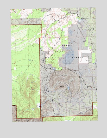
Egg Lake, CA USGS Topographic Map
Click on map above to begin viewing in our Map Viewer.

This topographic map contains these locations and features:
Feature Name Type Latitude Longitude GNIS ID View Map
Ben Eberli WaterholeLakeN41.3598°W121.2747°254601View Map
Ben Eberli WaterwellWellN41.3624°W121.2733°253109View Map
Curtis WaterholeLakeN41.3607°W121.3266°221937View Map
DemuthPopulated PlaceN41.3377°W121.2661°1655963View Map
Duck HoleLakeN41.3313°W121.2997°253133View Map
Egg LakeSwampN41.3202°W121.2911°223000View Map
Egg Lake ButteSummitN41.2977°W121.3030°223001View Map
Gasper MeadowFlatN41.2652°W121.3341°224092View Map
Hazelton SpringSpringN41.3174°W121.3475°225092View Map
Liza Large FlatFlatN41.2849°W121.3247°1665966View Map
Lost ReservoirReservoirN41.2888°W121.2922°227718View Map
Mac Afee FlatFlatN41.2627°W121.3458°227884View Map
Marshall SpringSpringN41.2936°W121.3439°228155View Map
Noonas SpringSpringN41.2852°W121.3435°229577View Map
Old Baker CabinLocaleN41.2679°W121.3400°253180View Map
Service GulchValleyN41.3488°W121.2841°266007View Map
Smith ButteSummitN41.2885°W121.3025°1665972View Map
Taylor MountainSummitN41.2777°W121.3511°236051View Map
Tom Large FlatFlatN41.3102°W121.3178°253194View Map
Wet Weather PondLakeN41.3430°W121.3300°1665980View Map

Note: Coordinates in the location and feature list above are referenced to NAD83 datum.


Copyright (C) 2008-2025 Ryan Niemi / Sunset Dynamics ... All Rights Reserved