TopoQuest Logo
Do you find TopoQuest useful?
Help keep TopoQuest running and adding new maps/features by donating!
Bitcoin:  19c7KJd3qBynnjoSw5npx9KScwjBe4ifkT
Litecoin:  LXs6TkuXGGXo1vDsWCkWVdjQX94eUKd6ui
Home View Maps Find Maps Find Places Resources & Links


Ehren, Florida Topographic Map

USGS Map Title: Ehren, FL
USGS Map MRC: 28082C4
DRG (GeoTIFF) Download: o28082c4.tif


Neighboring USGS Topographic Map Quads:


  Port Richey NE, FL  
28082D5
 

  Masaryktown, FL  
28082D4
 

  Spring Lake, FL  
28082D3
 

  Fivay Junction, FL  
28082C5
 

  Ehren, FL  
28082C4
 

  San Antonio, FL  
28082C3
 

  Odessa, FL  
28082B5
 

  Lutz, FL  
28082B4
 

  Wesley Chapel, FL  
28082B3


Map MRC Location:

N29°
W83°
N29°
W82°
H8 H7 H6 H5 H4 H3 H2 H1
G8 G7 G6 G5 G4 G3 G2 G1
F8 F7 F6 F5 F4 F3 F2 F1
E8 E7 E6 E5 E4 E3 E2 E1
D8 D7 D6 D5 D4 D3 D2 D1
C8 C7 C6 C5 C4 C3 C2 C1
B8 B7 B6 B5 B4 B3 B2 B1
A8 A7 A6 A5 A4 A3 A2 A1
N28°
W83°
N28°
W82°

Ehren, FL USGS 1:24K Topographic Map Preview:
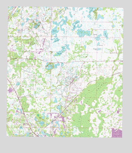
Ehren, FL USGS Topographic Map
Click on map above to begin viewing in our Map Viewer.

This topographic map contains these locations and features:
Feature Name Type Latitude Longitude GNIS ID View Map
Bay LakeLakeN28.2633°W82.4618°278209View Map
Big Cypress SwampSwampN28.2795°W82.4176°278661View Map
Big Fish LakeLakeN28.3714°W82.4114°278670View Map
Clear LakeLakeN28.3626°W82.4789°294404View Map
Connerton Census Designated PlaceCensusN28.3024°W82.4625°2583337View Map
Curve LakeLakeN28.2540°W82.4606°281173View Map
Cypress CreekStreamN28.3081°W82.3859°281204View Map
EhrenPopulated PlaceN28.2664°W82.4479°295258View Map
Goose LakeLakeN28.3569°W82.4685°283193View Map
Hog Island PondSwampN28.3351°W82.4011°284091View Map
Mann PondLakeN28.3400°W82.4017°286384View Map
New River PondSwampN28.3544°W82.4212°287680View Map
Oak Grove ChurchChurchN28.2761°W82.4354°287942View Map
Oakes PondLakeN28.3492°W82.3940°287998View Map
Parker LakeLakeN28.3311°W82.4437°288517View Map
Pasco CountyCivilN28.3067°W82.4389°295739View Map
Pasco County Fire Rescue Station 22BuildingN28.3025°W82.4961°2131521View Map
Pasco County Land O' Lakes Detention CenterBuildingN28.3074°W82.4839°2753095View Map
Pasco County Sheriff's Office Court Services BureauBuildingN28.3076°W82.4838°2333561View Map
Pilot Country AirportAirportN28.3267°W82.4958°309295View Map
Raft LakeLakeN28.3523°W82.4489°294335View Map
Red Bug LakeLakeN28.2685°W82.4603°289538View Map
Spivey LakeLakeN28.3415°W82.4472°291504View Map
Thomas E Weightman Middle SchoolSchoolN28.2631°W82.4782°2485610View Map
Way PondLakeN28.3497°W82.4073°292956View Map
Wistaria LakeLakeN28.2521°W82.4770°293439View Map

Note: Coordinates in the location and feature list above are referenced to NAD83 datum.


Copyright (C) 2008-2025 Ryan Niemi / Sunset Dynamics ... All Rights Reserved