TopoQuest Logo
Do you find TopoQuest useful?
Help keep TopoQuest running and adding new maps/features by donating!
Bitcoin:  19c7KJd3qBynnjoSw5npx9KScwjBe4ifkT
Litecoin:  LXs6TkuXGGXo1vDsWCkWVdjQX94eUKd6ui
Home View Maps Find Maps Find Places Resources & Links


Eightmile Mountain, Idaho Topographic Map

USGS Map Title: Eightmile Mountain, ID
USGS Map MRC: 44115B3
DRG (GeoTIFF) Download: o44115b3.tif


Neighboring USGS Topographic Map Quads:


  Cache Creek, ID  
44115C4
 

  Bull Trout Point, ID  
44115C3
 

  Banner Summit, ID  
44115C2
 

  Miller Mountain East, ID  
44115B4
 

  Eightmile Mountain, ID  
44115B3
 

  Grandjean, ID  
44115B2
 

  Jackson Peak, ID  
44115A4
 

  Tyee Mountain, ID  
44115A3
 

  Edaho Mountain, ID  
44115A2


Map MRC Location:

N45°
W116°
N45°
W115°
H8 H7 H6 H5 H4 H3 H2 H1
G8 G7 G6 G5 G4 G3 G2 G1
F8 F7 F6 F5 F4 F3 F2 F1
E8 E7 E6 E5 E4 E3 E2 E1
D8 D7 D6 D5 D4 D3 D2 D1
C8 C7 C6 C5 C4 C3 C2 C1
B8 B7 B6 B5 B4 B3 B2 B1
A8 A7 A6 A5 A4 A3 A2 A1
N44°
W116°
N44°
W115°

Eightmile Mountain, ID USGS 1:24K Topographic Map Preview:
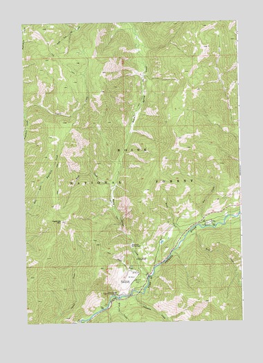
Eightmile Mountain, ID USGS Topographic Map
Click on map above to begin viewing in our Map Viewer.

This topographic map contains these locations and features:
Feature Name Type Latitude Longitude GNIS ID View Map
Blue Jay CreekStreamN44.1357°W115.3243°377915View Map
Bonneville Hot SpringsSpringN44.1569°W115.3144°378024View Map
Burn CreekStreamN44.1602°W115.2829°378519View Map
Bush CreekStreamN44.1799°W115.3237°378580View Map
Castro CreekStreamN44.2121°W115.3743°379024View Map
Chapman CreekStreamN44.1366°W115.3148°379189View Map
Eightmile MountainSummitN44.1674°W115.3540°381283View Map
Fox CreekStreamN44.1646°W115.2709°381987View Map
Lowman City AmbulanceBuildingN44.1571°W115.2876°2642841View Map
Lowman Volunteer Fire Department Station 1BuildingN44.1412°W115.3069°2619164View Map
MacDonald CreekStreamN44.1274°W115.3437°386321View Map
Penrod Access AreaLocaleN44.1435°W115.3159°401087View Map
Penrod CreekStreamN44.1480°W115.3082°388338View Map
South Fork Payette River Game PreserveParkN44.1463°W115.2682°399226View Map
Warm Spring CreekStreamN44.1441°W115.3045°392864View Map
Warm Springs CampgroundLocaleN44.1510°W115.3109°392879View Map
Warm Springs Creek AirportAirportN44.1434°W115.3128°400860View Map
Warm Springs Forest Service StationLocaleN44.1366°W115.3232°392894View Map
Wolf CreekStreamN44.1618°W115.2809°393623View Map

Note: Coordinates in the location and feature list above are referenced to NAD83 datum.


Copyright (C) 2008-2025 Ryan Niemi / Sunset Dynamics ... All Rights Reserved