TopoQuest Logo
Do you find TopoQuest useful?
Help keep TopoQuest running and adding new maps/features by donating!
Bitcoin:  19c7KJd3qBynnjoSw5npx9KScwjBe4ifkT
Litecoin:  LXs6TkuXGGXo1vDsWCkWVdjQX94eUKd6ui
Home View Maps Find Maps Find Places Resources & Links


El Dado, New Mexico Topographic Map

USGS Map Title: El Dado, NM
USGS Map MRC: 35107E5
DRG (GeoTIFF) Download: o35107e5.tif


Neighboring USGS Topographic Map Quads:


  Hospah, NM  
35107F6
 

  Mesita Americana, NM  
35107F5
 

  Mesita Del Gavilan, NM  
35107F4
 

  Piedra De La Aguila, NM  
35107E6
 

  El Dado, NM  
35107E5
 

  Mesa Cortada, NM  
35107E4
 

  San Lucas Dam, NM  
35107D6
 

  Cerro Alesna, NM  
35107D5
 

  El Dado Mesa, NM  
35107D4


Map MRC Location:

N36°
W108°
N36°
W107°
H8 H7 H6 H5 H4 H3 H2 H1
G8 G7 G6 G5 G4 G3 G2 G1
F8 F7 F6 F5 F4 F3 F2 F1
E8 E7 E6 E5 E4 E3 E2 E1
D8 D7 D6 D5 D4 D3 D2 D1
C8 C7 C6 C5 C4 C3 C2 C1
B8 B7 B6 B5 B4 B3 B2 B1
A8 A7 A6 A5 A4 A3 A2 A1
N35°
W108°
N35°
W107°

El Dado, NM USGS 1:24K Topographic Map Preview:
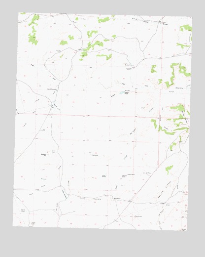
El Dado, NM USGS Topographic Map
Click on map above to begin viewing in our Map Viewer.

This topographic map contains these locations and features:
Feature Name Type Latitude Longitude GNIS ID View Map
Abeyta ArroyoStreamN35.5831°W107.5342°885535View Map
AgujaSummitN35.6220°W107.5784°885601View Map
Arroyo LeonStreamN35.5839°W107.5923°897646View Map
Arroyo TinajaStreamN35.5275°W107.5951°885463View Map
Arroyo TinajaStreamN35.5322°W107.5814°885515View Map
Brown TankReservoirN35.5442°W107.5958°886775View Map
Bull Pasture WellWellN35.5331°W107.5314°886889View Map
Burro SpringsSpringN35.5312°W107.5591°886966View Map
Caņon del DadoValleyN35.5050°W107.5214°2025928View Map
Cliff Dwelling CanyonValleyN35.5742°W107.5245°887686View Map
Cliff HouseLocaleN35.5620°W107.5037°887687View Map
Coal Mine SpringSpringN35.5315°W107.5481°887709View Map
Doctor ArroyoArroyoN35.5581°W107.5387°905792View Map
Doctor SpringSpringN35.5176°W107.5537°888417View Map
El DadoPopulated PlaceN35.5156°W107.5173°902819View Map
El Dado SpringSpringN35.5150°W107.5167°917573View Map
Escondido WellWellN35.5934°W107.5420°888911View Map
Felipe Tafoya GrantCivilN35.5236°W107.5178°906245View Map
Huerfano WellWellN35.6206°W107.5217°890248View Map
Laguna AbeytaReservoirN35.5798°W107.5495°897962View Map
Laguna AlamoReservoirN35.5091°W107.6155°897963View Map
Laguna AnacondaReservoirN35.5799°W107.5972°897964View Map
Laguna ElefanteReservoirN35.5191°W107.5892°897974View Map
Laguna EscondidoReservoirN35.5961°W107.5435°897975View Map
Laguna LeonReservoirN35.5705°W107.5960°897983View Map
Laguna PiedraReservoirN35.5019°W107.6128°897986View Map
LeonPopulated PlaceN35.5711°W107.6001°898812View Map
Leon Post Office (historical)Post OfficeN35.5711°W107.6001°938423View Map
Montaņo SpringSpringN35.5172°W107.5684°892165View Map
Montoya SpringSpringN35.5831°W107.5061°892189View Map
Mulatto CanyonValleyN35.5272°W107.5951°908964View Map
North Fork Arroyo LeonStreamN35.5650°W107.6226°892585View Map
Ojo RedondoSpringN35.5176°W107.5734°898100View Map
Peņa SpringsSpringN35.5425°W107.5703°893155View Map
Piedra CamelloPillarN35.5078°W107.5384°893252View Map
Salazar SpringSpringN35.5320°W107.5445°894321View Map
San Isidro ArroyoArroyoN35.5803°W107.5187°910627View Map
San Ysidro SpringSpringN35.5064°W107.6103°915790View Map
Sombrero AltoSummitN35.5422°W107.6026°894997View Map
South Fork Arroyo LeonStreamN35.5756°W107.6009°895040View Map
Stone A RuinsLocaleN35.5714°W107.5334°895363View Map
Ventana WellWellN35.6028°W107.5937°896120View Map
Voght DrawValleyN35.5800°W107.5184°897508View Map

Note: Coordinates in the location and feature list above are referenced to NAD83 datum.


Copyright (C) 2008-2025 Ryan Niemi / Sunset Dynamics ... All Rights Reserved