TopoQuest Logo
Do you find TopoQuest useful?
Help keep TopoQuest running and adding new maps/features by donating!
Bitcoin:  19c7KJd3qBynnjoSw5npx9KScwjBe4ifkT
Litecoin:  LXs6TkuXGGXo1vDsWCkWVdjQX94eUKd6ui
Home View Maps Find Maps Find Places Resources & Links


Elbow, Texas Topographic Map

USGS Map Title: Elbow, TX
USGS Map MRC: 32101B5
DRG (GeoTIFF) Download: o32101b5.tif


Neighboring USGS Topographic Map Quads:


  Knott SW, TX  
32101C6
 

  Knott SE, TX  
32101C5
 

  Big Spring North, TX  
32101C4
 

  Natural Dam Lake, TX  
32101B6
 

  Elbow, TX  
32101B5
 

  Big Spring South, TX  
32101B4
 

  Houston Ranch, TX  
32101A6
 

  Lucian Wells Ranch, TX  
32101A5
 

  Lees, TX  
32101A4


Map MRC Location:

N33°
W102°
N33°
W101°
H8 H7 H6 H5 H4 H3 H2 H1
G8 G7 G6 G5 G4 G3 G2 G1
F8 F7 F6 F5 F4 F3 F2 F1
E8 E7 E6 E5 E4 E3 E2 E1
D8 D7 D6 D5 D4 D3 D2 D1
C8 C7 C6 C5 C4 C3 C2 C1
B8 B7 B6 B5 B4 B3 B2 B1
A8 A7 A6 A5 A4 A3 A2 A1
N32°
W102°
N32°
W101°

Elbow, TX USGS 1:24K Topographic Map Preview:
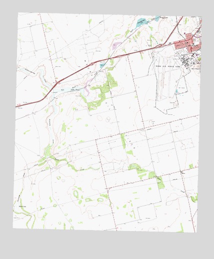
Elbow, TX USGS Topographic Map
Click on map above to begin viewing in our Map Viewer.

This topographic map contains these locations and features:
Feature Name Type Latitude Longitude GNIS ID View Map
Air Evac Lifeteam Base Big SpringBuildingN32.2248°W101.5314°2655953View Map
Big Spring Army Air Field (historical)MilitaryN32.2183°W101.5211°2091658View Map
Big Spring Fire Department Station 1BuildingN32.2285°W101.5176°2552057View Map
Big Spring Mc Mahon-Wrinkle AirportAirportN32.2147°W101.5269°1386250View Map
Big Spring Police DepartmentBuildingN32.2350°W101.5128°2750303View Map
ElbowPopulated PlaceN32.1604°W101.5121°1378248View Map
Elbow CreekStreamN32.1671°W101.6029°1335296View Map
Federal Correctional Institution Big Spring FacilityBuildingN32.2274°W101.5063°2738657View Map
Fourmile LakeLakeN32.2459°W101.5414°1336122View Map
Howard County Sheriff's OfficeBuildingN32.2349°W101.5124°2750403View Map
Howard County Volunteer Fire Department LomaxBuildingN32.1384°W101.5584°2551053View Map
Moore Oil FieldOilfieldN32.1879°W101.5518°1341873View Map
Mustang DrawValleyN32.2029°W101.5993°1342317View Map
Roberts LakeLakeN32.1376°W101.6217°1345318View Map
Salt LakeLakeN32.2058°W101.5934°1346239View Map
Sulphur Springs DrawValleyN32.2058°W101.5997°1376335View Map
Webb Air Force Base (historical)MilitaryN32.2156°W101.5225°2090482View Map

Note: Coordinates in the location and feature list above are referenced to NAD83 datum.


Copyright (C) 2008-2025 Ryan Niemi / Sunset Dynamics ... All Rights Reserved