TopoQuest Logo
Do you find TopoQuest useful?
Help keep TopoQuest running and adding new maps/features by donating!
Bitcoin:  19c7KJd3qBynnjoSw5npx9KScwjBe4ifkT
Litecoin:  LXs6TkuXGGXo1vDsWCkWVdjQX94eUKd6ui
Home View Maps Find Maps Find Places Resources & Links


Elkhorn, Montana Topographic Map

USGS Map Title: Elkhorn, MT
USGS Map MRC: 46111C8
DRG (GeoTIFF) Download: o46111c8.tif


Neighboring USGS Topographic Map Quads:


  Jefferson City, MT  
46112D1
 

  Clancy, MT  
46111D8
 

  Casey Peak, MT  
46111D7
 

  Wickes, MT  
46112C1
 

  Elkhorn, MT  
46111C8
 

  Crow Creek Falls, MT  
46111C7
 

  Boulder East, MT  
46112B1
 

  Tacoma Park, MT  
46111B8
 

  Devils Fence, MT  
46111B7


Map MRC Location:

N47°
W112°
N47°
W111°
H8 H7 H6 H5 H4 H3 H2 H1
G8 G7 G6 G5 G4 G3 G2 G1
F8 F7 F6 F5 F4 F3 F2 F1
E8 E7 E6 E5 E4 E3 E2 E1
D8 D7 D6 D5 D4 D3 D2 D1
C8 C7 C6 C5 C4 C3 C2 C1
B8 B7 B6 B5 B4 B3 B2 B1
A8 A7 A6 A5 A4 A3 A2 A1
N46°
W112°
N46°
W111°

Elkhorn, MT USGS 1:24K Topographic Map Preview:
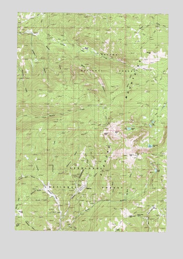
Elkhorn, MT USGS Topographic Map
Click on map above to begin viewing in our Map Viewer.

This topographic map contains these locations and features:
Feature Name Type Latitude Longitude GNIS ID View Map
Anderson GulchValleyN46.3613°W111.9886°779034View Map
Black CanyonValleyN46.3533°W111.9569°779983View Map
Boulaway MineMineN46.2599°W111.9483°780249View Map
Boulder ParkFlatN46.2602°W111.9964°806137View Map
Bullock HillSummitN46.3527°W111.8886°780591View Map
C and D MineMineN46.2891°W111.9347°780717View Map
C and D MineMineN46.2891°W111.9342°803538View Map
Carmody MineMineN46.2735°W111.9514°780954View Map
Carmody MineMineN46.2722°W111.9522°803551View Map
Crow PeakSummitN46.2938°W111.9042°781933View Map
DuBois GulchValleyN46.2694°W111.9100°782675View Map
Dunstone/Klondyke MineMineN46.2810°W111.9414°803322View Map
East Butte MineMineN46.2766°W111.9503°782789View Map
ElkhornPopulated PlaceN46.2747°W111.9458°783128View Map
Elkhorn (historical)LocaleN46.2747°W111.9458°1762688View Map
Elkhorn Census Designated PlaceCensusN46.2843°W111.9488°2583806View Map
Elkhorn PeakSummitN46.3072°W111.9203°783137View Map
Elkhorn Picnic AreaLocaleN46.2724°W111.9492°794188View Map
Elkhorn Post Office (historical)Post OfficeN46.2747°W111.9458°1762575View Map
Elkhorn Skyline MineMineN46.2902°W111.8889°783141View Map
Elkhorn State ParkParkN46.2747°W111.9458°1797301View Map
Glenwood LakeLakeN46.2993°W111.8900°783991View Map
Golden Moss MineMineN46.2885°W111.9392°784079View Map
Golden Moss MineMineN46.2883°W111.9392°803537View Map
Greyback GulchValleyN46.2780°W111.9739°806242View Map
Hardcash MineMineN46.2797°W111.9489°784546View Map
Heggen MineMineN46.2808°W111.9497°784710View Map
Hidden LakeLakeN46.3090°W111.9074°784833View Map
Hobo GulchValleyN46.2683°W111.9230°784906View Map
Iron MineMineN46.3113°W111.9255°785330View Map
Iron MineMineN46.3102°W111.9294°803572View Map
James R Keene MineMineN46.2794°W111.9430°803323View Map
King of Sweden MineMineN46.2880°W111.9522°803546View Map
Leslie LakeLakeN46.2853°W111.8850°786059View Map
Louise MineMineN46.2908°W111.9358°786647View Map
Lupien SpringSpringN46.2514°W111.9181°786723View Map
Luxanburgh MineMineN46.2730°W111.9414°803325View Map
Moreau MineMineN46.2785°W111.9514°787678View Map
Mud SpringsSpringN46.2630°W111.8880°806791View Map
Ninety Cent GulchValleyN46.2805°W111.9839°788018View Map
QueenPopulated PlaceN46.2513°W111.9650°789287View Map
Queen (historical)LocaleN46.2513°W111.9650°1762656View Map
Queen GulchValleyN46.2508°W111.9642°789291View Map
Queen Post Office (historical)Post OfficeN46.2513°W111.9650°1762566View Map
Rabbit GulchValleyN46.3419°W111.9053°789314View Map
Radersburg PassGapN46.2591°W111.9069°789324View Map
Rube Sobey SpringSpringN46.2591°W111.9000°806239View Map
Ruddville (historical)LocaleN46.3638°W111.9008°1762651View Map
SE NE Section 2 MineMineN46.3022°W111.9353°803573View Map
SE SW Section 1 MineMineN46.2960°W111.9230°803574View Map
Seven-Up GulchValleyN46.2735°W111.9775°790248View Map
Seven-Up Gulch MineMineN46.2752°W111.9839°803493View Map
Skyline MineMineN46.2902°W111.8892°803492View Map
Slaughterhouse GulchValleyN46.2730°W111.9500°790642View Map
Sourdough (historical)LocaleN46.2833°W111.9611°1762646View Map
Sourdough CreekStreamN46.2735°W111.9750°790861View Map
Sourdough MineMineN46.2844°W111.9619°790866View Map
Sourdough MineMineN46.2833°W111.9611°803550View Map
South Fork Queen GulchValleyN46.2527°W111.9555°791032View Map
Spring CreekStreamN46.2599°W111.9628°791208View Map
Tizer LakesLakeN46.3116°W111.8894°792219View Map
Tizer Lakes Fishing Access SiteLocaleN46.3113°W111.8917°1744439View Map
Turnley CreekStreamN46.2572°W111.9630°792473View Map
Turnley MeadowsFlatN46.2738°W111.9747°806138View Map
Union MineMineN46.2905°W111.9422°792590View Map
Weimer CreekStreamN46.3624°W111.9855°792925View Map
Windy PointSummitN46.3060°W111.9292°806135View Map
Woods ParkFlatN46.3541°W111.9447°806134View Map

Note: Coordinates in the location and feature list above are referenced to NAD83 datum.


Copyright (C) 2008-2025 Ryan Niemi / Sunset Dynamics ... All Rights Reserved