TopoQuest Logo
Do you find TopoQuest useful?
Help keep TopoQuest running and adding new maps/features by donating!
Bitcoin:  19c7KJd3qBynnjoSw5npx9KScwjBe4ifkT
Litecoin:  LXs6TkuXGGXo1vDsWCkWVdjQX94eUKd6ui
Home View Maps Find Maps Find Places Resources & Links


Ellenburg Depot, New York Topographic Map

USGS Map Title: Ellenburg Depot, NY
USGS Map MRC: 44073H7
DRG (GeoTIFF) Download: o44073h7.tif


Neighboring USGS Topographic Map Quads:


  Churubusco, NY  
44073H8
 

  Ellenburg Depot, NY  
44073H7
 

  Altona, NY  
44073H6
 

  Ellenburg Center, NY  
44073G8
 

  Ellenburg Mountain, NY  
44073G7
 

  Jericho, NY  
44073G6


Map MRC Location:

N45°
W74°
N45°
W73°
H8 H7 H6 H5 H4 H3 H2 H1
G8 G7 G6 G5 G4 G3 G2 G1
F8 F7 F6 F5 F4 F3 F2 F1
E8 E7 E6 E5 E4 E3 E2 E1
D8 D7 D6 D5 D4 D3 D2 D1
C8 C7 C6 C5 C4 C3 C2 C1
B8 B7 B6 B5 B4 B3 B2 B1
A8 A7 A6 A5 A4 A3 A2 A1
N44°
W74°
N44°
W73°

Ellenburg Depot, NY USGS 1:24K Topographic Map Preview:
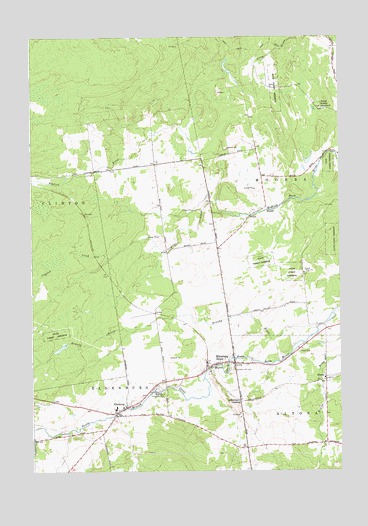
Ellenburg Depot, NY USGS Topographic Map
Click on map above to begin viewing in our Map Viewer.

This topographic map contains these locations and features:
Feature Name Type Latitude Longitude GNIS ID View Map
Brandy BrookStreamN44.9161°W73.7596°944640View Map
Crystal CreekStreamN44.9495°W73.7974°947893View Map
Dannemora CrossingPopulated PlaceN44.8953°W73.7907°972363View Map
EllenburgPopulated PlaceN44.8939°W73.8365°949504View Map
Ellenburg DepotPopulated PlaceN44.9059°W73.8010°949506View Map
Ellenburg Depot Fire DepartmentBuildingN44.9060°W73.7961°2718312View Map
Fernwood School (historical)SchoolN44.9601°W73.7810°2463390View Map
ForestPopulated PlaceN44.9020°W73.7560°950384View Map
Green Valley School (historical)SchoolN44.9223°W73.7733°2463389View Map
Hammond School (historical)SchoolN44.8814°W73.7876°2463388View Map
Northern Adirondack Elementary SchoolSchoolN44.8935°W73.8406°2597546View Map
Northern Adirondack Junior - Senior High SchoolSchoolN44.8942°W73.8429°2597552View Map
Saint Edmund's ChurchChurchN44.8937°W73.8370°2597576View Map
Saint Edmunds CemeteryCemeteryN44.8987°W73.8257°963460View Map
Sarah A Munsil Free LibraryBuildingN44.9039°W73.8044°2598615View Map
Sheldon Hill CemeteryCemeteryN44.9037°W73.7937°965018View Map
Silver Lane DairyLocaleN44.8767°W73.8564°2703164View Map
Wesleyan ChurchChurchN44.9049°W73.7929°2597655View Map
Woods School (historical)SchoolN44.9637°W73.8242°2463391View Map

Note: Coordinates in the location and feature list above are referenced to NAD83 datum.


Copyright (C) 2008-2024 Ryan Niemi / Sunset Dynamics ... All Rights Reserved