TopoQuest Logo
Do you find TopoQuest useful?
Help keep TopoQuest running and adding new maps/features by donating!
Bitcoin:  19c7KJd3qBynnjoSw5npx9KScwjBe4ifkT
Litecoin:  LXs6TkuXGGXo1vDsWCkWVdjQX94eUKd6ui
Home View Maps Find Maps Find Places Resources & Links


Ellinwood NW, Kansas Topographic Map

USGS Map Title: Ellinwood NW, KS
USGS Map MRC: 38098D6
DRG (GeoTIFF) Download: o38098d6.tif


Neighboring USGS Topographic Map Quads:


  Hoisington, KS  
38098E7
 

  Redwing, KS  
38098E6
 

  Claflin, KS  
38098E5
 

  Great Bend NE, KS  
38098D7
 

  Ellinwood NW, KS  
38098D6
 

  Ellinwood NE, KS  
38098D5
 

  Great Bend, KS  
38098C7
 

  Ellinwood SW, KS  
38098C6
 

  Ellinwood, KS  
38098C5


Map MRC Location:

N39°
W99°
N39°
W98°
H8 H7 H6 H5 H4 H3 H2 H1
G8 G7 G6 G5 G4 G3 G2 G1
F8 F7 F6 F5 F4 F3 F2 F1
E8 E7 E6 E5 E4 E3 E2 E1
D8 D7 D6 D5 D4 D3 D2 D1
C8 C7 C6 C5 C4 C3 C2 C1
B8 B7 B6 B5 B4 B3 B2 B1
A8 A7 A6 A5 A4 A3 A2 A1
N38°
W99°
N38°
W98°

Ellinwood NW, KS USGS 1:24K Topographic Map Preview:
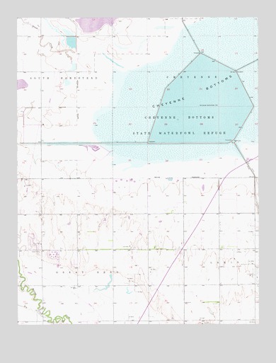
Ellinwood NW, KS USGS Topographic Map
Click on map above to begin viewing in our Map Viewer.

This topographic map contains these locations and features:
Feature Name Type Latitude Longitude GNIS ID View Map
Barton Community College - A BuildingSchoolN38.4045°W98.7322°2692290View Map
Barton Community College - C BuildingSchoolN38.4027°W98.7326°2692291View Map
Barton Community College - F BuildingSchoolN38.4027°W98.7306°2692293View Map
Barton Community College - L BuildingSchoolN38.4035°W98.7316°2692294View Map
Barton Community College - P BuildingSchoolN38.4035°W98.7332°2692295View Map
Barton Community College - S BuildingSchoolN38.4044°W98.7307°2692296View Map
Barton Community College - T BuildingSchoolN38.4037°W98.7300°2692297View Map
Barton Community College - U BuildingSchoolN38.4024°W98.7316°2692298View Map
Barton Community College Child Development CenterSchoolN38.4014°W98.7308°2692292View Map
Barton Community College Kirkman Student Activity CenterBuildingN38.4039°W98.7332°2692543View Map
Barton Community College PlanetariumBuildingN38.4044°W98.7311°2692542View Map
Barton County Community CollegeSchoolN38.4036°W98.7317°2692095View Map
Barton County Community College Water Treatment FacilityLocaleN38.3987°W98.7293°2693395View Map
Barton County LandfillLocaleN38.4079°W98.7057°2692266View Map
Blood CreekStreamN38.4756°W98.7015°475498View Map
Button AirportAirportN38.3767°W98.7464°481394View Map
Cheyenne BottomsBendN38.4695°W98.6559°475522View Map
Cheyenne Bottoms Wildlife AreaParkN38.4542°W98.6642°475523View Map
Cheyenne View SchoolSchoolN38.4036°W98.6631°475654View Map
Community Christian ChurchChurchN38.4047°W98.7276°2690035View Map
Dry Walnut CreekStreamN38.3786°W98.7348°475624View Map
Fort Hays State University Kansas Wetlands Education CenterSchoolN38.4403°W98.6283°2692315View Map
Fort Zarah (historical)MilitaryN38.4028°W98.7306°485188View Map
KBJC-FM (Great Bend)TowerN38.4036°W98.7290°481506View Map
L E Gus and Eva Shafer Memorial Art GalleryBuildingN38.4028°W98.7308°2694920View Map
Pool 1ALakeN38.4614°W98.6442°2761660View Map
Pool 1BLakeN38.4617°W98.6672°2761659View Map
Pool 1CLakeN38.4756°W98.6528°2761661View Map
Pool 2SwampN38.4742°W98.6813°2761662View Map
Pool 3ASwampN38.4911°W98.6485°2761663View Map
Pool 3BSwampN38.4949°W98.6314°2761664View Map
Pool 5SwampN38.4440°W98.6810°2761667View Map
Township of Great BendCivilN38.3959°W98.7339°475651View Map

Note: Coordinates in the location and feature list above are referenced to NAD83 datum.


Copyright (C) 2008-2024 Ryan Niemi / Sunset Dynamics ... All Rights Reserved