TopoQuest Logo
Do you find TopoQuest useful?
Help keep TopoQuest running and adding new maps/features by donating!
Bitcoin:  19c7KJd3qBynnjoSw5npx9KScwjBe4ifkT
Litecoin:  LXs6TkuXGGXo1vDsWCkWVdjQX94eUKd6ui
Home View Maps Find Maps Find Places Resources & Links


Elm Creek West, Nebraska Topographic Map

USGS Map Title: Elm Creek West, NE
USGS Map MRC: 40099F4
DRG (GeoTIFF) Download: o40099f4.tif


Neighboring USGS Topographic Map Quads:


  Lexington SE, NE  
40099G5
 

  Miller SW, NE  
40099G4
 

  Amherst, NE  
40099G3
 

  Overton, NE  
40099F5
 

  Elm Creek West, NE  
40099F4
 

  Elm Creek East, NE  
40099F3
 

  Bertrand SE, NE  
40099E5
 

  Elm Creek SW, NE  
40099E4
 

  Elm Creek SE, NE  
40099E3


Map MRC Location:

N41°
W100°
N41°
W99°
H8 H7 H6 H5 H4 H3 H2 H1
G8 G7 G6 G5 G4 G3 G2 G1
F8 F7 F6 F5 F4 F3 F2 F1
E8 E7 E6 E5 E4 E3 E2 E1
D8 D7 D6 D5 D4 D3 D2 D1
C8 C7 C6 C5 C4 C3 C2 C1
B8 B7 B6 B5 B4 B3 B2 B1
A8 A7 A6 A5 A4 A3 A2 A1
N40°
W100°
N40°
W99°

Elm Creek West, NE USGS 1:24K Topographic Map Preview:
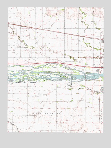
Elm Creek West, NE USGS Topographic Map
Click on map above to begin viewing in our Map Viewer.

This topographic map contains these locations and features:
Feature Name Type Latitude Longitude GNIS ID View Map
Blue Hole West LakeReservoirN40.6903°W99.4003°1875138View Map
East Twelfth SchoolSchoolN40.7072°W99.4640°828996View Map
Elm Creek CanalCanalN40.7364°W99.3790°829086View Map
Elm Creek Volunteer Fire and Rescue DepartmentBuildingN40.7198°W99.3786°2553254View Map
Historic Platte Valley Historical MarkerParkN40.6556°W99.3801°1873973View Map
Interchange 257CrossingN40.6900°W99.3798°1875374View Map
Platte River BridgeBridgeN40.6825°W99.3798°1874064View Map
School Number 3SchoolN40.6564°W99.4540°836526View Map
School Number 94SchoolN40.7297°W99.4084°837203View Map
Township of OvertonCivilN40.7417°W99.4809°1874882View Map
Township of WilliamsburgCivilN40.6436°W99.4584°838331View Map
TruedPopulated PlaceN40.7278°W99.4643°835469View Map
Village of Elm CreekCivilN40.7201°W99.3756°2398813View Map
Williamsburg ChurchChurchN40.6489°W99.4543°834757View Map
Williamsburg Post Office (historical)Post OfficeN40.6500°W99.4559°1873896View Map

Note: Coordinates in the location and feature list above are referenced to NAD83 datum.


Copyright (C) 2008-2025 Ryan Niemi / Sunset Dynamics ... All Rights Reserved