TopoQuest Logo
Do you find TopoQuest useful?
Help keep TopoQuest running and adding new maps/features by donating!
Bitcoin:  19c7KJd3qBynnjoSw5npx9KScwjBe4ifkT
Litecoin:  LXs6TkuXGGXo1vDsWCkWVdjQX94eUKd6ui
Home View Maps Find Maps Find Places Resources & Links


Elverson, Pennsylvania Topographic Map

USGS Map Title: Elverson, PA
USGS Map MRC: 40075B7
DRG (GeoTIFF) Download: o40075b7.tif


Neighboring USGS Topographic Map Quads:


  Reading, PA  
40075C8
 

  Birdsboro, PA  
40075C7
 

  Boyertown, PA  
40075C6
 

  Morgantown, PA  
40075B8
 

  Elverson, PA  
40075B7
 

  Pottstown, PA  
40075B6
 

  Honey Brook, PA  
40075A8
 

  Wagontown, PA  
40075A7
 

  Downingtown, PA  
40075A6


Map MRC Location:

N41°
W76°
N41°
W75°
H8 H7 H6 H5 H4 H3 H2 H1
G8 G7 G6 G5 G4 G3 G2 G1
F8 F7 F6 F5 F4 F3 F2 F1
E8 E7 E6 E5 E4 E3 E2 E1
D8 D7 D6 D5 D4 D3 D2 D1
C8 C7 C6 C5 C4 C3 C2 C1
B8 B7 B6 B5 B4 B3 B2 B1
A8 A7 A6 A5 A4 A3 A2 A1
N40°
W76°
N40°
W75°

Elverson, PA USGS 1:24K Topographic Map Preview:
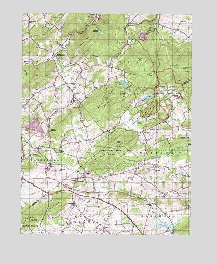
Elverson, PA USGS Topographic Map
Click on map above to begin viewing in our Map Viewer.

This topographic map contains these locations and features:
Feature Name Type Latitude Longitude GNIS ID View Map
Beaver RunStreamN40.2259°W75.8519°1169031View Map
Bethesda ChurchChurchN40.2034°W75.7588°1169421View Map
Bethlehem Mines Corporation DamDamN40.1898°W75.8634°1208932View Map
Birdsboro - Union Fire Department Station 7 - 2BuildingN40.2441°W75.7972°2489008View Map
Birdsboro QuarryReserveN40.2478°W75.8185°2487838View Map
Birdsboro ReservoirReservoirN40.2398°W75.8170°1169663View Map
Birdsboro Reservoir DamDamN40.2401°W75.8196°1194663View Map
Boone TrailTrailN40.2101°W75.7835°2487858View Map
Borough of ElversonCivilN40.1559°W75.8304°1215069View Map
BriarwoodPopulated PlaceN40.1850°W75.8461°2487892View Map
BrushSummitN40.2243°W75.7869°1170434View Map
Camp ClewellLocaleN40.2066°W75.7857°2487923View Map
Central SchoolSchoolN40.1332°W75.8227°1171495View Map
Chestnut HillSummitN40.2193°W75.7566°1171720View Map
Cold RunPopulated PlaceN40.1968°W75.8327°1172148View Map
Colliers TrailTrailN40.2107°W75.7795°2487985View Map
ConestogaPopulated PlaceN40.1423°W75.8349°1203320View Map
East Nantmeal ChurchChurchN40.1407°W75.7505°1173849View Map
Ebenezer ChurchChurchN40.1593°W75.7521°1173949View Map
ElversonPopulated PlaceN40.1568°W75.8327°1174190View Map
Elverson Post OfficePost OfficeN40.1571°W75.8274°2772688View Map
French Creek AmphitheatreBuildingN40.2155°W75.7805°2487648View Map
French Creek CampgroundLocaleN40.2157°W75.7836°2487649View Map
French Creek State ParkParkN40.2118°W75.7916°1175223View Map
Friendship Fire Company 1 Geigertown Station 24BuildingN40.2013°W75.8362°2487657View Map
Friendship Fire Company Baseball FieldParkN40.2014°W75.8349°2487655View Map
GeigertownPopulated PlaceN40.2026°W75.8363°1175506View Map
Geigertown Post OfficePost OfficeN40.2061°W75.8369°2487676View Map
Geigertown Station (historical)LocaleN40.2162°W75.8299°1197585View Map
Glen Morgan LakeReservoirN40.1857°W75.8650°2488711View Map
Grace Mine Tailings DamDamN40.1884°W75.8680°1194613View Map
Grange HallBuildingN40.2060°W75.8369°2488744View Map
Hampton DamDamN40.2418°W75.8280°1208951View Map
Hause SchoolSchoolN40.1418°W75.7783°1176652View Map
Hay Creek WatershedReserveN40.2497°W75.8152°2488792View Map
High Point Baptist AcademySchoolN40.2084°W75.8518°2488811View Map
High Point Baptist ChapelChurchN40.2084°W75.8518°2488812View Map
High Point CampLocaleN40.2028°W75.8499°2488813View Map
High Point Camp PoolReservoirN40.2029°W75.8507°2488814View Map
Hopewell DamDamN40.2042°W75.7779°1194629View Map
Hopewell Fire TowerTowerN40.2018°W75.8121°1213234View Map
Hopewell FurnaceLocaleN40.2068°W75.7755°1207381View Map
Hopewell Furnace National Historic SiteParkN40.2061°W75.7681°1193717View Map
Hopewell Furnace National Historic Site Visitor's CenterBuildingN40.2054°W75.7736°2488843View Map
Hopewell LakeReservoirN40.2021°W75.7837°1177403View Map
Indian Run DamDamN40.2406°W75.8180°1208961View Map
JoannaPopulated PlaceN40.1737°W75.8619°1178088View Map
Joanna HeightsPopulated PlaceN40.1854°W75.8547°1178089View Map
Jones MillpondLakeN40.1720°W75.8485°1178149View Map
Kalmia TrailTrailN40.2235°W75.7958°2488886View Map
KenneysPopulated PlaceN40.1654°W75.8510°1197541View Map
KulptownPopulated PlaceN40.2445°W75.7958°1178708View Map
Lenade TrailTrailN40.2157°W75.7891°1179194View Map
Livingood ParkParkN40.1548°W75.8365°2488156View Map
LoagPopulated PlaceN40.1290°W75.8130°1204040View Map
Long MountainSummitN40.2345°W75.8288°1192838View Map
MarshLocaleN40.1426°W75.7760°1180440View Map
Mill Creek TrailTrailN40.2179°W75.7537°2488630View Map
Morgantown AirportAirportN40.1574°W75.8712°1193845View Map
Morgantown Community ChurchChurchN40.1574°W75.8589°2488650View Map
Morgantown CrossingsLocaleN40.1545°W75.8625°2488651View Map
Morgantown Industrial ParkLocaleN40.1486°W75.8722°2488652View Map
Morningside CemeteryCemeteryN40.1617°W75.7768°1181562View Map
Mountain PleasureSummitN40.1957°W75.7791°1184104View Map
Northgate Business CenterLocaleN40.1511°W75.8569°2488204View Map
Pennsylvania Turnpike Interchange 19CrossingN40.2195°W75.7877°1196083View Map
Pennwood FarmsPopulated PlaceN40.1456°W75.8710°2488265View Map
Pine CreekStreamN40.1895°W75.7583°1183767View Map
Pine Grove CemeteryCemeteryN40.1615°W75.8466°1183797View Map
Pine SwampSwampN40.1890°W75.7908°1183911View Map
Pine SwampPopulated PlaceN40.1837°W75.7855°1204402View Map
Pine Swamp Natural AreaReserveN40.1914°W75.7960°2488285View Map
Ridge TrailTrailN40.2018°W75.8181°2488382View Map
Robeson Elementary CenterSchoolN40.2445°W75.8699°2488394View Map
Rock ChurchChurchN40.1637°W75.8522°1185247View Map
Rock Church Road CemeteryCemeteryN40.1637°W75.8526°2776282View Map
Saint James CemeteryCemeteryN40.2106°W75.8354°2488535View Map
Saint James ChurchChurchN40.2104°W75.8352°1186015View Map
Saint Pauls ChurchChurchN40.2165°W75.8321°1186589View Map
Saint Pauls United Methodist Church CemeteryCemeteryN40.2168°W75.8322°2488597View Map
Scarlets MillPopulated PlaceN40.2270°W75.8502°1213355View Map
Scotts RunStreamN40.2026°W75.7885°1193310View Map
Scotts Run DamDamN40.2090°W75.7974°1194632View Map
Scotts Run LakeReservoirN40.2110°W75.7996°1187176View Map
Six Penny TrailTrailN40.2283°W75.7872°2488481View Map
Sixpenny DamDamN40.2309°W75.7955°1208935View Map
State Game Lands Number 43ParkN40.1715°W75.8063°1188515View Map
Stolzfus SpringSpringN40.1834°W75.8024°1202437View Map
Thomas HillSummitN40.1770°W75.7969°1189480View Map
Thousand Oaks Corporate CenterLocaleN40.1650°W75.8727°2488965View Map
Township of RobesonCivilN40.2363°W75.8725°1215944View Map
Township of UnionCivilN40.2273°W75.7800°1215951View Map
Township of WarwickCivilN40.1757°W75.7539°1216183View Map
Trap RockSummitN40.2473°W75.8258°1189723View Map
Trap RockPopulated PlaceN40.2486°W75.8212°2488976View Map
TrythallPopulated PlaceN40.1801°W75.7521°1204833View Map
Turtle TrailTrailN40.1957°W75.8225°2488998View Map
Twin Valley Elementary CenterSchoolN40.1547°W75.8441°2489000View Map
Twin Valley Fire Department Station 69BuildingN40.1549°W75.8455°2653146View Map
Twin Valley Middle SchoolSchoolN40.1646°W75.8615°2489003View Map
Union Township Municipal BuildingBuildingN40.2466°W75.7929°2489011View Map
WarwickPopulated PlaceN40.1651°W75.7838°1204904View Map
Warwick Bible Church CemeteryCemeteryN40.1554°W75.8332°1188291View Map
Williams HillSummitN40.2018°W75.8121°1191462View Map

Note: Coordinates in the location and feature list above are referenced to NAD83 datum.


Copyright (C) 2008-2024 Ryan Niemi / Sunset Dynamics ... All Rights Reserved