TopoQuest Logo
Do you find TopoQuest useful?
Help keep TopoQuest running and adding new maps/features by donating!
Bitcoin:  19c7KJd3qBynnjoSw5npx9KScwjBe4ifkT
Litecoin:  LXs6TkuXGGXo1vDsWCkWVdjQX94eUKd6ui
Home View Maps Find Maps Find Places Resources & Links


Emerson, Nebraska Topographic Map

USGS Map Title: Emerson, NE
USGS Map MRC: 42096C6
DRG (GeoTIFF) Download: o42096c6.tif


Neighboring USGS Topographic Map Quads:


  Allen, NE  
42096D7
 

  Waterbury, NE  
42096D6
 

  Jackson, NE  
42096D5
 

  Wakefield, NE  
42096C7
 

  Emerson, NE  
42096C6
 

  Emerson SE, NE  
42096C5
 

  Altona NE, NE  
42096B7
 

  Thurston, NE  
42096B6
 

  Pender NE, NE  
42096B5


Map MRC Location:

N43°
W97°
N43°
W96°
H8 H7 H6 H5 H4 H3 H2 H1
G8 G7 G6 G5 G4 G3 G2 G1
F8 F7 F6 F5 F4 F3 F2 F1
E8 E7 E6 E5 E4 E3 E2 E1
D8 D7 D6 D5 D4 D3 D2 D1
C8 C7 C6 C5 C4 C3 C2 C1
B8 B7 B6 B5 B4 B3 B2 B1
A8 A7 A6 A5 A4 A3 A2 A1
N42°
W97°
N42°
W96°

Emerson, NE USGS 1:24K Topographic Map Preview:
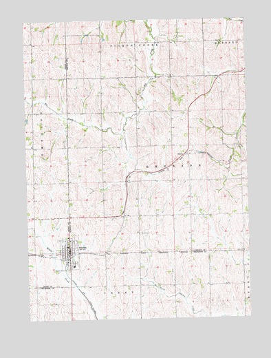
Emerson, NE USGS Topographic Map
Click on map above to begin viewing in our Map Viewer.

This topographic map contains these locations and features:
Feature Name Type Latitude Longitude GNIS ID View Map
Calvary CemeteryCemeteryN42.2844°W96.7316°2518826View Map
EmersonPopulated PlaceN42.2786°W96.7267°829108View Map
Emerson (historical)LocaleN42.2753°W96.7295°1884151View Map
Emerson City Police DepartmentBuildingN42.2762°W96.7291°1884148View Map
Emerson Election PrecinctCivilN42.3220°W96.6706°1928860View Map
Emerson Hubbard High SchoolSchoolN42.2725°W96.7245°1884083View Map
Emerson Medical ClinicHospitalN42.2786°W96.7267°1884149View Map
Emerson Post OfficePost OfficeN42.2787°W96.7263°1884084View Map
Emerson Public LibraryBuildingN42.2792°W96.7270°1884145View Map
Emerson Volunteer Fire and RescueBuildingN42.2797°W96.7264°1884150View Map
Emerson-Hubbard Elementary SchoolSchoolN42.2806°W96.7273°1884154View Map
Heritage of EmersonHospitalN42.2839°W96.7234°1884080View Map
Jopp CemeteryCemeteryN42.2781°W96.6284°830412View Map
Mueller Grain ElevatorLocaleN42.2758°W96.7303°1884146View Map
NacoraPopulated PlaceN42.3186°W96.6609°835388View Map
Nacora (historical)LocaleN42.3186°W96.6609°1883976View Map
Nacora Post OfficePost OfficeN42.3186°W96.6609°1883975View Map
Rose Hill CemeteryCemeteryN42.2832°W96.7322°2518825View Map
Sacred Heart Catholic ChurchChurchN42.2839°W96.7264°1884081View Map
Sacred Heart SchoolSchoolN42.2839°W96.7264°1884082View Map
Saint Luke Lutheran ChurchChurchN42.2794°W96.7295°1884153View Map
Saint Pauls Lutheran ChurchChurchN42.2808°W96.7270°1884152View Map
Township of EmersonCivilN42.3167°W96.6586°1884049View Map
Village of EmersonCivilN42.2783°W96.7264°2398827View Map

Note: Coordinates in the location and feature list above are referenced to NAD83 datum.


Copyright (C) 2008-2024 Ryan Niemi / Sunset Dynamics ... All Rights Reserved