TopoQuest Logo
Do you find TopoQuest useful?
Help keep TopoQuest running and adding new maps/features by donating!
Bitcoin:  19c7KJd3qBynnjoSw5npx9KScwjBe4ifkT
Litecoin:  LXs6TkuXGGXo1vDsWCkWVdjQX94eUKd6ui
Home View Maps Find Maps Find Places Resources & Links


Enid East, Oklahoma Topographic Map

USGS Map Title: Enid East, OK
USGS Map MRC: 36097D7
DRG (GeoTIFF) Download: o36097d7.tif


Neighboring USGS Topographic Map Quads:


  Hillsdale, OK  
36097E8
 

  Kremlin, OK  
36097E7
 

  Hunter, OK  
36097E6
 

  Enid West, OK  
36097D8
 

  Enid East, OK  
36097D7
 

  Breckinridge, OK  
36097D6
 

  Waukomis, OK  
36097C8
 

  Enid SE, OK  
36097C7
 

  Fairmont, OK  
36097C6


Map MRC Location:

N37°
W98°
N37°
W97°
H8 H7 H6 H5 H4 H3 H2 H1
G8 G7 G6 G5 G4 G3 G2 G1
F8 F7 F6 F5 F4 F3 F2 F1
E8 E7 E6 E5 E4 E3 E2 E1
D8 D7 D6 D5 D4 D3 D2 D1
C8 C7 C6 C5 C4 C3 C2 C1
B8 B7 B6 B5 B4 B3 B2 B1
A8 A7 A6 A5 A4 A3 A2 A1
N36°
W98°
N36°
W97°

Enid East, OK USGS 1:24K Topographic Map Preview:
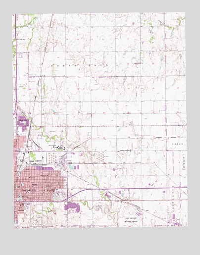
Enid East, OK USGS Topographic Map
Click on map above to begin viewing in our Map Viewer.

This topographic map contains these locations and features:
Feature Name Type Latitude Longitude GNIS ID View Map
Abundant Life Temple ChurchChurchN36.4053°W97.8551°1798119View Map
Adams Elementary SchoolSchoolN36.3983°W97.8456°1803991View Map
Bethany United Methodist ChurchChurchN36.3981°W97.8662°1798122View Map
Bible Baptist ChurchChurchN36.3992°W97.8628°1798123View Map
Boggy CreekStreamN36.3770°W97.8026°1090342View Map
Booker Washington SchoolSchoolN36.3886°W97.8706°1090400View Map
Calvary Assembly of God ChurchChurchN36.4250°W97.8720°1798124View Map
Calvary Baptist ChurchChurchN36.3964°W97.8667°1798125View Map
Chisholm Elementary SchoolSchoolN36.4369°W97.8692°1803990View Map
City of EnidCivilN36.4061°W97.8701°2410442View Map
Coolidge Elementary SchoolSchoolN36.4059°W97.8554°1091633View Map
David Park Christian ChurchChurchN36.4045°W97.8628°1798141View Map
Enid DivisionCivilN36.3861°W97.8727°1937708View Map
Enid Fire Department Station 3BuildingN36.3976°W97.8360°2658570View Map
Enid State SchoolSchoolN36.4206°W97.8417°1092627View Map
Enid State School HeliportAirportN36.4211°W97.8459°1102462View Map
Enid Woodring Regional AirportAirportN36.3836°W97.7875°1102461View Map
Full Gospel Tabernacle ChurchChurchN36.3892°W97.8714°1798155View Map
Garfield CountyCivilN36.3791°W97.7827°1101811View Map
Garfield Elementary SchoolSchoolN36.4007°W97.8691°1093121View Map
Glenwood ParkParkN36.3986°W97.8520°1093207View Map
Gore ParkParkN36.4011°W97.8689°1093270View Map
Integris Bass PavilionHospitalN36.3926°W97.8741°2695799View Map
Jackson SchoolSchoolN36.3856°W97.8731°1094168View Map
KCRC-AM (Enid)TowerN36.4198°W97.8748°1102189View Map
Longfellow Middle SchoolSchoolN36.3974°W97.8644°1094974View Map
Maine Nazarene ChurchChurchN36.3953°W97.8559°1798162View Map
Memorial Park CemeteryCemeteryN36.4584°W97.8696°1095312View Map
Mennonite Brethren of Enid CemeteryCemeteryN36.4638°W97.8605°2705401View Map
Mennonite ChurchChurchN36.4642°W97.8617°1095324View Map
North End Police DepartmentBuildingN36.4363°W97.8666°2757909View Map
North EnidPopulated PlaceN36.4356°W97.8689°1095941View Map
North/Hirst Aero Spray Airport (historical)AirportN36.4550°W97.8628°1102125View Map
Phillips University (historical)SchoolN36.3973°W97.8442°1096608View Map
Pioneer - Pleasant Vale Elementary SchoolSchoolN36.4200°W97.7912°1096749View Map
Pleasant Vale ChurchChurchN36.3900°W97.7976°1096748View Map
Progressive Baptist ChurchChurchN36.4039°W97.8689°1798166View Map
Roosevelt SchoolSchoolN36.3928°W97.8659°1097418View Map
Saint Mary's Regional Medical CenterHospitalN36.3937°W97.8714°1097630View Map
Saint Paul's Lutheran SchoolSchoolN36.3972°W97.8536°1803996View Map
Saint Pauls Lutheran ChurchChurchN36.3956°W97.8562°1798173View Map
SheaPopulated PlaceN36.3842°W97.7809°1100829View Map
Spring Valley SchoolSchoolN36.4848°W97.8731°1098447View Map
Springs ParkParkN36.3917°W97.8709°1098461View Map
Town of North EnidCivilN36.4457°W97.8634°2413053View Map
Township of North EnidCivilN36.4639°W97.8364°1825591View Map
Trinity United Methodist ChurchChurchN36.3970°W97.8520°1798174View Map
United Pentecostal ChurchChurchN36.4053°W97.8614°1798175View Map
University Place Christian ChurchChurchN36.3970°W97.8478°1798176View Map
Wilson SchoolSchoolN36.4045°W97.8639°1099904View Map

Note: Coordinates in the location and feature list above are referenced to NAD83 datum.


Copyright (C) 2008-2024 Ryan Niemi / Sunset Dynamics ... All Rights Reserved