TopoQuest Logo
Do you find TopoQuest useful?
Help keep TopoQuest running and adding new maps/features by donating!
Bitcoin:  19c7KJd3qBynnjoSw5npx9KScwjBe4ifkT
Litecoin:  LXs6TkuXGGXo1vDsWCkWVdjQX94eUKd6ui
Home View Maps Find Maps Find Places Resources & Links


Enon, Louisiana Topographic Map

USGS Map Title: Enon, LA
USGS Map MRC: 30090F1
DRG (GeoTIFF) Download: o30090f1.tif


Neighboring USGS Topographic Map Quads:


  Franklinton, LA  
30090G2
 

  Sheridan, LA  
30090G1
 

  Bogalusa West, LA  
30089G8
 

  Folsom, LA  
30090F2
 

  Enon, LA  
30090F1
 

  Sun, LA  
30089F8
 

  Martinville, LA  
30090E2
 

  Waldheim, LA  
30090E1
 

  Bush, LA  
30089E8


Map MRC Location:

N31°
W91°
N31°
W90°
H8 H7 H6 H5 H4 H3 H2 H1
G8 G7 G6 G5 G4 G3 G2 G1
F8 F7 F6 F5 F4 F3 F2 F1
E8 E7 E6 E5 E4 E3 E2 E1
D8 D7 D6 D5 D4 D3 D2 D1
C8 C7 C6 C5 C4 C3 C2 C1
B8 B7 B6 B5 B4 B3 B2 B1
A8 A7 A6 A5 A4 A3 A2 A1
N30°
W91°
N30°
W90°

Enon, LA USGS 1:24K Topographic Map Preview:
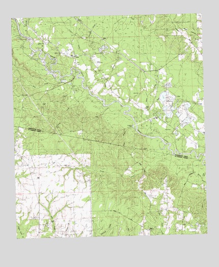
Enon, LA USGS Topographic Map
Click on map above to begin viewing in our Map Viewer.

This topographic map contains these locations and features:
Feature Name Type Latitude Longitude GNIS ID View Map
Adams CemeteryCemeteryN30.6849°W90.0226°532079View Map
Barlow BranchStreamN30.7391°W90.1134°553348View Map
Black BayouStreamN30.7399°W90.0834°543979View Map
Black SwampSwampN30.7132°W90.0162°544030View Map
Clearwater CreekStreamN30.7280°W90.0734°533998View Map
Cordelia CemeteryCemeteryN30.7049°W90.0923°542189View Map
Corkern Airport (historical)AirportN30.7224°W90.0654°1632697View Map
Corkern CemeteryCemeteryN30.6921°W90.0695°556691View Map
Corkern LakeLakeN30.6869°W90.0466°534140View Map
EnonPopulated PlaceN30.7274°W90.0842°543186View Map
Enon Baptist ChurchChurchN30.7271°W90.0854°559421View Map
Enon Elementary SchoolSchoolN30.7279°W90.0858°544026View Map
Enon Lookout TowerTowerN30.7060°W90.1154°542190View Map
Enon Post Office (historical)Post OfficeN30.7280°W90.0834°1632375View Map
Finney CreekStreamN30.7096°W90.0787°560740View Map
Fussell CemeteryCemeteryN30.6341°W90.1023°560807View Map
House CemeteryCemeteryN30.7007°W90.1059°542191View Map
House CreekStreamN30.6707°W90.0215°1627307View Map
Huggins (historical)Populated PlaceN30.7119°W90.0298°544029View Map
Hunt BranchStreamN30.6949°W90.0262°535861View Map
HurdLocaleN30.6985°W90.0034°542192View Map
Isabel Baptist ChurchChurchN30.6816°W90.0001°559688View Map
Johnson BranchStreamN30.7121°W90.0651°554888View Map
Jones BranchStreamN30.6982°W90.0520°544028View Map
Jones CemeteryCemeteryN30.7060°W90.0423°536101View Map
Julia (historical)Populated PlaceN30.7182°W90.0387°559736View Map
Magee CemeteryCemeteryN30.7296°W90.0934°536823View Map
Magee CemeteryCemeteryN30.7355°W90.1042°536824View Map
Mill CreekStreamN30.7013°W90.0659°537099View Map
Miller CreekStreamN30.6860°W90.0443°559698View Map
Mizell CemeteryCemeteryN30.6974°W90.0359°537172View Map
Nick CreekStreamN30.7138°W90.0948°555498View Map
Pig BranchStreamN30.7285°W90.1017°538131View Map
PriceLocaleN30.7032°W90.0176°542193View Map
Sharp Chapel CemeteryCemeteryN30.6285°W90.0387°1629025View Map
Sharps CemeteryCemeteryN30.6741°W90.0404°1628207View Map
Sharps ChapelChurchN30.6288°W90.0381°1628208View Map
The Place AirportAirportN30.6508°W90.1132°2717157View Map
Thigpen CreekStreamN30.7280°W90.0734°556231View Map
True Light ChurchChurchN30.6919°W90.0309°540000View Map
Warner-Thunder Hill AirportAirportN30.6305°W90.0773°1632675View Map
Wascom BranchStreamN30.7099°W90.0798°544027View Map
Wash BranchStreamN30.6846°W90.0448°1628442View Map
Washington Parish Library Enon BranchBuildingN30.7272°W90.0859°2603171View Map
Wells CreekStreamN30.6732°W90.0190°544031View Map
WillisPopulated PlaceN30.7366°W90.0667°543786View Map
ZonaPopulated PlaceN30.7482°W90.0812°541221View Map

Note: Coordinates in the location and feature list above are referenced to NAD83 datum.


Copyright (C) 2008-2025 Ryan Niemi / Sunset Dynamics ... All Rights Reserved