TopoQuest Logo
Do you find TopoQuest useful?
Help keep TopoQuest running and adding new maps/features by donating!
Bitcoin:  19c7KJd3qBynnjoSw5npx9KScwjBe4ifkT
Litecoin:  LXs6TkuXGGXo1vDsWCkWVdjQX94eUKd6ui
Home View Maps Find Maps Find Places Resources & Links


Epoufette, Michigan Topographic Map

USGS Map Title: Epoufette, MI
USGS Map MRC: 46085A2
DRG (GeoTIFF) Download: o46085a2.tif


Neighboring USGS Topographic Map Quads:


  Garnet, MI  
46085B3
 

  Rexton, MI  
46085B2
 

  Trout Lake, MI  
46085B1
 

  Hog Island Point, MI  
46085A3
 

  Epoufette, MI  
46085A2
 

  Brevort, MI  
46085A1


Map MRC Location:

N47°
W86°
N47°
W85°
H8 H7 H6 H5 H4 H3 H2 H1
G8 G7 G6 G5 G4 G3 G2 G1
F8 F7 F6 F5 F4 F3 F2 F1
E8 E7 E6 E5 E4 E3 E2 E1
D8 D7 D6 D5 D4 D3 D2 D1
C8 C7 C6 C5 C4 C3 C2 C1
B8 B7 B6 B5 B4 B3 B2 B1
A8 A7 A6 A5 A4 A3 A2 A1
N46°
W86°
N46°
W85°

Epoufette, MI USGS 1:24K Topographic Map Preview:
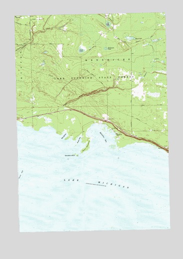
Epoufette, MI USGS Topographic Map
Click on map above to begin viewing in our Map Viewer.

This topographic map contains these locations and features:
Feature Name Type Latitude Longitude GNIS ID View Map
Cut RiverStreamN46.0445°W85.1267°624251View Map
EpoufettePopulated PlaceN46.0556°W85.1684°625620View Map
Epoufette BayBayN46.0533°W85.1798°625621View Map
Epoufette CemeteryCemeteryN46.0644°W85.1757°625622View Map
Epoufette Historical MarkerParkN46.0569°W85.1633°2360039View Map
Epoufette IslandIslandN46.0442°W85.2017°625623View Map
Epoufette Post Office (historical)Post OfficeN46.0556°W85.1684°1926643View Map
Hendricks Township Volunteer Fire DepartmentBuildingN46.0576°W85.1548°2626825View Map
Kenyon BayBayN46.0531°W85.1984°629612View Map
Marsh LakeLakeN46.1103°W85.1542°631624View Map
McNamara PondLakeN46.1048°W85.1751°632008View Map
Paquin CreekStreamN46.0619°W85.2201°634343View Map
Peggley LakeLakeN46.1188°W85.1729°634561View Map
Pelkie ReefBarN46.0325°W85.2495°634568View Map
Point EpoufetteCapeN46.0489°W85.1920°635180View Map
Sand LakeLakeN46.1041°W85.1957°637190View Map
West HarborBayN46.0558°W85.2106°1616118View Map

Note: Coordinates in the location and feature list above are referenced to NAD83 datum.


Copyright (C) 2008-2025 Ryan Niemi / Sunset Dynamics ... All Rights Reserved