TopoQuest Logo
Do you find TopoQuest useful?
Help keep TopoQuest running and adding new maps/features by donating!
Bitcoin:  19c7KJd3qBynnjoSw5npx9KScwjBe4ifkT
Litecoin:  LXs6TkuXGGXo1vDsWCkWVdjQX94eUKd6ui
Home View Maps Find Maps Find Places Resources & Links


Ermont, Montana Topographic Map

USGS Map Title: Ermont, MT
USGS Map MRC: 45112C8
DRG (GeoTIFF) Download: o45112c8.tif


Neighboring USGS Topographic Map Quads:


  Elkhorn Hot Springs, MT  
45113D1
 

  Torrey Mountain, MT  
45112D8
 

  Twin Adams Mountain, MT  
45112D7
 

  Polaris, MT  
45113C1
 

  Ermont, MT  
45112C8
 

  Argenta, MT  
45112C7
 

  Mill Point, MT  
45113B1
 

  Bannack, MT  
45112B8
 

  Burns Mountain, MT  
45112B7


Map MRC Location:

N46°
W113°
N46°
W112°
H8 H7 H6 H5 H4 H3 H2 H1
G8 G7 G6 G5 G4 G3 G2 G1
F8 F7 F6 F5 F4 F3 F2 F1
E8 E7 E6 E5 E4 E3 E2 E1
D8 D7 D6 D5 D4 D3 D2 D1
C8 C7 C6 C5 C4 C3 C2 C1
B8 B7 B6 B5 B4 B3 B2 B1
A8 A7 A6 A5 A4 A3 A2 A1
N45°
W113°
N45°
W112°

Ermont, MT USGS 1:24K Topographic Map Preview:
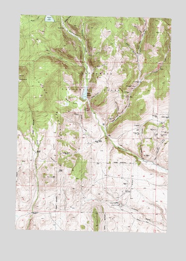
Ermont, MT USGS Topographic Map
Click on map above to begin viewing in our Map Viewer.

This topographic map contains these locations and features:
Feature Name Type Latitude Longitude GNIS ID View Map
Argenta Guard StationLocaleN45.2946°W112.9581°768331View Map
Argenta MineMineN45.3099°W112.8881°768332View Map
Argenta SpringSpringN45.3169°W112.8761°768333View Map
Argenta SpringSpringN45.3168°W112.8759°794599View Map
Badger MineMineN45.2783°W112.9095°768435View Map
Badger MineMineN45.2833°W112.9175°802360View Map
Bear GulchValleyN45.3508°W112.9464°768590View Map
Best SpringSpringN45.3118°W112.9289°768733View Map
Carbonate MineMineN45.3116°W112.8817°769595View Map
Carroll RanchLocaleN45.2952°W112.9848°769617View Map
Cat CreekStreamN45.3430°W112.9448°781042View Map
Clarks CanyonValleyN45.2933°W112.8978°769905View Map
Comstock MineMineN45.2758°W112.9120°802406View Map
Cross MineMineN45.3319°W112.9106°802410View Map
Cross MineMineN45.3316°W112.9100°770326View Map
Discovery MineMineN45.3291°W112.9100°770666View Map
Discovery MineMineN45.3333°W112.9175°802352View Map
Dutchman MineMineN45.3119°W112.9011°770937View Map
East Ermont MineMineN45.2666°W112.9009°802364View Map
Ermont MillPopulated PlaceN45.2669°W112.9156°771239View Map
Ermont MillMineN45.2666°W112.9175°802255View Map
Ermont Number 19 MineMineN45.2741°W112.9100°799312View Map
Ermont Number 19 MineMineN45.2666°W112.9175°802362View Map
Ermont Number 2 MineMineN45.2660°W112.9150°799313View Map
Estler LakeReservoirN45.3733°W112.9770°783234View Map
Estler Lake DamDamN45.3717°W112.9725°795918View Map
Florence MineMineN45.2999°W112.9009°802441View Map
French CreekStreamN45.3055°W112.9278°783731View Map
French Creek MineMineN45.3166°W112.9175°802351View Map
Gold Finch MineMineN45.2999°W112.9009°802350View Map
Golden Era MineMineN45.3177°W112.8859°771837View Map
Golden Era MineMineN45.3166°W112.8842°802358View Map
Goldfinch MineMineN45.3074°W112.9003°800861View Map
Goodview MineMineN45.3069°W112.8814°802272View Map
Goodview MineMineN45.3069°W112.8823°771858View Map
Gozad RanchLocaleN45.2599°W112.9878°771889View Map
Ground Hog MineMineN45.3085°W112.8775°772012View Map
Jack MineMineN45.3099°W112.9006°772768View Map
Kearns BasinBasinN45.3246°W112.9575°772946View Map
Kearns CreekStreamN45.3060°W112.9281°772947View Map
Kelley GulchValleyN45.3260°W112.9425°772962View Map
Kelley ReservoirSwampN45.3297°W112.9453°772963View Map
Kelly DamDamN45.3266°W112.9459°796685View Map
Legal Tender MineMineN45.2949°W112.8920°802400View Map
Legal Tender MineMineN45.2946°W112.8917°773287View Map
Little Bear GulchValleyN45.3430°W112.9406°773396View Map
Long Stapleton GulchValleyN45.2908°W112.8867°773657View Map
Madison MineMineN45.3110°W112.8859°802369View Map
May Day MineMineN45.3196°W112.8753°802379View Map
May Day MineMineN45.3194°W112.8753°786955View Map
McMannis CreekStreamN45.3602°W112.9506°774039View Map
Midnight MineMineN45.3069°W112.8867°774194View Map
NE Section 24 MineMineN45.3035°W112.8859°802367View Map
NW Ermont MineMineN45.2666°W112.9175°802363View Map
Park MineMineN45.3377°W112.9034°775086View Map
Park MineMineN45.3333°W112.9009°802353View Map
Pay Day MineMineN45.3235°W112.8750°802401View Map
Pilon RanchLocaleN45.3024°W112.9342°775225View Map
Pilon Ranch MineMineN45.2999°W112.9342°802349View Map
Red ButteSummitN45.3208°W112.9448°775617View Map
Red GulchValleyN45.3177°W112.9181°775639View Map
Rena MineMineN45.3141°W112.8831°775702View Map
Sawlog GulchValleyN45.3710°W112.9656°790046View Map
SE Section 21 MineMineN45.2966°W112.9578°802425View Map
Silver Rule MineMineN45.3174°W112.9506°776558View Map
Silver Rule MineMineN45.3166°W112.9509°802357View Map
Starlight MineMineN45.2949°W112.8900°802380View Map
Stinson MineMineN45.3152°W112.9245°801543View Map
Stinson MineMineN45.3166°W112.9175°802355View Map
Storm King MineMineN45.3063°W112.8934°802381View Map
Sylvia MineMineN45.3046°W112.8914°777386View Map
Taylor SpringSpringN45.2851°W112.9657°777437View Map
The SandbarBarN45.3674°W112.9636°777543View Map
Trout CreekStreamN45.3371°W112.9000°777779View Map
Trout Creek MineMineN45.3499°W112.8842°802354View Map
Watson GulchValleyN45.3524°W112.9028°778153View Map
Watson Gulch MineMineN45.3610°W112.9120°802365View Map
Watt GulchValleyN45.3649°W112.8995°778156View Map
Yellow Band MineMineN45.3346°W112.9059°801723View Map
Yellow Band MineMineN45.3333°W112.9009°802347View Map

Note: Coordinates in the location and feature list above are referenced to NAD83 datum.


Copyright (C) 2008-2024 Ryan Niemi / Sunset Dynamics ... All Rights Reserved