TopoQuest Logo
Do you find TopoQuest useful?
Help keep TopoQuest running and adding new maps/features by donating!
Bitcoin:  19c7KJd3qBynnjoSw5npx9KScwjBe4ifkT
Litecoin:  LXs6TkuXGGXo1vDsWCkWVdjQX94eUKd6ui
Home View Maps Find Maps Find Places Resources & Links


Esmond Park, Wyoming Topographic Map

USGS Map Title: Esmond Park, WY
USGS Map MRC: 43109F7
DRG (GeoTIFF) Download: o43109f7.tif


Neighboring USGS Topographic Map Quads:


  Dundee Meadows, WY  
43109G8
 

  Shoshone Pass, WY  
43109G7
 

  Five Pockets, WY  
43109G6
 

  Kisinger Lakes, WY  
43109F8
 

  Esmond Park, WY  
43109F7
 

  Ramshorn Peak, WY  
43109F6
 

  Fish Lake, WY  
43109E8
 

  Warm Spring Mountain, WY  
43109E7
 

  Dubois, WY  
43109E6


Map MRC Location:

N44°
W110°
N44°
W109°
H8 H7 H6 H5 H4 H3 H2 H1
G8 G7 G6 G5 G4 G3 G2 G1
F8 F7 F6 F5 F4 F3 F2 F1
E8 E7 E6 E5 E4 E3 E2 E1
D8 D7 D6 D5 D4 D3 D2 D1
C8 C7 C6 C5 C4 C3 C2 C1
B8 B7 B6 B5 B4 B3 B2 B1
A8 A7 A6 A5 A4 A3 A2 A1
N43°
W110°
N43°
W109°

Esmond Park, WY USGS 1:24K Topographic Map Preview:
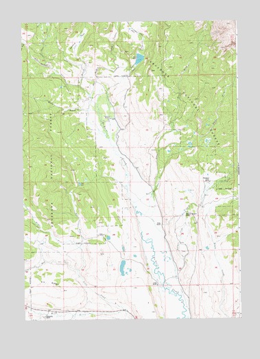
Esmond Park, WY USGS Topographic Map
Click on map above to begin viewing in our Map Viewer.

This topographic map contains these locations and features:
Feature Name Type Latitude Longitude GNIS ID View Map
Cross RanchLocaleN43.6394°W109.7979°1587258View Map
Du Noir TrailTrailN43.7350°W109.8602°1599390View Map
East Du Noir CreekStreamN43.7194°W109.8360°1599451View Map
East Fork Long CreekStreamN43.6547°W109.8421°1588081View Map
East Fork Sixmile CreekStreamN43.6955°W109.7963°1599492View Map
Esmond CreekStreamN43.7238°W109.8416°1599632View Map
Esmond ParkFlatN43.7425°W109.8427°1588332View Map
Falls CreekStreamN43.7316°W109.8593°1599671View Map
Fivemile CreekStreamN43.6647°W109.7941°1599743View Map
Fourmile CreekStreamN43.6452°W109.7879°1588685View Map
Gap LakeLakeN43.6821°W109.8423°1588795View Map
Glade RanchLocaleN43.6647°W109.7957°1588925View Map
Highland Meadow RanchLocaleN43.6694°W109.7804°1589547View Map
Long CreekStreamN43.6283°W109.8179°1590972View Map
Middle Fork Long CreekStreamN43.6452°W109.8441°1601403View Map
Pickett RanchLocaleN43.7100°W109.8249°1592732View Map
Ramshorn Guest RanchLocaleN43.6822°W109.7674°1602379View Map
Sixmile CreekStreamN43.6741°W109.8113°1594397View Map
Timberline RanchLocaleN43.6263°W109.8635°1595579View Map
Trail CreekStreamN43.7308°W109.8196°1595667View Map
Trail LakeLakeN43.7344°W109.8065°1595681View Map
Trail LakeReservoirN43.7316°W109.8107°1607549View Map
Trail LakeReservoirN43.7250°W109.8007°1608157View Map
Trail Lake Control DamDamN43.7250°W109.8007°1608156View Map
Trail Lake DamDamN43.7316°W109.8107°1607548View Map
West Du Noir CreekStreamN43.7194°W109.8360°1604526View Map
West Fork Long CreekStreamN43.6452°W109.8441°1604068View Map
West Fork Sixmile CreekStreamN43.6955°W109.7963°1604073View Map
Willow BranchStreamN43.7130°W109.8374°1596426View Map
Wolf CreekStreamN43.7416°W109.8735°1604260View Map

Note: Coordinates in the location and feature list above are referenced to NAD83 datum.


Copyright (C) 2008-2025 Ryan Niemi / Sunset Dynamics ... All Rights Reserved