TopoQuest Logo
Do you find TopoQuest useful?
Help keep TopoQuest running and adding new maps/features by donating!
Bitcoin:  19c7KJd3qBynnjoSw5npx9KScwjBe4ifkT
Litecoin:  LXs6TkuXGGXo1vDsWCkWVdjQX94eUKd6ui
Home View Maps Find Maps Find Places Resources & Links


Eustis, Nebraska Topographic Map

USGS Map Title: Eustis, NE
USGS Map MRC: 40100F1
DRG (GeoTIFF) Download: o40100f1.tif


Neighboring USGS Topographic Map Quads:


  Gothenburg SW, NE  
40100G2
 

  Gothenburg SE, NE  
40100G1
 

  Cozad, NE  
40099G8
 

  Farnam, NE  
40100F2
 

  Eustis, NE  
40100F1
 

  Elwood NW, NE  
40099F8
 

  Eustis SW, NE  
40100E2
 

  Eustis SE, NE  
40100E1
 

  Elwood SW, NE  
40099E8


Map MRC Location:

N41°
W101°
N41°
W100°
H8 H7 H6 H5 H4 H3 H2 H1
G8 G7 G6 G5 G4 G3 G2 G1
F8 F7 F6 F5 F4 F3 F2 F1
E8 E7 E6 E5 E4 E3 E2 E1
D8 D7 D6 D5 D4 D3 D2 D1
C8 C7 C6 C5 C4 C3 C2 C1
B8 B7 B6 B5 B4 B3 B2 B1
A8 A7 A6 A5 A4 A3 A2 A1
N40°
W101°
N40°
W100°

Eustis, NE USGS 1:24K Topographic Map Preview:
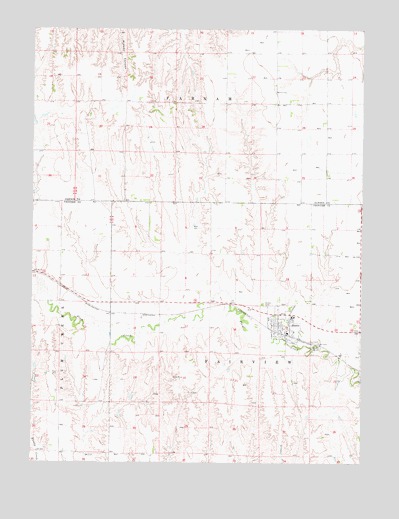
Eustis, NE USGS Topographic Map
Click on map above to begin viewing in our Map Viewer.

This topographic map contains these locations and features:
Feature Name Type Latitude Longitude GNIS ID View Map
Dawson Company Road Dam Number 1DamN40.7000°W100.0621°1769226View Map
Dawson Company Road Dam Number 2DamN40.7000°W100.0687°1769228View Map
Dawson Company Road Dam Reservoir Number 1ReservoirN40.7010°W100.0632°1769227View Map
Dawson Company Road Dam Reservoir Number 2ReservoirN40.7013°W100.0699°1769229View Map
Dawson Company Road Dam Reservoir Number 8ReservoirN40.7006°W100.0909°1769441View Map
Dawson Company Road Dam Reservoir Number 9ReservoirN40.7006°W100.0933°1769443View Map
Dawson County Road Dam Number 8DamN40.7000°W100.0904°1769440View Map
Dawson County Road Dam Number 9DamN40.7000°W100.0937°1769442View Map
EustisLocaleN40.6611°W100.0243°1841043View Map
EustisPopulated PlaceN40.6625°W100.0296°829160View Map
Eustis Fire and RescueBuildingN40.6635°W100.0288°1841040View Map
Eustis Lutheran CemeteryCemeteryN40.6716°W100.0202°1765009View Map
Eustis Methodist CemeteryCemeteryN40.6711°W100.0207°1765010View Map
Eustis Post OfficePost OfficeN40.6630°W100.0288°1841036View Map
Eustis Public LibraryBuildingN40.6625°W100.0296°1841039View Map
Eustis Volunteer Rescue SquadBuildingN40.6635°W100.0294°2553763View Map
Eustis West CemeteryCemeteryN40.6706°W100.0376°829161View Map
Eustis-Farnam High SchoolSchoolN40.6670°W100.0271°1841041View Map
Fairview Election PrecinctCivilN40.6564°W100.0385°1928869View Map
Farmers Cooperative Association ElevatorLocaleN40.6625°W100.0296°1841042View Map
Hueftle DamDamN40.6429°W100.0879°1769256View Map
Hueftle ReservoirReservoirN40.6438°W100.0877°1769257View Map
KingstonLocaleN40.6681°W100.0949°1841011View Map
Koch Dam-1 DamDamN40.6850°W100.0454°1769260View Map
Koch ReservoirReservoirN40.6859°W100.0462°1769261View Map
Pioneer CemeteryCemeteryN40.6633°W100.0012°1765016View Map
Plum Creek Medical GroupHospitalN40.6625°W100.0296°1841037View Map
Saint John Lutheran ChurchChurchN40.6625°W100.0296°1841038View Map
Township of FairviewCivilN40.6556°W100.0365°1841051View Map
Township of FarnamCivilN40.7472°W100.0504°1875078View Map
United Methodist ChurchChurchN40.6625°W100.0296°1841035View Map
Village of EustisCivilN40.6645°W100.0296°2398843View Map
Yeutter DamDamN40.7367°W100.0237°1769502View Map
Yeutter ReservoirReservoirN40.7375°W100.0245°1769503View Map

Note: Coordinates in the location and feature list above are referenced to NAD83 datum.


Copyright (C) 2008-2025 Ryan Niemi / Sunset Dynamics ... All Rights Reserved