TopoQuest Logo
Do you find TopoQuest useful?
Help keep TopoQuest running and adding new maps/features by donating!
Bitcoin:  19c7KJd3qBynnjoSw5npx9KScwjBe4ifkT
Litecoin:  LXs6TkuXGGXo1vDsWCkWVdjQX94eUKd6ui
Home View Maps Find Maps Find Places Resources & Links


Evan, Minnesota Topographic Map

USGS Map Title: Evan, MN
USGS Map MRC: 44094C7
DRG (GeoTIFF) Download: o44094c7.tif


Neighboring USGS Topographic Map Quads:


  Morgan, MN  
44094D8
 

  Morgan NE, MN  
44094D7
 

  Sleepy Eye NW, MN  
44094D6
 

  Boise Lake, MN  
44094C8
 

  Evan, MN  
44094C7
 

  Sleepy Eye, MN  
44094C6
 

  Springfield, MN  
44094B8
 

  Leavenworth, MN  
44094B7
 

  Lake Hanska West, MN  
44094B6


Map MRC Location:

N45°
W95°
N45°
W94°
H8 H7 H6 H5 H4 H3 H2 H1
G8 G7 G6 G5 G4 G3 G2 G1
F8 F7 F6 F5 F4 F3 F2 F1
E8 E7 E6 E5 E4 E3 E2 E1
D8 D7 D6 D5 D4 D3 D2 D1
C8 C7 C6 C5 C4 C3 C2 C1
B8 B7 B6 B5 B4 B3 B2 B1
A8 A7 A6 A5 A4 A3 A2 A1
N44°
W95°
N44°
W94°

Evan, MN USGS 1:24K Topographic Map Preview:
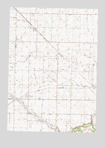
Evan, MN USGS Topographic Map
Click on map above to begin viewing in our Map Viewer.

This topographic map contains these locations and features:
Feature Name Type Latitude Longitude GNIS ID View Map
Bloemke Lake (historical)LakeN44.2619°W94.8505°640265View Map
Bloemke LakebedFlatN44.2625°W94.8503°1815266View Map
Braun Landing Strip (historical)AirportN44.3427°W94.8647°1815446View Map
City of CobdenCivilN44.2825°W94.8466°2393581View Map
City of EvanCivilN44.3549°W94.8361°2394708View Map
CobdenPopulated PlaceN44.2863°W94.8489°641372View Map
CobdenLocaleN44.2881°W94.8478°2063610View Map
Cobden Post Office (historical)Post OfficeN44.2864°W94.8486°2063611View Map
County Ditch Number SixtyCanalN44.3011°W94.7919°1815444View Map
County Ditch Number ThirtyCanalN44.3041°W94.8364°1815445View Map
EvanPopulated PlaceN44.3541°W94.8414°643429View Map
Evan (historical)LocaleN44.3544°W94.8406°2063758View Map
Evan Post OfficePost OfficeN44.3542°W94.8411°2063759View Map
Mielke CemeteryCemeteryN44.2677°W94.8130°647828View Map
Prairieville CemeteryCemeteryN44.3686°W94.7919°649720View Map
Redwood Brown Ditch Number OneCanalN44.3247°W94.7850°639156View Map
Saint Matthew's Lutheran ChurchChurchN44.3542°W94.8411°2063760View Map
School Number 29SchoolN44.3505°W94.7755°651609View Map
School Number 36SchoolN44.2966°W94.7869°651645View Map
School Number 43SchoolN44.2686°W94.7700°651657View Map
School Number 44SchoolN44.2675°W94.8269°651658View Map
School Number 60SchoolN44.3111°W94.8361°651692View Map
Sleepy Eye CreekStreamN44.2533°W94.7728°652151View Map
Sleepy Eye Golf ClubLocaleN44.2944°W94.7533°2063693View Map
Township of PrairievilleCivilN44.3256°W94.8043°665351View Map

Note: Coordinates in the location and feature list above are referenced to NAD83 datum.


Copyright (C) 2008-2024 Ryan Niemi / Sunset Dynamics ... All Rights Reserved