TopoQuest Logo
Do you find TopoQuest useful?
Help keep TopoQuest running and adding new maps/features by donating!
Bitcoin:  19c7KJd3qBynnjoSw5npx9KScwjBe4ifkT
Litecoin:  LXs6TkuXGGXo1vDsWCkWVdjQX94eUKd6ui
Home View Maps Find Maps Find Places Resources & Links


Evergreen, South Carolina Topographic Map

USGS Map Title: Evergreen, SC
USGS Map MRC: 34079A6
DRG (GeoTIFF) Download: o34079a6.tif


Neighboring USGS Topographic Map Quads:


  Florence West, SC  
34079B7
 

  Florence East, SC  
34079B6
 

  Pee Dee, SC  
34079B5
 

  Effingham, SC  
34079A7
 

  Evergreen, SC  
34079A6
 

  Pamplico North, SC  
34079A5
 

  Mill Bay, SC  
33079H7
 

  Scranton, SC  
33079H6
 

  Pamplico South, SC  
33079H5


Map MRC Location:

N35°
W80°
N35°
W79°
H8 H7 H6 H5 H4 H3 H2 H1
G8 G7 G6 G5 G4 G3 G2 G1
F8 F7 F6 F5 F4 F3 F2 F1
E8 E7 E6 E5 E4 E3 E2 E1
D8 D7 D6 D5 D4 D3 D2 D1
C8 C7 C6 C5 C4 C3 C2 C1
B8 B7 B6 B5 B4 B3 B2 B1
A8 A7 A6 A5 A4 A3 A2 A1
N34°
W80°
N34°
W79°

Evergreen, SC USGS 1:24K Topographic Map Preview:
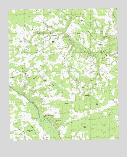
Evergreen, SC USGS Topographic Map
Click on map above to begin viewing in our Map Viewer.

This topographic map contains these locations and features:
Feature Name Type Latitude Longitude GNIS ID View Map
Alligator BaySwampN34.0329°W79.6887°1220173View Map
Amada ChurchChurchN34.0974°W79.6992°1242300View Map
Bay BranchStreamN34.0438°W79.7362°1220368View Map
Big BranchStreamN34.0290°W79.7173°1220672View Map
Christian Fellowship ChurchChurchN34.0190°W79.6965°1241819View Map
Claussen StationLocaleN34.1149°W79.6676°1221618View Map
Coward CemeteryCemeteryN34.0188°W79.7178°1221795View Map
Cox BayBasinN34.0149°W79.7398°1221801View Map
Cox Bay BranchStreamN34.0057°W79.7203°1221802View Map
Cypress BaySwampN34.0110°W79.6501°1221892View Map
Cypress CreekStreamN34.0774°W79.6451°1221901View Map
Dials BaySwampN34.0329°W79.6490°1222013View Map
Elizabeth ChurchChurchN34.1152°W79.7109°1241864View Map
Elizabeth SchoolSchoolN34.1154°W79.7103°1222263View Map
EvergreenPopulated PlaceN34.0685°W79.6790°1222312View Map
Evergreen Baptist ChurchChurchN34.0690°W79.6801°1241869View Map
Evergreen CemeteryCemeteryN34.0685°W79.6798°1241870View Map
Evergreen SchoolSchoolN34.0577°W79.6720°1222322View Map
Evergreen School (historical)SchoolN34.0688°W79.6773°1241872View Map
Florence CountyCivilN34.0244°W79.7028°1248001View Map
Florence County Emergency Management OfficeBuildingN34.0535°W79.7372°2334959View Map
Florence County Emergency Medical ServicesBuildingN34.0529°W79.7349°2368259View Map
Florence County Sheriff's OfficeBuildingN34.0533°W79.7366°2334906View Map
Florence County Sheriff's Office - Detention CenterBuildingN34.0538°W79.7370°2334905View Map
Garden of Memories CemeteryCemeteryN34.0993°W79.7006°1241921View Map
Gardner CrossroadsPopulated PlaceN34.0429°W79.6578°1227907View Map
Goodland ChurchChurchN34.0946°W79.7353°1241936View Map
Goodland SchoolSchoolN34.0954°W79.7340°1222762View Map
Green Spring BaySwampN34.0107°W79.7265°1222884View Map
Gregg BaySwampN34.0568°W79.7092°1222898View Map
Hewitt CemeteryCemeteryN34.1018°W79.7162°1223125View Map
Hopewell School (historical)SchoolN34.1174°W79.6648°1241971View Map
Howe Springs Fire Department Station 2BuildingN34.0661°W79.6834°2368137View Map
Lebanon CemeteryCemeteryN34.0493°W79.7242°1223858View Map
Lebanon ChurchChurchN34.0474°W79.7220°1242018View Map
Little Willow CreekStreamN34.1027°W79.6848°1224075View Map
Maple BaySwampN34.0321°W79.6967°1224298View Map
Mathis CornerPopulated PlaceN34.0946°W79.6970°1224364View Map
McCall BranchStreamN34.0427°W79.7312°1224382View Map
McKnight SchoolSchoolN34.0518°W79.6356°1224415View Map
Mount Tabor ChurchChurchN34.0568°W79.6720°1242074View Map
Olive Grove Baptist ChurchChurchN34.0221°W79.7377°1242117View Map
Olive Grove CemeteryCemeteryN34.0210°W79.7215°1225227View Map
Olive Grove Church (historical)ChurchN34.0210°W79.7223°1242114View Map
Olive Grove SchoolSchoolN34.0265°W79.7298°1225229View Map
Othello SchoolSchoolN34.0240°W79.7373°1225253View Map
Pentecostal United Apostolic Church of ChristChurchN34.1063°W79.7052°2489801View Map
Saint Paul CemeteryCemeteryN34.0982°W79.6387°1242170View Map
Saint Paul ChurchChurchN34.0988°W79.6392°1250662View Map
Tabernacle CemeteryCemeteryN34.0593°W79.6464°1242214View Map
Tabernacle ChurchChurchN34.0588°W79.6467°1242215View Map
Tabernacle SchoolSchoolN34.0543°W79.6498°1227017View Map
Taylor BranchStreamN34.0565°W79.7267°1227045View Map
The House of GodChurchN34.0498°W79.6667°1241871View Map
Turner BaySwampN34.0523°W79.6985°1227251View Map
Turner CemeteryCemeteryN34.0865°W79.7159°1227252View Map
Ward Mill BranchStreamN34.0210°W79.7103°1227396View Map
Willow Creek ChurchChurchN34.0993°W79.6815°1242249View Map
Willow Creek SchoolSchoolN34.0990°W79.7009°1227625View Map
Willow Creek SidingPopulated PlaceN34.0913°W79.6473°1231927View Map
Wills BaySwampN34.0099°W79.6328°1227634View Map

Note: Coordinates in the location and feature list above are referenced to NAD83 datum.


Copyright (C) 2008-2024 Ryan Niemi / Sunset Dynamics ... All Rights Reserved