TopoQuest Logo
Do you find TopoQuest useful?
Help keep TopoQuest running and adding new maps/features by donating!
Bitcoin:  19c7KJd3qBynnjoSw5npx9KScwjBe4ifkT
Litecoin:  LXs6TkuXGGXo1vDsWCkWVdjQX94eUKd6ui
Home View Maps Find Maps Find Places Resources & Links


Armington, Montana Topographic Map

USGS Map Title: Armington, MT
USGS Map MRC: 47110C8
DRG (GeoTIFF) Download: o47110c8.tif


Neighboring USGS Topographic Map Quads:


  Fife, MT  
47111D1
 

  Belt, MT  
47110D8
 

  Belt NE, MT  
47110D7
 

  Mahoney Hill, MT  
47111C1
 

  Armington, MT  
47110C8
 

  Blythe, MT  
47110C7
 

  Evans, MT  
47111B1
 

  Riceville, MT  
47110B8
 

  Monarch NE, MT  
47110B7


Map MRC Location:

N48°
W111°
N48°
W110°
H8 H7 H6 H5 H4 H3 H2 H1
G8 G7 G6 G5 G4 G3 G2 G1
F8 F7 F6 F5 F4 F3 F2 F1
E8 E7 E6 E5 E4 E3 E2 E1
D8 D7 D6 D5 D4 D3 D2 D1
C8 C7 C6 C5 C4 C3 C2 C1
B8 B7 B6 B5 B4 B3 B2 B1
A8 A7 A6 A5 A4 A3 A2 A1
N47°
W111°
N47°
W110°

Armington, MT USGS 1:24K Topographic Map Preview:
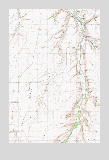
Armington, MT USGS Topographic Map
Click on map above to begin viewing in our Map Viewer.

This topographic map contains these locations and features:
Feature Name Type Latitude Longitude GNIS ID View Map
17N06E01C___01 WellWellN47.2605°W110.9136°821774View Map
17N06E01C___02 WellWellN47.2605°W110.9136°821775View Map
18N06E14A___01 WellWellN47.3236°W110.9244°822206View Map
18N06E14C___01 WellWellN47.3158°W110.9341°822154View Map
18N06E15A___01 WellWellN47.3219°W110.9461°822200View Map
18N06E20D___01 WellWellN47.2969°W110.9888°822036View Map
18N06E25D___01 WellWellN47.2889°W110.9008°821981View Map
18N06E28A___01 WellWellN47.2911°W110.9677°821989View Map
18N06E33A___01 WellWellN47.2761°W110.9677°821887View Map
18N06E36____01 WellWellN47.2777°W110.9063°821894View Map
19N06E32A___01 WellWellN47.3586°W110.9947°822432View Map
19N06E32DA__01 WellWellN47.3577°W110.9869°822431View Map
19N06E34____01 WellWellN47.3622°W110.9511°822450View Map
19N06E36ACDA01 WellWellN47.3672°W110.9030°822471View Map
19N06E36DDDC01 WellWellN47.3594°W110.8988°822433View Map
ArmingtonPopulated PlaceN47.3664°W110.9036°768337View Map
ArmingtonLocaleN47.3664°W110.9036°1762289View Map
Armington CouleeValleyN47.3622°W110.8991°768338View Map
Armington JunctionPopulated PlaceN47.3480°W110.8944°802000View Map
Armington Junction Rest AreaLocaleN47.3494°W110.8966°1761786View Map
Armington Post Office (historical)Post OfficeN47.3664°W110.9036°1762288View Map
Belt DivisionCivilN47.3672°W110.9289°1940568View Map
Big Otter CreekStreamN47.3458°W110.9108°779849View Map
Goodman (historical)LocaleN47.2597°W110.9155°1762377View Map
Goodman CemeteryCemeteryN47.2555°W110.9035°1762324View Map
Goodman School (historical)SchoolN47.2569°W110.9158°800863View Map
Neil CreekStreamN47.3744°W110.9175°787929View Map
Neil Creek RanchLocaleN47.2989°W110.9513°805821View Map
Neil Creek School (historical)SchoolN47.2875°W110.9966°1761835View Map
Peterson School (historical)SchoolN47.2597°W110.9813°1761836View Map
Pleasant View CemeteryCemeteryN47.3726°W110.9088°775289View Map
Siegling (historical)LocaleN47.2769°W110.9063°1762430View Map
Swede BenchBenchN47.3047°W110.9638°777355View Map
Tiger Butte Community CenterLocaleN47.2880°W110.9894°777642View Map
Voights Spur (historical)LocaleN47.3389°W110.8800°1762414View Map

Note: Coordinates in the location and feature list above are referenced to NAD83 datum.


Copyright (C) 2008-2025 Ryan Niemi / Sunset Dynamics ... All Rights Reserved