TopoQuest Logo
Do you find TopoQuest useful?
Help keep TopoQuest running and adding new maps/features by donating!
Bitcoin:  19c7KJd3qBynnjoSw5npx9KScwjBe4ifkT
Litecoin:  LXs6TkuXGGXo1vDsWCkWVdjQX94eUKd6ui
Home View Maps Find Maps Find Places Resources & Links


Exira East, Iowa Topographic Map

USGS Map Title: Exira East, IA
USGS Map MRC: 41094E7
DRG (GeoTIFF) Download: o41094e7.tif


Neighboring USGS Topographic Map Quads:


  Audubon, IA  
41094F8
 

  Gardner, IA  
41094F7
 

  North Branch, IA  
41094F6
 

  Exira West, IA  
41094E8
 

  Exira East, IA  
41094E7
 

  Adair North, IA  
41094E6
 

  Wiota, IA  
41094D8
 

  Anita, IA  
41094D7
 

  Adair South, IA  
41094D6


Map MRC Location:

N42°
W95°
N42°
W94°
H8 H7 H6 H5 H4 H3 H2 H1
G8 G7 G6 G5 G4 G3 G2 G1
F8 F7 F6 F5 F4 F3 F2 F1
E8 E7 E6 E5 E4 E3 E2 E1
D8 D7 D6 D5 D4 D3 D2 D1
C8 C7 C6 C5 C4 C3 C2 C1
B8 B7 B6 B5 B4 B3 B2 B1
A8 A7 A6 A5 A4 A3 A2 A1
N41°
W95°
N41°
W94°

Exira East, IA USGS 1:24K Topographic Map Preview:
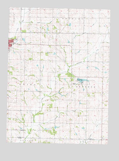
Exira East, IA USGS Topographic Map
Click on map above to begin viewing in our Map Viewer.

This topographic map contains these locations and features:
Feature Name Type Latitude Longitude GNIS ID View Map
Audubon County Courthouse MuseumBuildingN41.5914°W94.8750°1994832View Map
Bowen CemeteryCemeteryN41.5114°W94.8586°457460View Map
Exira - Elk Horn - Kimballton Middle SchoolSchoolN41.5853°W94.8746°463385View Map
Exira CemeteryCemeteryN41.5954°W94.8658°1994901View Map
Exira Christian ChurchChurchN41.5900°W94.8750°1994844View Map
Exira Community School LibraryBuildingN41.5855°W94.8750°1994848View Map
Exira Elementary SchoolSchoolN41.5917°W94.8733°1994847View Map
Federated United Church of ChristChurchN41.5908°W94.8736°1994845View Map
Fourmile CreekStreamN41.5728°W94.7936°456704View Map
Grove CemeteryCemeteryN41.5461°W94.7950°1823254View Map
Grove Post Office (historical)Post OfficeN41.5389°W94.8275°1994822View Map
Holy Trinity Catholic ParishChurchN41.5942°W94.8750°1994846View Map
Holy Trinity CemeteryCemeteryN41.5907°W94.8646°457590View Map
Honey CreekStreamN41.6117°W94.8578°457616View Map
Littlefield County ParkParkN41.5564°W94.7850°1823253View Map
Pleasant CreekStreamN41.5164°W94.8425°460296View Map
Township of AudubonCivilN41.5533°W94.7584°467403View Map
Township of ExiraCivilN41.5532°W94.8712°467804View Map

Note: Coordinates in the location and feature list above are referenced to NAD83 datum.


Copyright (C) 2008-2024 Ryan Niemi / Sunset Dynamics ... All Rights Reserved