TopoQuest Logo
Do you find TopoQuest useful?
Help keep TopoQuest running and adding new maps/features by donating!
Bitcoin:  19c7KJd3qBynnjoSw5npx9KScwjBe4ifkT
Litecoin:  LXs6TkuXGGXo1vDsWCkWVdjQX94eUKd6ui
Home View Maps Find Maps Find Places Resources & Links


Fairfield, Montana Topographic Map

USGS Map Title: Fairfield, MT
USGS Map MRC: 47111E8
DRG (GeoTIFF) Download: o47111e8.tif


Neighboring USGS Topographic Map Quads:


  Freezeout Lake, MT  
47112F1
 

  Cleiv, MT  
47111F8
 

  Greenfield, MT  
47111F7
 

  Lowry, MT  
47112E1
 

  Fairfield, MT  
47111E8
 

  Fort Shaw, MT  
47111E7
 

  Bowmans Corners NE, MT  
47112D1
 

  Simms, MT  
47111D8
 

  Cascade Colony, MT  
47111D7


Map MRC Location:

N48°
W112°
N48°
W111°
H8 H7 H6 H5 H4 H3 H2 H1
G8 G7 G6 G5 G4 G3 G2 G1
F8 F7 F6 F5 F4 F3 F2 F1
E8 E7 E6 E5 E4 E3 E2 E1
D8 D7 D6 D5 D4 D3 D2 D1
C8 C7 C6 C5 C4 C3 C2 C1
B8 B7 B6 B5 B4 B3 B2 B1
A8 A7 A6 A5 A4 A3 A2 A1
N47°
W112°
N47°
W111°

Fairfield, MT USGS 1:24K Topographic Map Preview:
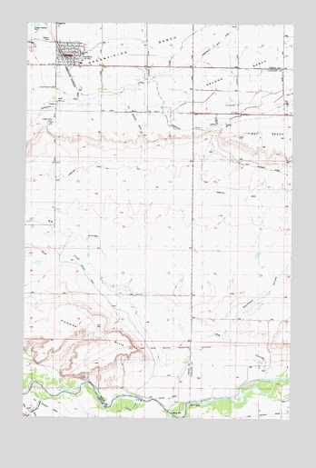
Fairfield, MT USGS Topographic Map
Click on map above to begin viewing in our Map Viewer.

This topographic map contains these locations and features:
Feature Name Type Latitude Longitude GNIS ID View Map
20N03W04D___01 WellWellN47.5136°W111.9922°823508View Map
20N03W10A___01 WellWellN47.5063°W111.9708°823460View Map
21N02W20C___01 WellWellN47.5563°W111.8955°823752View Map
21N03W03CBBA01 WellWellN47.6038°W111.9856°824012View Map
21N03W03CBCB01 WellWellN47.6019°W111.9858°823999View Map
21N03W03CBCC01 WellWellN47.6008°W111.9867°823990View Map
21N03W04AAAA01 WellWellN47.6108°W111.9878°824048View Map
21N03W04AAAB01 WellWellN47.6113°W111.9889°824049View Map
21N03W04DADD01 WellWellN47.6011°W111.9875°823991View Map
21N03W09AAAA01 WellWellN47.5966°W111.9878°823964View Map
22N03W33DBBB01 WellWellN47.6183°W111.9972°824107View Map
22N03W34ADDD01 WellWellN47.6186°W111.9664°824109View Map
22N03W34CCBB01 WellWellN47.6150°W111.9867°824068View Map
22N03W35BCCC01 WellWellN47.6188°W111.9653°824111View Map
22N03W35C___01 WellWellN47.6152°W111.9606°824072View Map
22N03W35D___01 WellWellN47.6152°W111.9500°824071View Map
Anderson CouleeValleyN47.5072°W111.9867°800354View Map
Assembly of God ChurchChurchN47.6116°W111.9800°1762126View Map
Big CouleeValleyN47.5155°W111.8814°768767View Map
Big Coulee CanalCanalN47.5336°W111.9542°768770View Map
Blackfoot CouleeValleyN47.5277°W111.9061°768993View Map
Busch Agricultural Resources ElevatorLocaleN47.6147°W111.9803°1761994View Map
Duck CreekStreamN47.5444°W111.9650°768054View Map
FairfieldLocaleN47.6138°W111.9836°1762113View Map
FairfieldPopulated PlaceN47.6147°W111.9803°771287View Map
Fairfield AmbulanceBuildingN47.6126°W111.9865°2637866View Map
Fairfield Faith Bible ChurchChurchN47.6147°W111.9803°1762123View Map
Fairfield Medical OfficeHospitalN47.6147°W111.9803°1762007View Map
Fairfield Mennonite ChurchChurchN47.6147°W111.9803°1762124View Map
Fairfield Mennonite SchoolSchoolN47.6147°W111.9803°1762125View Map
Fairfield Police DepartmentBuildingN47.6152°W111.9781°1762077View Map
Fairfield Post OfficePost OfficeN47.6138°W111.9812°1762071View Map
Fairfield Public LibraryBuildingN47.6150°W111.9819°1761991View Map
Fairfield Public SchoolsSchoolN47.6158°W111.9758°1761964View Map
Fairfield Volunteer Fire DepartmentBuildingN47.6140°W111.9809°1762076View Map
Floweree ButteSummitN47.5224°W111.9511°771475View Map
Genger School (historical)SchoolN47.5972°W111.9222°1761928View Map
Grace Lutheran ChurchChurchN47.6147°W111.9803°1762122View Map
Hamilton CanalCanalN47.5727°W111.9175°807020View Map
Harvest Hills Golf CourseLocaleN47.6147°W111.9803°1762107View Map
Saint Johns Catholic ChurchChurchN47.6147°W111.9803°1762121View Map
Simms CreekStreamN47.5052°W111.9461°776567View Map
Sunset Hills CemeteryCemeteryN47.5941°W111.9880°1762075View Map
The Church of Jesus Christ of Latter Day SaintsChurchN47.5972°W111.9675°1762127View Map
Town of FairfieldCivilN47.6153°W111.9816°2412613View Map
United Church of Christ CongregationalChurchN47.6147°W111.9803°1762120View Map

Note: Coordinates in the location and feature list above are referenced to NAD83 datum.


Copyright (C) 2008-2025 Ryan Niemi / Sunset Dynamics ... All Rights Reserved