TopoQuest Logo
Do you find TopoQuest useful?
Help keep TopoQuest running and adding new maps/features by donating!
Bitcoin:  19c7KJd3qBynnjoSw5npx9KScwjBe4ifkT
Litecoin:  LXs6TkuXGGXo1vDsWCkWVdjQX94eUKd6ui
Home View Maps Find Maps Find Places Resources & Links


Fairmount, North Dakota Topographic Map

USGS Map Title: Fairmount, ND
USGS Map MRC: 46096A5
DRG (GeoTIFF) Download: o46096a5.tif


Neighboring USGS Topographic Map Quads:


  Fairmount NW, ND  
46096B6
 

  South of Wahpeton, MN  
46096B5
 

  Doran, MN  
46096B4
 

  Sonora, ND  
46096A6
 

  Fairmount, ND  
46096A5
 

  Campbell, MN  
46096A4
 

  La Mars, ND  
45096H6
 

  Boisberg, MN  
45096H5
 

  Wheaton NW, MN  
45096H4


Map MRC Location:

N47°
W97°
N47°
W96°
H8 H7 H6 H5 H4 H3 H2 H1
G8 G7 G6 G5 G4 G3 G2 G1
F8 F7 F6 F5 F4 F3 F2 F1
E8 E7 E6 E5 E4 E3 E2 E1
D8 D7 D6 D5 D4 D3 D2 D1
C8 C7 C6 C5 C4 C3 C2 C1
B8 B7 B6 B5 B4 B3 B2 B1
A8 A7 A6 A5 A4 A3 A2 A1
N46°
W97°
N46°
W96°

Fairmount, ND USGS 1:24K Topographic Map Preview:
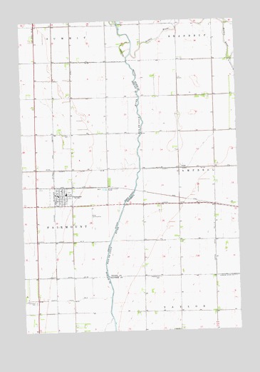
Fairmount, ND USGS Topographic Map
Click on map above to begin viewing in our Map Viewer.

This topographic map contains these locations and features:
Feature Name Type Latitude Longitude GNIS ID View Map
Calvary CemeteryCemeteryN46.0792°W96.5972°1028234View Map
ChildsPopulated PlaceN46.0655°W96.5345°654642View Map
Childs Post Office (historical)Post OfficeN46.0656°W96.5342°2094020View Map
City of FairmountCivilN46.0546°W96.6028°1036029View Map
County Ditch Number 26CanalN46.0652°W96.5931°1028489View Map
County Ditch Number 34CanalN46.0366°W96.5995°1028498View Map
County Ditch Number 35CanalN46.0219°W96.6037°1028500View Map
County Ditch Number 58CanalN46.1019°W96.5953°1028506View Map
County Ditch Number ThirtynineCanalN46.0652°W96.5273°642039View Map
County Ditch Number TwentyfiveCanalN46.1058°W96.5009°641864View Map
FairmountPopulated PlaceN46.0550°W96.6023°1028925View Map
Fairmount CemeteryCemeteryN46.0120°W96.6186°1028926View Map
Fairmount City HallBuildingN46.0558°W96.6041°2744466View Map
Fairmount Fire Protection DistrictBuildingN46.0553°W96.6041°2637702View Map
Fairmount Post OfficePost OfficeN46.0552°W96.6034°2741993View Map
Fairmount Public SchoolSchoolN46.0555°W96.5998°2747742View Map
Judicial Ditch Number Eleven-TenCanalN46.0363°W96.5145°645789View Map
Pleasant Hill CemeteryCemeteryN46.0218°W96.5461°649551View Map
Rabbit RiverStreamN46.1122°W96.5609°649782View Map
Saint Pauls ChurchChurchN46.0005°W96.5356°650997View Map
Township of FairmountCivilN46.0240°W96.6021°1036817View Map
Wetherbee Farm AirportAirportN46.0476°W96.5478°660438View Map

Note: Coordinates in the location and feature list above are referenced to NAD83 datum.


Copyright (C) 2008-2024 Ryan Niemi / Sunset Dynamics ... All Rights Reserved