TopoQuest Logo
Do you find TopoQuest useful?
Help keep TopoQuest running and adding new maps/features by donating!
Bitcoin:  19c7KJd3qBynnjoSw5npx9KScwjBe4ifkT
Litecoin:  LXs6TkuXGGXo1vDsWCkWVdjQX94eUKd6ui
Home View Maps Find Maps Find Places Resources & Links


Falfurrias SE, Texas Topographic Map

USGS Map Title: Falfurrias SE, TX
USGS Map MRC: 27098A1
DRG (GeoTIFF) Download: o27098a1.tif


Neighboring USGS Topographic Map Quads:


  Falfurrias, TX  
27098B2
 

  Flowella, TX  
27098B1
 

  La Paloma Ranch, TX  
27097B8
 

  Cage Ranch, TX  
27098A2
 

  Falfurrias SE, TX  
27098A1
 

  Sarita SW, TX  
27097A8
 

  Encino, TX  
26098H2
 

  San Tomas Camp, TX  
26098H1
 

  Pita Camp, TX  
26097H8


Map MRC Location:

N28°
W99°
N28°
W98°
H8 H7 H6 H5 H4 H3 H2 H1
G8 G7 G6 G5 G4 G3 G2 G1
F8 F7 F6 F5 F4 F3 F2 F1
E8 E7 E6 E5 E4 E3 E2 E1
D8 D7 D6 D5 D4 D3 D2 D1
C8 C7 C6 C5 C4 C3 C2 C1
B8 B7 B6 B5 B4 B3 B2 B1
A8 A7 A6 A5 A4 A3 A2 A1
N27°
W99°
N27°
W98°

Falfurrias SE, TX USGS 1:24K Topographic Map Preview:
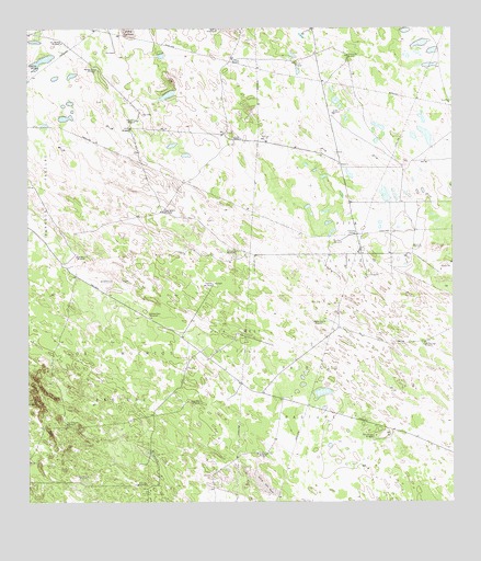
Falfurrias SE, TX USGS Topographic Map
Click on map above to begin viewing in our Map Viewer.

This topographic map contains these locations and features:
Feature Name Type Latitude Longitude GNIS ID View Map
Barroso TrapFlatN27.0589°W98.0989°1330094View Map
Cados Negros WindmillLocaleN27.0767°W98.0844°1331841View Map
Camp Vista WindmillLocaleN27.0498°W98.0892°1332017View Map
Caramayola WindmillLocaleN27.1181°W98.0303°1332149View Map
Crudo WindmillLocaleN27.1028°W98.0347°1333751View Map
El Azul WindmillLocaleN27.0053°W98.0908°1335158View Map
El Toro WindmillLocaleN27.1162°W98.0453°1335284View Map
Humble WindmillLocaleN27.0675°W98.0117°1338289View Map
Jimmy WindmillLocaleN27.0987°W98.0942°1338741View Map
La Becerra WindmillLocaleN27.0070°W98.1106°1339276View Map
La Mula WindmillLocaleN27.1170°W98.0636°1339364View Map
La Pela WindmillLocaleN27.0692°W98.0347°1339377View Map
La Sulfurosa WindmillLocaleN27.0212°W98.1139°1339410View Map
Las Avispas WindmillLocaleN27.0478°W98.0381°1339647View Map
Las Hormigas WindmillLocaleN27.0423°W98.0089°1374476View Map
Las Liebras WindmillLocaleN27.1220°W98.1153°1339668View Map
Los Muertos PastureFlatN27.0120°W98.1111°1340618View Map
Los Muertos WindmillLocaleN27.0270°W98.0769°1340619View Map
Medio WindmillLocaleN27.1153°W98.1242°1341331View Map
Mota Bonita WindmillLocaleN27.0131°W98.0547°1341980View Map
Number Nine WindmillLocaleN27.1145°W98.1044°1342919View Map
Number One WindmillLocaleN27.0176°W98.0231°1342920View Map
Old Barrosa WindmillLocaleN27.0650°W98.1106°1343113View Map
Papalote del NortePopulated PlaceN27.0578°W98.0700°1378832View Map
Patricio PastureFlatN27.0256°W98.0417°1343660View Map
Petroteros WindmillLocaleN27.1009°W98.0925°1343914View Map
Pita Oil FieldOilfieldN27.0670°W98.0303°1344138View Map
Pita PensLocaleN27.0898°W98.0153°1344140View Map
Pita West Oil FieldOilfieldN27.0428°W98.0636°1344141View Map
San Juan WindmillLocaleN27.0664°W98.0631°1346414View Map
Sorillo WindmillLocaleN27.0964°W98.0631°1347387View Map

Note: Coordinates in the location and feature list above are referenced to NAD83 datum.


Copyright (C) 2008-2025 Ryan Niemi / Sunset Dynamics ... All Rights Reserved