TopoQuest Logo
Do you find TopoQuest useful?
Help keep TopoQuest running and adding new maps/features by donating!
Bitcoin:  19c7KJd3qBynnjoSw5npx9KScwjBe4ifkT
Litecoin:  LXs6TkuXGGXo1vDsWCkWVdjQX94eUKd6ui
Home View Maps Find Maps Find Places Resources & Links


Ferry, Michigan Topographic Map

USGS Map Title: Ferry, MI
USGS Map MRC: 43086E2
DRG (GeoTIFF) Download: o43086e2.tif


Neighboring USGS Topographic Map Quads:


  Walkerville West, MI  
43086F2
 

  Walkerville East, MI  
43086F1


  Ferry, MI  
43086E2
 

  Hesperia, MI  
43086E1


  Big Blue Lake, MI  
43086D2
 

  Holton, MI  
43086D1


Map MRC Location:

N44°
W87°
N44°
W86°
H8 H7 H6 H5 H4 H3 H2 H1
G8 G7 G6 G5 G4 G3 G2 G1
F8 F7 F6 F5 F4 F3 F2 F1
E8 E7 E6 E5 E4 E3 E2 E1
D8 D7 D6 D5 D4 D3 D2 D1
C8 C7 C6 C5 C4 C3 C2 C1
B8 B7 B6 B5 B4 B3 B2 B1
A8 A7 A6 A5 A4 A3 A2 A1
N43°
W87°
N43°
W86°

Ferry, MI USGS 1:24K Topographic Map Preview:
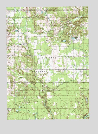
Ferry, MI USGS Topographic Map
Click on map above to begin viewing in our Map Viewer.

This topographic map contains these locations and features:
Feature Name Type Latitude Longitude GNIS ID View Map
Bear CreekStreamN43.5231°W86.1926°1621006View Map
Blackmer LakeLakeN43.5102°W86.2348°1619243View Map
Camp KeewanaLocaleN43.5878°W86.1598°622588View Map
Camp ManisteeLocaleN43.5153°W86.1920°1619407View Map
FerryPopulated PlaceN43.5842°W86.2248°625922View Map
Ferry Elementary SchoolSchoolN43.5833°W86.2250°2515729View Map
Ferry Lookout TowerTowerN43.5461°W86.2451°1623347View Map
Ferry Post Office (historical)Post OfficeN43.5842°W86.2247°2515399View Map
Ferry Township Fire DepartmentBuildingN43.5843°W86.2244°2515728View Map
Ferry Township South CemeteryCemeteryN43.5717°W86.2395°1619901View Map
Ferry United Methodist ChurchChurchN43.5842°W86.2225°2515794View Map
Ferry Wesleyan ChurchChurchN43.5853°W86.2228°2515730View Map
Gillan LakeLakeN43.5139°W86.2312°1620015View Map
Gillon LakeLakeN43.5870°W86.1621°626833View Map
Hansen Post Office (historical)Post OfficeN43.6208°W86.2075°2515393View Map
Hightower LakeLakeN43.5898°W86.1486°1620203View Map
Knutson CreekStreamN43.5306°W86.1912°1620454View Map
Landin LakeLakeN43.5988°W86.2349°630119View Map
Lidkey SwampSwampN43.5123°W86.2204°1622383View Map
Michigan Department of Natural Resources Oceana Field OfficeBuildingN43.5702°W86.2372°2627107View Map
Newman ChapelChurchN43.5556°W86.2111°2515770View Map
Newman SchoolSchoolN43.5547°W86.2295°1621008View Map
Osborn CreekStreamN43.6167°W86.1912°1617018View Map
Otto CemeteryCemeteryN43.5550°W86.2084°1621128View Map
Robinson CreekStreamN43.5992°W86.2220°1621408View Map
Shelby Wesleyan ChurchChurchN43.5839°W86.2225°2515731View Map
Swinton CreekStreamN43.5972°W86.1876°1619544View Map
Township of FerryCivilN43.5994°W86.2183°1626279View Map
Township of OttoCivilN43.5126°W86.2186°1626871View Map
Wager Post Office (historical)Post OfficeN43.5631°W86.1731°2515368View Map
Woodward CemeteryCemeteryN43.5264°W86.1397°2515832View Map

Note: Coordinates in the location and feature list above are referenced to NAD83 datum.


Copyright (C) 2008-2024 Ryan Niemi / Sunset Dynamics ... All Rights Reserved