TopoQuest Logo
Do you find TopoQuest useful?
Help keep TopoQuest running and adding new maps/features by donating!
Bitcoin:  19c7KJd3qBynnjoSw5npx9KScwjBe4ifkT
Litecoin:  LXs6TkuXGGXo1vDsWCkWVdjQX94eUKd6ui
Home View Maps Find Maps Find Places Resources & Links


Firth, Idaho Topographic Map

USGS Map Title: Firth, ID
USGS Map MRC: 43112C2
DRG (GeoTIFF) Download: o43112c2.tif


Neighboring USGS Topographic Map Quads:


  Morgans Pasture NE, ID  
43112D3
 

  Woodville, ID  
43112D2
 

  Idaho Falls South, ID  
43112D1
 

  Rose, ID  
43112C3
 

  Firth, ID  
43112C2
 

  Goshen, ID  
43112C1
 

  Blackfoot, ID  
43112B3
 

  Lincoln Creek, ID  
43112B2
 

  Higham Peak, ID  
43112B1


Map MRC Location:

N44°
W113°
N44°
W112°
H8 H7 H6 H5 H4 H3 H2 H1
G8 G7 G6 G5 G4 G3 G2 G1
F8 F7 F6 F5 F4 F3 F2 F1
E8 E7 E6 E5 E4 E3 E2 E1
D8 D7 D6 D5 D4 D3 D2 D1
C8 C7 C6 C5 C4 C3 C2 C1
B8 B7 B6 B5 B4 B3 B2 B1
A8 A7 A6 A5 A4 A3 A2 A1
N43°
W113°
N43°
W112°

Firth, ID USGS 1:24K Topographic Map Preview:
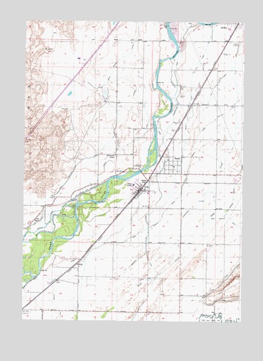
Firth, ID USGS Topographic Map
Click on map above to begin viewing in our Map Viewer.

This topographic map contains these locations and features:
Feature Name Type Latitude Longitude GNIS ID View Map
A W Johnson Elementary SchoolSchoolN43.3021°W112.1761°401296View Map
BasaltPopulated PlaceN43.3155°W112.1644°397411View Map
Basalt CanalCanalN43.3504°W112.2024°2439530View Map
Basalt CemeteryCemeteryN43.3329°W112.1615°371376View Map
Basalt Post OfficePost OfficeN43.3153°W112.1639°2766796View Map
Blackfoot CanalCanalN43.2949°W112.1866°371587View Map
Cedar Point CanalCanalN43.3624°W112.1472°371942View Map
Christenson LateralCanalN43.2977°W112.1544°372015View Map
City of BasaltCivilN43.3144°W112.1650°2409794View Map
City of FirthCivilN43.3058°W112.1835°2410508View Map
Cox LateralCanalN43.3466°W112.1419°372208View Map
FirthPopulated PlaceN43.3052°W112.1830°396489View Map
Firth DivisionCivilN43.2977°W112.1651°1936709View Map
Firth High SchoolSchoolN43.3066°W112.1875°401471View Map
Firth Post OfficePost OfficeN43.3071°W112.1815°2781796View Map
Goshen JunctionPopulated PlaceN43.3082°W112.1794°396574View Map
Harding Gibbs Middle SchoolSchoolN43.3060°W112.1878°401490View Map
Hillcrest CemeteryCemeteryN43.3661°W112.1266°373081View Map
Jensen LateralCanalN43.2608°W112.1569°2440291View Map
KimballPopulated PlaceN43.2735°W112.2194°396742View Map
Larson LateralCanalN43.3171°W112.1986°376023View Map
Neil RanchLocaleN43.2916°W112.2428°374113View Map
New Lavaside and People CanalCanalN43.3044°W112.2136°374126View Map
Reservation CanalCanalN43.2949°W112.1778°374642View Map
Riverview CemeteryCemeteryN43.3149°W112.1865°374698View Map
Riverview SchoolSchoolN43.3196°W112.1975°374700View Map
Shelley Firth Fire DistrictBuildingN43.3748°W112.1354°2619086View Map
Shelley Firth Fire DistrictBuildingN43.3062°W112.1825°2619113View Map
Shelley Senior High SchoolSchoolN43.3741°W112.1328°401156View Map
Steel LateralCanalN43.3371°W112.1800°375272View Map
Warnett LateralCanalN43.2771°W112.1816°375746View Map
West Branch Snake River Valley CanalCanalN43.3049°W112.1591°375794View Map

Note: Coordinates in the location and feature list above are referenced to NAD83 datum.


Copyright (C) 2008-2024 Ryan Niemi / Sunset Dynamics ... All Rights Reserved