TopoQuest Logo
Do you find TopoQuest useful?
Help keep TopoQuest running and adding new maps/features by donating!
Bitcoin:  19c7KJd3qBynnjoSw5npx9KScwjBe4ifkT
Litecoin:  LXs6TkuXGGXo1vDsWCkWVdjQX94eUKd6ui
Home View Maps Find Maps Find Places Resources & Links


Fish Lake, Montana Topographic Map

USGS Map Title: Fish Lake, MT
USGS Map MRC: 48112B7
DRG (GeoTIFF) Download: o48112b7.tif


Neighboring USGS Topographic Map Quads:


  Mitten Lake, MT  
48112C8
 

  Heart Butte, MT  
48112C7
 

  Four Horns Lake, MT  
48112C6
 

  Swift Reservoir, MT  
48112B8
 

  Fish Lake, MT  
48112B7
 

  Scoffin Butte, MT  
48112B6
 

  Gateway Pass, MT  
48112A8
 

  Walling Reef, MT  
48112A7
 

  Volcano Reef, MT  
48112A6


Map MRC Location:

N49°
W113°
N49°
W112°
H8 H7 H6 H5 H4 H3 H2 H1
G8 G7 G6 G5 G4 G3 G2 G1
F8 F7 F6 F5 F4 F3 F2 F1
E8 E7 E6 E5 E4 E3 E2 E1
D8 D7 D6 D5 D4 D3 D2 D1
C8 C7 C6 C5 C4 C3 C2 C1
B8 B7 B6 B5 B4 B3 B2 B1
A8 A7 A6 A5 A4 A3 A2 A1
N48°
W113°
N48°
W112°

Fish Lake, MT USGS 1:24K Topographic Map Preview:
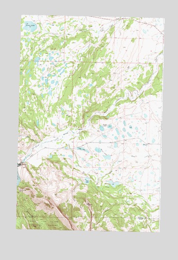
Fish Lake, MT USGS Topographic Map
Click on map above to begin viewing in our Map Viewer.

This topographic map contains these locations and features:
Feature Name Type Latitude Longitude GNIS ID View Map
Cody LakeLakeN48.1723°W112.8186°781470View Map
Deep LakeLakeN48.1753°W112.7900°1748693View Map
Eagle CreekStreamN48.1758°W112.8556°782756View Map
Fish CreekStreamN48.1825°W112.8217°783426View Map
Fish LakeLakeN48.1540°W112.8143°783442View Map
Fish Lake DamDamN48.1550°W112.8142°798772View Map
Fish Lake School (historical)SchoolN48.1761°W112.7623°783446View Map
Floating Rib DamDamN48.1600°W112.7676°798554View Map
Green LakeReservoirN48.2432°W112.8671°795537View Map
Green Lake DamDamN48.2433°W112.8609°795536View Map
Hell Roaring SpringSpringN48.1474°W112.8731°784732View Map
Hidden LakeLakeN48.1677°W112.8463°1748692View Map
Howes LakesLakeN48.1722°W112.8052°785116View Map
Miller DitchCanalN48.1497°W112.7909°787413View Map
Pondera County Waterfowl Production AreaParkN48.1765°W112.7949°2765460View Map
Round LakeLakeN48.1617°W112.7860°1748694View Map
South Fork Blacktail CreekStreamN48.2400°W112.8076°790910View Map
Split MountainSummitN48.1405°W112.8142°791165View Map
Swift DamDamN48.1627°W112.8719°791820View Map
Swift Dam TrailheadLocaleN48.1633°W112.8673°798892View Map
Twin Lake DamDamN48.1533°W112.7909°796470View Map
Twin LakesLakeN48.1528°W112.7911°792522View Map
Waddel LakesLakeN48.1860°W112.7954°792738View Map

Note: Coordinates in the location and feature list above are referenced to NAD83 datum.


Copyright (C) 2008-2025 Ryan Niemi / Sunset Dynamics ... All Rights Reserved