TopoQuest Logo
Do you find TopoQuest useful?
Help keep TopoQuest running and adding new maps/features by donating!
Bitcoin:  19c7KJd3qBynnjoSw5npx9KScwjBe4ifkT
Litecoin:  LXs6TkuXGGXo1vDsWCkWVdjQX94eUKd6ui
Home View Maps Find Maps Find Places Resources & Links


Five Forks, South Carolina Topographic Map

USGS Map Title: Five Forks, SC
USGS Map MRC: 34082F6
DRG (GeoTIFF) Download: o34082f6.tif


Neighboring USGS Topographic Map Quads:


  Six Mile, SC  
34082G7
 

  Liberty, SC  
34082G6
 

  Easley, SC  
34082G5
 

  Clemson, SC  
34082F7
 

  Five Forks, SC  
34082F6
 

  Piercetown, SC  
34082F5
 

  La France, SC  
34082E7
 

  Anderson North, SC  
34082E6
 

  Belton West, SC  
34082E5


Map MRC Location:

N35°
W83°
N35°
W82°
H8 H7 H6 H5 H4 H3 H2 H1
G8 G7 G6 G5 G4 G3 G2 G1
F8 F7 F6 F5 F4 F3 F2 F1
E8 E7 E6 E5 E4 E3 E2 E1
D8 D7 D6 D5 D4 D3 D2 D1
C8 C7 C6 C5 C4 C3 C2 C1
B8 B7 B6 B5 B4 B3 B2 B1
A8 A7 A6 A5 A4 A3 A2 A1
N34°
W83°
N34°
W82°

Five Forks, SC USGS 1:24K Topographic Map Preview:
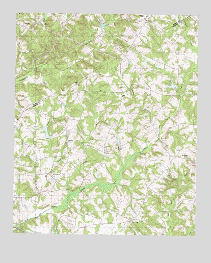
Five Forks, SC USGS Topographic Map
Click on map above to begin viewing in our Map Viewer.

This topographic map contains these locations and features:
Feature Name Type Latitude Longitude GNIS ID View Map
Big Garvin CreekStreamN34.6343°W82.7346°1246876View Map
Bishop Branch School (historical)SchoolN34.6701°W82.7143°1233188View Map
Calvary Baptist CemeteryCemeteryN34.7034°W82.6754°2052506View Map
Calvary ChurchChurchN34.7026°W82.6754°1247110View Map
Carmel CreekStreamN34.7301°W82.6254°1221357View Map
Cedar Ridge FarmLocaleN34.6364°W82.6858°2564090View Map
Clemson University Pond Dam D-3113DamN34.6284°W82.7215°1239759View Map
Corinth Baptist Cemetery Number TwoCemeteryN34.6770°W82.7124°2052550View Map
Corinth Number 2 ChurchChurchN34.6768°W82.7126°1247391View Map
Cuffie CreekStreamN34.6476°W82.7107°1247459View Map
Double BranchStreamN34.6757°W82.6579°1222071View Map
F Revves Pond Dam D-3264DamN34.7051°W82.7199°1239915View Map
Fifteenmile CreekStreamN34.7187°W82.7368°1247740View Map
Five ForksPopulated PlaceN34.6329°W82.6704°1247758View Map
Flat Rock Baptist ChurchChurchN34.7484°W82.6615°1247770View Map
Flat Rock CemeteryCemeteryN34.7498°W82.6617°1243347View Map
Gillespie LakeReservoirN34.6984°W82.7163°1222702View Map
H T Double Pond Dam D-3271DamN34.7218°W82.6632°1239916View Map
Hickory Flat Post Office (historical)Post OfficeN34.6912°W82.7260°1253379View Map
Little Garvin CreekStreamN34.6476°W82.7318°1253477View Map
Majors Post Office (historical)Post OfficeN34.7259°W82.6749°1253383View Map
McElmoyle SchoolSchoolN34.7073°W82.6743°1224403View Map
Melton School (historical)SchoolN34.6707°W82.6437°1236820View Map
Meltons Academy (historical)SchoolN34.6629°W82.6454°1253385View Map
Midway Number 2 ChurchChurchN34.7432°W82.7429°1246648View Map
Mount Able Baptist ChurchChurchN34.6601°W82.6443°1236828View Map
Mount Able School (historical)SchoolN34.6601°W82.6446°1236829View Map
Oak Grove School (historical)SchoolN34.6443°W82.7479°1236871View Map
Oak Grove School (historical)SchoolN34.7068°W82.6571°1236872View Map
Pendleton DivisionCivilN34.6303°W82.7319°1938383View Map
Pickens CreekStreamN34.7209°W82.6254°1225404View Map
Praters Store (historical)LocaleN34.7284°W82.6735°1253391View Map
Ruhamah School (historical)SchoolN34.7429°W82.6968°1243528View Map
Septus Post Office (historical)Post OfficeN34.6332°W82.6704°1253395View Map
Shady Grove School (historical)SchoolN34.6584°W82.7301°1233477View Map
Sharon CemeteryCemeteryN34.7101°W82.7062°1233479View Map
Sharon ChurchChurchN34.7109°W82.7068°1250850View Map
Simpson CemeteryCemeteryN34.6468°W82.7246°1226635View Map
Six and Twenty ChurchChurchN34.6693°W82.6326°1226653View Map
South Carolina Noname 04014 D-3124 DamDamN34.7084°W82.6399°1238351View Map
South Carolina Noname 04020 D-3121 DamDamN34.6768°W82.6799°1238362View Map
South Carolina Noname 04031 D-3114 DamDamN34.6268°W82.7215°1239756View Map
Symmes Church (historical)ChurchN34.7276°W82.7246°1243557View Map
Symmes Mill (historical)LocaleN34.7265°W82.7226°1243558View Map
Symmes School (historical)SchoolN34.7273°W82.7246°1243559View Map
Three and Twenty Creek Watershed Five LakeReservoirN34.7107°W82.6422°1238352View Map
Walker McElmoyle Fire Department - Anderson County Station 16BuildingN34.6718°W82.6881°2578546View Map
White Oak School (historical)SchoolN34.7176°W82.7340°1243583View Map
White Oak Spring ChurchChurchN34.7179°W82.7340°1251411View Map
Willis ChapelChurchN34.6757°W82.6874°1251455View Map
Willis Chapel CemeteryCemeteryN34.6751°W82.6879°1233570View Map

Note: Coordinates in the location and feature list above are referenced to NAD83 datum.


Copyright (C) 2008-2025 Ryan Niemi / Sunset Dynamics ... All Rights Reserved