TopoQuest Logo
Do you find TopoQuest useful?
Help keep TopoQuest running and adding new maps/features by donating!
Bitcoin:  19c7KJd3qBynnjoSw5npx9KScwjBe4ifkT
Litecoin:  LXs6TkuXGGXo1vDsWCkWVdjQX94eUKd6ui
Home View Maps Find Maps Find Places Resources & Links


Flandreau, South Dakota Topographic Map

USGS Map Title: Flandreau, SD
USGS Map MRC: 44096A5
DRG (GeoTIFF) Download: o44096a5.tif


Neighboring USGS Topographic Map Quads:


  Flandreau NW, SD  
44096B6
 

  Flandreau NE, SD  
44096B5
 

  Elkton, SD  
44096B4
 

  Flandreau SW, SD  
44096A6
 

  Flandreau, SD  
44096A5
 

  Elkton SW, MN  
44096A4
 

  Trent, SD  
43096H6
 

  Dell Rapids NE, SD  
43096H5
 

  Jasper NW, MN  
43096H4


Map MRC Location:

N45°
W97°
N45°
W96°
H8 H7 H6 H5 H4 H3 H2 H1
G8 G7 G6 G5 G4 G3 G2 G1
F8 F7 F6 F5 F4 F3 F2 F1
E8 E7 E6 E5 E4 E3 E2 E1
D8 D7 D6 D5 D4 D3 D2 D1
C8 C7 C6 C5 C4 C3 C2 C1
B8 B7 B6 B5 B4 B3 B2 B1
A8 A7 A6 A5 A4 A3 A2 A1
N44°
W97°
N44°
W96°

Flandreau, SD USGS 1:24K Topographic Map Preview:
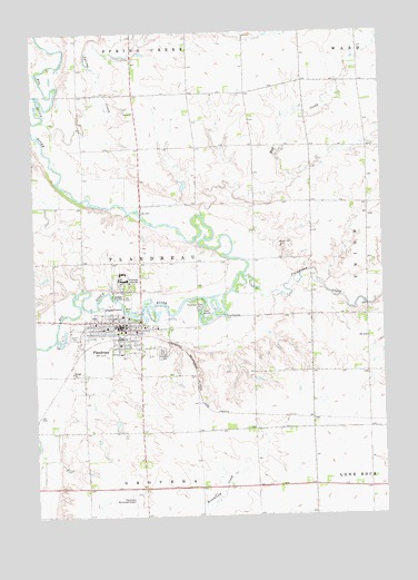
Flandreau, SD USGS Topographic Map
Click on map above to begin viewing in our Map Viewer.

This topographic map contains these locations and features:
Feature Name Type Latitude Longitude GNIS ID View Map
Avera Flandreau HospitalHospitalN44.0514°W96.5915°2610914View Map
City of FlandreauCivilN44.0465°W96.5983°1267391View Map
Clay Hill CemeteryCemeteryN44.0520°W96.5356°2779272View Map
First Presbyterian CemeteryCemeteryN44.0690°W96.5861°2779273View Map
First Presbyterian ChurchChurchN44.0694°W96.5853°1264890View Map
FlandreauPopulated PlaceN44.0494°W96.5953°1255073View Map
Flandreau City OfficeBuildingN44.0450°W96.6112°2724736View Map
Flandreau CreekStreamN44.0583°W96.5545°1255074View Map
Flandreau CreekStreamN44.0583°W96.5545°643728View Map
Flandreau Elementary SchoolSchoolN44.0516°W96.6026°2728714View Map
Flandreau Fire DepartmentBuildingN44.0477°W96.5926°2580947View Map
Flandreau High SchoolSchoolN44.0517°W96.6038°2728715View Map
Flandreau Indian SchoolSchoolN44.0611°W96.5923°1255075View Map
Flandreau Middle SchoolSchoolN44.0519°W96.6054°2728716View Map
Flandreau Municipal AirportAirportN44.0061°W96.5967°1260241View Map
Flandreau ParkParkN44.0558°W96.5650°1255076View Map
Flandreau Police DepartmentBuildingN44.0496°W96.5936°2755467View Map
Flandreau Post OfficePost OfficeN44.0497°W96.5958°2709883View Map
Flandreau ReservationCivilN44.0805°W96.5873°1934365View Map
Moody County Ambulance ServiceBuildingN44.0488°W96.5946°2659003View Map
Moody County CourthouseBuildingN44.0479°W96.5944°2712684View Map
Moody County Historical Society MuseumBuildingN44.0487°W96.5824°2729335View Map
Moody County Resource CenterBuildingN44.0514°W96.6045°2723475View Map
Moody County SheriffBuildingN44.0486°W96.5946°2755588View Map
Mud CreekStreamN44.0775°W96.5650°1256586View Map
Old Catholic CemeteryCemeteryN44.0422°W96.5779°2652145View Map
Saint Simon and Jude Catholic CemeteryCemeteryN44.0414°W96.5802°1254271View Map
Spring CreekStreamN44.1022°W96.6212°652444View Map
Spring CreekStreamN44.1022°W96.6212°1258260View Map
Township of FlandreauCivilN44.0667°W96.5866°1267746View Map
Union CemeteryCemeteryN44.0427°W96.5804°1258694View Map

Note: Coordinates in the location and feature list above are referenced to NAD83 datum.


Copyright (C) 2008-2025 Ryan Niemi / Sunset Dynamics ... All Rights Reserved