TopoQuest Logo
Do you find TopoQuest useful?
Help keep TopoQuest running and adding new maps/features by donating!
Bitcoin:  19c7KJd3qBynnjoSw5npx9KScwjBe4ifkT
Litecoin:  LXs6TkuXGGXo1vDsWCkWVdjQX94eUKd6ui
Home View Maps Find Maps Find Places Resources & Links


Arroyo Huisache, Texas Topographic Map

USGS Map Title: Arroyo Huisache, TX
USGS Map MRC: 26099H1
DRG (GeoTIFF) Download: o26099h1.tif


Neighboring USGS Topographic Map Quads:


  Mogotes Hill, TX  
27099A2
 

  Escobas, TX  
27099A1
 

  Randado, TX  
27098A8
 

  Arroyo Veleno, TX  
26099H2
 

  Arroyo Huisache, TX  
26099H1
 

  Guerra, TX  
26098H8
 

  Arroyo Clareno, TX  
26099G2
 

  Arroyo Miguel, TX  
26099G1
 

  Cuevitas SW, TX  
26098G8


Map MRC Location:

N27°
W100°
N27°
W99°
H8 H7 H6 H5 H4 H3 H2 H1
G8 G7 G6 G5 G4 G3 G2 G1
F8 F7 F6 F5 F4 F3 F2 F1
E8 E7 E6 E5 E4 E3 E2 E1
D8 D7 D6 D5 D4 D3 D2 D1
C8 C7 C6 C5 C4 C3 C2 C1
B8 B7 B6 B5 B4 B3 B2 B1
A8 A7 A6 A5 A4 A3 A2 A1
N26°
W100°
N26°
W99°

Arroyo Huisache, TX USGS 1:24K Topographic Map Preview:
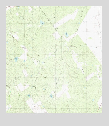
Arroyo Huisache, TX USGS Topographic Map
Click on map above to begin viewing in our Map Viewer.

This topographic map contains these locations and features:
Feature Name Type Latitude Longitude GNIS ID View Map
Adame CreekStreamN26.9348°W99.0809°1329201View Map
Adame TankReservoirN26.8956°W99.0954°1329202View Map
Adame Tank DamDamN26.8970°W99.0953°1865469View Map
Arroyo CarizalesValleyN26.9348°W99.0803°1329717View Map
Arroyo HuisacheValleyN26.9550°W99.0500°1329733View Map
Arroyo PalomasValleyN26.9520°W99.1108°1329747View Map
Arroyo SaladoValleyN26.9679°W99.1240°1329756View Map
Beulah TankReservoirN26.9059°W99.0909°1330544View Map
Burras TankReservoirN26.9340°W99.0776°1331714View Map
Cuatus TankReservoirN26.8832°W99.0757°1333775View Map
Fandango CreekStreamN26.9553°W99.0500°1335689View Map
Jones and Flores Lake DamDamN26.9337°W99.0786°1859006View Map
La Cabrada TankReservoirN26.9645°W99.0453°1339287View Map
La Cabrada Tank DamDamN26.9637°W99.0453°1865473View Map
Lobitas TankReservoirN26.9807°W99.0783°1340298View Map
Los Huesos TankReservoirN26.9529°W99.0417°1340599View Map
Los Tanques CreekStreamN26.9525°W99.0431°1340631View Map
Sabana TankReservoirN26.8949°W99.0660°1345799View Map
Sandoval TankReservoirN26.9109°W99.0456°1346571View Map
Vidaurri Lake DamDamN26.9787°W99.0786°1859008View Map
Villa TankReservoirN26.9034°W99.0757°1349280View Map
Volpe TankReservoirN26.9394°W99.1131°1349317View Map
Volpe Tank DamDamN26.9403°W99.1136°1865471View Map
Zapata DivisionCivilN26.9523°W99.1223°1939344View Map

Note: Coordinates in the location and feature list above are referenced to NAD83 datum.


Copyright (C) 2008-2025 Ryan Niemi / Sunset Dynamics ... All Rights Reserved