TopoQuest Logo
Do you find TopoQuest useful?
Help keep TopoQuest running and adding new maps/features by donating!
Bitcoin:  19c7KJd3qBynnjoSw5npx9KScwjBe4ifkT
Litecoin:  LXs6TkuXGGXo1vDsWCkWVdjQX94eUKd6ui
Home View Maps Find Maps Find Places Resources & Links


Arsenic Mountain, Montana Topographic Map

USGS Map Title: Arsenic Mountain, MT
USGS Map MRC: 47112F7
DRG (GeoTIFF) Download: o47112f7.tif


Neighboring USGS Topographic Map Quads:


  Gates Park, MT  
47112G8
 

  Our Lake, MT  
47112G7
 

  Ear Mountain, MT  
47112G6
 

  Glenn Creek, MT  
47112F8
 

  Arsenic Mountain, MT  
47112F7
 

  Castle Reef, MT  
47112F6
 

  Pretty Prairie, MT  
47112E8
 

  Patricks Basin, MT  
47112E7
 

  Sawtooth Ridge, MT  
47112E6


Map MRC Location:

N48°
W113°
N48°
W112°
H8 H7 H6 H5 H4 H3 H2 H1
G8 G7 G6 G5 G4 G3 G2 G1
F8 F7 F6 F5 F4 F3 F2 F1
E8 E7 E6 E5 E4 E3 E2 E1
D8 D7 D6 D5 D4 D3 D2 D1
C8 C7 C6 C5 C4 C3 C2 C1
B8 B7 B6 B5 B4 B3 B2 B1
A8 A7 A6 A5 A4 A3 A2 A1
N47°
W113°
N47°
W112°

Arsenic Mountain, MT USGS 1:24K Topographic Map Preview:
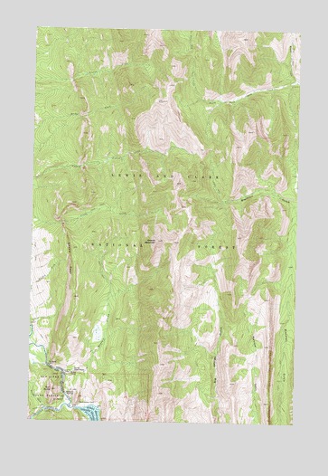
Arsenic Mountain, MT USGS Topographic Map
Click on map above to begin viewing in our Map Viewer.

This topographic map contains these locations and features:
Feature Name Type Latitude Longitude GNIS ID View Map
Arsenic CreekStreamN47.6394°W112.8595°779152View Map
Arsenic MountainSummitN47.6827°W112.8164°779153View Map
Furman CreekStreamN47.6291°W112.8681°800820View Map
JJJ Wilderness RanchLocaleN47.6274°W112.7692°799084View Map
K L RanchLocaleN47.6316°W112.8592°801005View Map
Klicks ResortLocaleN47.6305°W112.8550°798943View Map
Medicine SpringsSpringN47.6330°W112.8553°787176View Map
Mortimer Gulch National Recreation TrailTrailN47.6391°W112.7745°793973View Map
Reclamation FlatsFlatN47.6305°W112.8484°789435View Map
Sheep ReefBarN47.6763°W112.8573°776459View Map
Sorrell Guest ResortLocaleN47.6408°W112.8498°790857View Map
South Fork Sun RiverStreamN47.6297°W112.8570°801498View Map
South Fork Teton-Blacktail National Recreation TrailTrailN47.7294°W112.7559°793966View Map
Sun ButteSummitN47.6349°W112.8650°801563View Map
The BarsBarN47.6430°W112.8664°792019View Map
White CabinLocaleN47.6405°W112.8556°793187View Map

Note: Coordinates in the location and feature list above are referenced to NAD83 datum.


Copyright (C) 2008-2025 Ryan Niemi / Sunset Dynamics ... All Rights Reserved