TopoQuest Logo
Do you find TopoQuest useful?
Help keep TopoQuest running and adding new maps/features by donating!
Bitcoin:  19c7KJd3qBynnjoSw5npx9KScwjBe4ifkT
Litecoin:  LXs6TkuXGGXo1vDsWCkWVdjQX94eUKd6ui
Home View Maps Find Maps Find Places Resources & Links


Artesia NE, New Mexico Topographic Map

USGS Map Title: Artesia NE, NM
USGS Map MRC: 32104H3
DRG (GeoTIFF) Download: o32104h3.tif


Neighboring USGS Topographic Map Quads:


  Hagerman SW, NM  
33104A4
 

  Hagerman, NM  
33104A3
 

  Derrick Draw, NM  
33104A2
 

  Espuela, NM  
32104H4
 

  Artesia NE, NM  
32104H3
 

  Diamond Mound, NM  
32104H2
 

  Artesia, NM  
32104G4
 

  Spring Lake, NM  
32104G3
 

  Red Lake, NM  
32104G2


Map MRC Location:

N33°
W105°
N33°
W104°
H8 H7 H6 H5 H4 H3 H2 H1
G8 G7 G6 G5 G4 G3 G2 G1
F8 F7 F6 F5 F4 F3 F2 F1
E8 E7 E6 E5 E4 E3 E2 E1
D8 D7 D6 D5 D4 D3 D2 D1
C8 C7 C6 C5 C4 C3 C2 C1
B8 B7 B6 B5 B4 B3 B2 B1
A8 A7 A6 A5 A4 A3 A2 A1
N32°
W105°
N32°
W104°

Artesia NE, NM USGS 1:24K Topographic Map Preview:
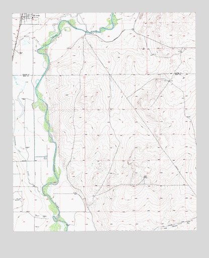
Artesia NE, NM USGS Topographic Map
Click on map above to begin viewing in our Map Viewer.

This topographic map contains these locations and features:
Feature Name Type Latitude Longitude GNIS ID View Map
05346 Water WellWellN32.9965°W104.3708°925024View Map
05347 Water WellWellN32.9918°W104.3611°928423View Map
05348 Water WellWellN32.9926°W104.3689°928422View Map
05349 Water WellWellN32.9893°W104.3711°928418View Map
05350 Water WellWellN32.9768°W104.3705°922051View Map
05351 Water WellWellN32.9737°W104.3602°922058View Map
06124 Water WellWellN32.9965°W104.3608°925023View Map
06126 Water WellWellN32.9876°W104.3569°925027View Map
10348 Water WellWellN32.9923°W104.3255°928421View Map
10349 Water WellWellN32.9898°W104.3608°928419View Map
10354 Water WellWellN32.9648°W104.3614°922071View Map
10913 Water WellWellN32.9765°W104.3614°923151View Map
10914 Water WellWellN32.9773°W104.3652°922054View Map
10915 Water WellWellN32.9768°W104.3705°922052View Map
10917 Water WellWellN32.9823°W104.3614°925025View Map
10918 Water WellWellN32.9929°W104.3555°925020View Map
10919 Water WellWellN32.9901°W104.3608°928420View Map
12827 Water WellWellN32.9962°W104.3283°925022View Map
12885 Water WellWellN32.9873°W104.3569°925026View Map
12886 Water WellWellN32.9884°W104.3605°925029View Map
12887 Water WellWellN32.9884°W104.3602°925028View Map
13590 Water WellWellN32.9929°W104.3686°925021View Map
13593 Water WellWellN32.9640°W104.3591°922078View Map
Cottonwood CreekStreamN32.8957°W104.3536°887911View Map
First Baptist ChurchChurchN32.9982°W104.3694°921231View Map
Lake ArthurPopulated PlaceN32.9982°W104.3666°890873View Map
Lake Arthur Educational MuseumBuildingN32.9982°W104.3666°929469View Map
Lake Arthur Elementary SchoolSchoolN32.9982°W104.3666°933880View Map
Lake Arthur High SchoolSchoolN32.9982°W104.3666°933879View Map
Lake Arthur Middle SchoolSchoolN32.9982°W104.3666°934001View Map
Lake Arthur Post OfficePost OfficeN32.9987°W104.3643°938034View Map
Lake Arthur Volunteer Fire Department Main StationBuildingN32.9984°W104.3667°2658129View Map
Lake Arthur Volunteer Fire Department The MillsBuildingN32.9984°W104.3698°2658229View Map
Town of Lake ArthurCivilN32.9995°W104.3641°2412862View Map
Walnut CreekStreamN32.9807°W104.3544°896224View Map

Note: Coordinates in the location and feature list above are referenced to NAD83 datum.


Copyright (C) 2008-2025 Ryan Niemi / Sunset Dynamics ... All Rights Reserved