TopoQuest Logo
Do you find TopoQuest useful?
Help keep TopoQuest running and adding new maps/features by donating!
Bitcoin:  19c7KJd3qBynnjoSw5npx9KScwjBe4ifkT
Litecoin:  LXs6TkuXGGXo1vDsWCkWVdjQX94eUKd6ui
Home View Maps Find Maps Find Places Resources & Links


Forked Horn Butte, Oregon Topographic Map

USGS Map Title: Forked Horn Butte, OR
USGS Map MRC: 44121B2
DRG (GeoTIFF) Download: o44121b2.tif


Neighboring USGS Topographic Map Quads:


  Cline Falls, OR  
44121C3
 

  Redmond, OR  
44121C2
 

  O'Neil, OR  
44121C1
 

  Tumalo, OR  
44121B3
 

  Forked Horn Butte, OR  
44121B2
 

  Powell Butte, OR  
44121B1
 

  Bend, OR  
44121A3
 

  Bend Airport, OR  
44121A2
 

  Alfalfa, OR  
44121A1


Map MRC Location:

N45°
W122°
N45°
W121°
H8 H7 H6 H5 H4 H3 H2 H1
G8 G7 G6 G5 G4 G3 G2 G1
F8 F7 F6 F5 F4 F3 F2 F1
E8 E7 E6 E5 E4 E3 E2 E1
D8 D7 D6 D5 D4 D3 D2 D1
C8 C7 C6 C5 C4 C3 C2 C1
B8 B7 B6 B5 B4 B3 B2 B1
A8 A7 A6 A5 A4 A3 A2 A1
N44°
W122°
N44°
W121°

Forked Horn Butte, OR USGS 1:24K Topographic Map Preview:
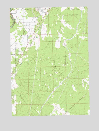
Forked Horn Butte, OR USGS Topographic Map
Click on map above to begin viewing in our Map Viewer.

This topographic map contains these locations and features:
Feature Name Type Latitude Longitude GNIS ID View Map
Deschutes County FairgroundsLocaleN44.2354°W121.1835°2699317View Map
Forked Horn ButteSummitN44.2479°W121.2131°1136296View Map
Hensley (historical)LocaleN44.2196°W121.2089°1167778View Map
Hooker Creek Event CenterBuildingN44.2355°W121.1833°2699038View Map
Juniper ArenaLocaleN44.2369°W121.1819°2699039View Map
Lateral BCanalN44.2385°W121.2217°1144853View Map
Pilot Butte CanalCanalN44.2090°W121.2339°1147673View Map
Pronghorn Census Designated PlaceCensusN44.1881°W121.1817°2584421View Map
Redmond CemeteryCemeteryN44.2449°W121.2040°1125914View Map
Redmond Pumping PlantLocaleN44.2435°W121.2498°1163766View Map
Redmond-Bend Juniper State ParkParkN44.2165°W121.2150°1638710View Map
Sagebrush ArenaLocaleN44.2343°W121.1820°2699994View Map
Three Sisters Conference CenterBuildingN44.2374°W121.1857°2699077View Map

Note: Coordinates in the location and feature list above are referenced to NAD83 datum.


Copyright (C) 2008-2025 Ryan Niemi / Sunset Dynamics ... All Rights Reserved