TopoQuest Logo
Do you find TopoQuest useful?
Help keep TopoQuest running and adding new maps/features by donating!
Bitcoin:  19c7KJd3qBynnjoSw5npx9KScwjBe4ifkT
Litecoin:  LXs6TkuXGGXo1vDsWCkWVdjQX94eUKd6ui
Home View Maps Find Maps Find Places Resources & Links


Forreston South, Illinois Topographic Map

USGS Map Title: Forreston South, IL
USGS Map MRC: 42089A5
DRG (GeoTIFF) Download: o42089a5.tif


Neighboring USGS Topographic Map Quads:


  Shannon, IL  
42089B6
 

  Forreston North, IL  
42089B5
 

  German Valley, IL  
42089B4
 

  Brookville, IL  
42089A6
 

  Forreston South, IL  
42089A5
 

  Mount Morris, IL  
42089A4
 

  Hazelhurst, IL  
41089H6
 

  Polo, IL  
41089H5
 

  Grand Detour, IL  
41089H4


Map MRC Location:

N43°
W90°
N43°
W89°
H8 H7 H6 H5 H4 H3 H2 H1
G8 G7 G6 G5 G4 G3 G2 G1
F8 F7 F6 F5 F4 F3 F2 F1
E8 E7 E6 E5 E4 E3 E2 E1
D8 D7 D6 D5 D4 D3 D2 D1
C8 C7 C6 C5 C4 C3 C2 C1
B8 B7 B6 B5 B4 B3 B2 B1
A8 A7 A6 A5 A4 A3 A2 A1
N42°
W90°
N42°
W89°

Forreston South, IL USGS 1:24K Topographic Map Preview:
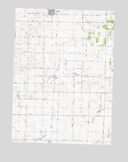
Forreston South, IL USGS Topographic Map
Click on map above to begin viewing in our Map Viewer.

This topographic map contains these locations and features:
Feature Name Type Latitude Longitude GNIS ID View Map
B and E FarmLocaleN42.0725°W89.6222°2706581View Map
Brand School (historical)SchoolN42.0031°W89.5784°404797View Map
Brick School (historical)SchoolN42.0009°W89.6129°404847View Map
Church of the BrethrenChurchN42.0703°W89.5398°1705908View Map
Eldorado School (historical)SchoolN42.0400°W89.6068°407850View Map
Eureka School (historical)SchoolN42.0406°W89.5282°408092View Map
Excelsior School (historical)SchoolN42.0403°W89.5684°408141View Map
Forreston Grade and Junior High SchoolSchoolN42.1239°W89.5784°1808226View Map
Gratatum School (historical)SchoolN42.0025°W89.5273°409339View Map
HaldanePopulated PlaceN42.0625°W89.5740°409620View Map
Haldane CemeteryCemeteryN42.0692°W89.5707°1705910View Map
Haldane Post Office (historical)Post OfficeN42.0628°W89.5743°1808236View Map
Haldane School (historical)SchoolN42.0697°W89.5690°409621View Map
Marr School (historical)SchoolN42.0975°W89.5682°413033View Map
MarylandPopulated PlaceN42.0656°W89.5473°413085View Map
Oakwood FarmLocaleN42.0467°W89.6036°2680880View Map
Springdale School (historical)SchoolN42.0678°W89.6068°418996View Map
Summer Hill School (historical)SchoolN42.0981°W89.6073°419344View Map
Township of LincolnCivilN42.0698°W89.5686°1784905View Map
West Branch CemeteryCemeteryN42.0631°W89.5357°1705909View Map
West Branch School (historical)SchoolN42.0731°W89.5390°420797View Map
West Grove CemeteryCemeteryN42.0997°W89.5293°1808314View Map
West Grove ChurchChurchN42.0992°W89.5312°420850View Map

Note: Coordinates in the location and feature list above are referenced to NAD83 datum.


Copyright (C) 2008-2025 Ryan Niemi / Sunset Dynamics ... All Rights Reserved