TopoQuest Logo
Do you find TopoQuest useful?
Help keep TopoQuest running and adding new maps/features by donating!
Bitcoin:  19c7KJd3qBynnjoSw5npx9KScwjBe4ifkT
Litecoin:  LXs6TkuXGGXo1vDsWCkWVdjQX94eUKd6ui
Home View Maps Find Maps Find Places Resources & Links


Fort Craig, New Mexico Topographic Map

USGS Map Title: Fort Craig, NM
USGS Map MRC: 33107F1
DRG (GeoTIFF) Download: o33107f1.tif


Neighboring USGS Topographic Map Quads:


  Puertecito Gap, NM  
33107G2
 

  Cienega Ranch, NM  
33107G1
 

  Indian Well Wilderness, NM  
33106G8
 

  Hickman Ranch, NM  
33107F2
 

  Fort Craig, NM  
33107F1
 

  San Marcial, NM  
33106F8
 

  Black Hill, NM  
33107E2
 

  Paraje Well, NM  
33107E1


Map MRC Location:

N34°
W108°
N34°
W107°
H8 H7 H6 H5 H4 H3 H2 H1
G8 G7 G6 G5 G4 G3 G2 G1
F8 F7 F6 F5 F4 F3 F2 F1
E8 E7 E6 E5 E4 E3 E2 E1
D8 D7 D6 D5 D4 D3 D2 D1
C8 C7 C6 C5 C4 C3 C2 C1
B8 B7 B6 B5 B4 B3 B2 B1
A8 A7 A6 A5 A4 A3 A2 A1
N33°
W108°
N33°
W107°

Fort Craig, NM USGS 1:24K Topographic Map Preview:
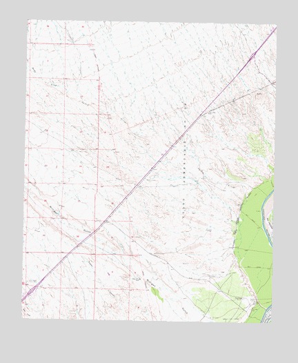
Fort Craig, NM USGS Topographic Map
Click on map above to begin viewing in our Map Viewer.

This topographic map contains these locations and features:
Feature Name Type Latitude Longitude GNIS ID View Map
10057 Water WellWellN33.7120°W107.0339°925606View Map
10058 Water WellWellN33.6637°W107.0328°922022View Map
Craig (historical)Populated PlaceN33.6356°W107.0148°920917View Map
Elephant Butte Lake State ParkParkN33.6251°W107.0095°929178View Map
Fort Craig (historical)MilitaryN33.6356°W107.0142°1680749View Map
Fort Craig CemeteryCemeteryN33.6307°W107.0114°889149View Map
Fort Craig Post Office (historical)Post OfficeN33.6356°W107.0148°937646View Map
George Birner RanchLocaleN33.6426°W107.0664°889386View Map
Highway WellWellN33.7126°W107.0339°889992View Map
RG34609 Water WellWellN33.7248°W107.1206°922027View Map
RG38248 Water WellWellN33.7231°W107.1200°922026View Map
Rocky ArroyoStreamN33.7198°W107.1048°894108View Map
San Marcial InterchangeCrossingN33.7370°W107.0125°929583View Map
Spikey ArroyoStreamN33.6762°W107.0139°895234View Map
State Highway District HeadquartersBuildingN33.6409°W107.1220°895317View Map
Stone WellWellN33.6634°W107.0328°895370View Map

Note: Coordinates in the location and feature list above are referenced to NAD83 datum.


Copyright (C) 2008-2025 Ryan Niemi / Sunset Dynamics ... All Rights Reserved