TopoQuest Logo
Do you find TopoQuest useful?
Help keep TopoQuest running and adding new maps/features by donating!
Bitcoin:  19c7KJd3qBynnjoSw5npx9KScwjBe4ifkT
Litecoin:  LXs6TkuXGGXo1vDsWCkWVdjQX94eUKd6ui
Home View Maps Find Maps Find Places Resources & Links


Foster City, Michigan Topographic Map

USGS Map Title: Foster City, MI
USGS Map MRC: 45087H6
DRG (GeoTIFF) Download: o45087h6.tif


Neighboring USGS Topographic Map Quads:


  Ralph, MI  
46087A7
 

  Alfred, MI  
46087A6
 

  Northland, MI  
46087A5
 

  Felch, MI  
45087H7
 

  Foster City, MI  
45087H6
 

  Helps, MI  
45087H5
 

  Vulcan, MI  
45087G7
 

  Waucedah, MI  
45087G6
 

  Vega, MI  
45087G5


Map MRC Location:

N46°
W88°
N46°
W87°
H8 H7 H6 H5 H4 H3 H2 H1
G8 G7 G6 G5 G4 G3 G2 G1
F8 F7 F6 F5 F4 F3 F2 F1
E8 E7 E6 E5 E4 E3 E2 E1
D8 D7 D6 D5 D4 D3 D2 D1
C8 C7 C6 C5 C4 C3 C2 C1
B8 B7 B6 B5 B4 B3 B2 B1
A8 A7 A6 A5 A4 A3 A2 A1
N45°
W88°
N45°
W87°

Foster City, MI USGS 1:24K Topographic Map Preview:
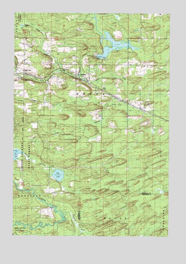
Foster City, MI USGS Topographic Map
Click on map above to begin viewing in our Map Viewer.

This topographic map contains these locations and features:
Feature Name Type Latitude Longitude GNIS ID View Map
Anderson CreekStreamN45.9530°W87.6565°620089View Map
Breen Township Fire DepartmentBuildingN45.9640°W87.7330°2627012View Map
Brown CreekGutN45.9822°W87.7293°622072View Map
Crow CreekGutN45.9294°W87.7207°624135View Map
East LakeLakeN45.9091°W87.7137°625211View Map
Foster CityPopulated PlaceN45.9633°W87.7440°626308View Map
Foster City CemeteryCemeteryN45.9634°W87.7285°2128917View Map
Foster City Post OfficePost OfficeN45.9661°W87.7414°2128885View Map
Foster City Station (historical)LocaleN45.9636°W87.7431°2128886View Map
HardwoodPopulated PlaceN45.9616°W87.6912°627778View Map
Hardwood ImpoundmentReservoirN45.9907°W87.6820°2128576View Map
Hardwood Post Office (historical)Post OfficeN45.9617°W87.6911°2128845View Map
Hardwood Station (historical)LocaleN45.9639°W87.6972°2128844View Map
HylasPopulated PlaceN45.9572°W87.6796°1617636View Map
Mission Covenant ChurchChurchN45.9653°W87.7353°2128888View Map
Peshtigo Harbor Wildlife Area H2.117 DamDamN45.9716°W87.7101°1793622View Map
Saint Joseph Catholic ChurchChurchN45.9647°W87.7331°2128887View Map
Schultz CreekStreamN45.9647°W87.6987°637440View Map
Spruce LakeLakeN45.9927°W87.7443°638644View Map
Stromberg County ParkParkN45.9750°W87.6861°2128577View Map
Township of BreenCivilN45.9794°W87.7051°1625973View Map

Note: Coordinates in the location and feature list above are referenced to NAD83 datum.


Copyright (C) 2008-2025 Ryan Niemi / Sunset Dynamics ... All Rights Reserved